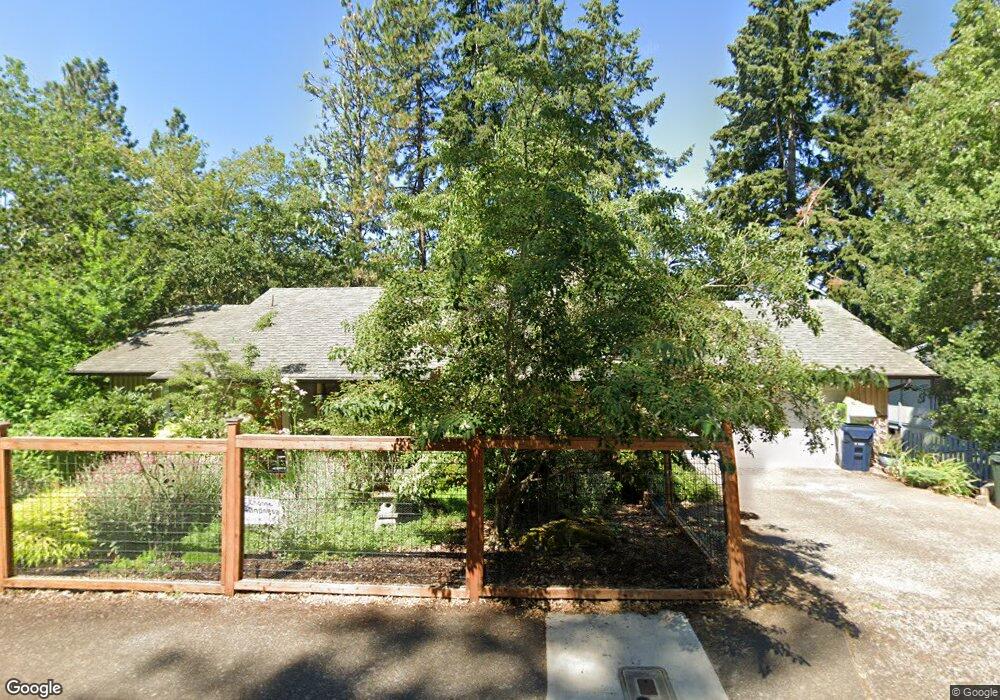
5220 Saratoga St Eugene, OR 97405
Southeast Eugene NeighborhoodEstimated Value: $557,177 - $625,000
4
Beds
3
Baths
1,152
Sq Ft
$511/Sq Ft
Est. Value
About This Home
This home is located at 5220 Saratoga St, Eugene, OR 97405 and is currently estimated at $588,294, approximately $510 per square foot. 5220 Saratoga St is a home located in Lane County with nearby schools including Edgewood Community Elementary School, Spencer Butte Middle School, and South Eugene High School.
Ownership History
Date
Name
Owned For
Owner Type
Purchase Details
Closed on
Dec 5, 2014
Sold by
Hughes R Wade
Bought by
Hughes Teresa B
Current Estimated Value
Home Financials for this Owner
Home Financials are based on the most recent Mortgage that was taken out on this home.
Original Mortgage
$170,950
Outstanding Balance
$130,037
Interest Rate
3.89%
Mortgage Type
New Conventional
Estimated Equity
$458,257
Purchase Details
Closed on
Jun 8, 2001
Sold by
Lyle Hall and Lyle Diana K
Bought by
Hughes R Wade and Hughes Teresa B
Home Financials for this Owner
Home Financials are based on the most recent Mortgage that was taken out on this home.
Original Mortgage
$149,900
Interest Rate
7.14%
Create a Home Valuation Report for This Property
The Home Valuation Report is an in-depth analysis detailing your home's value as well as a comparison with similar homes in the area
Home Values in the Area
Average Home Value in this Area
Purchase History
| Date | Buyer | Sale Price | Title Company |
|---|---|---|---|
| Hughes Teresa B | -- | Evergreen Land Title | |
| Hughes R Wade | $199,900 | Western Pioneer Title Co |
Source: Public Records
Mortgage History
| Date | Status | Borrower | Loan Amount |
|---|---|---|---|
| Open | Hughes Teresa B | $170,950 | |
| Closed | Hughes R Wade | $149,900 |
Source: Public Records
Tax History
| Year | Tax Paid | Tax Assessment Tax Assessment Total Assessment is a certain percentage of the fair market value that is determined by local assessors to be the total taxable value of land and additions on the property. | Land | Improvement |
|---|---|---|---|---|
| 2025 | $6,072 | $311,625 | -- | -- |
| 2024 | $5,996 | $302,549 | -- | -- |
| 2023 | $5,996 | $293,737 | $0 | $0 |
| 2022 | $5,617 | $285,182 | $0 | $0 |
| 2021 | $5,276 | $276,876 | $0 | $0 |
| 2020 | $5,295 | $268,812 | $0 | $0 |
| 2019 | $5,114 | $260,983 | $0 | $0 |
| 2018 | $4,813 | $246,002 | $0 | $0 |
| 2017 | $4,598 | $246,002 | $0 | $0 |
| 2016 | $4,460 | $238,837 | $0 | $0 |
| 2015 | $4,328 | $231,881 | $0 | $0 |
| 2014 | $4,267 | $225,127 | $0 | $0 |
Source: Public Records
Map
Nearby Homes
- 4734 Brookwood St
- 4845 Brookwood St
- 296 Woodridge Dr
- 202 Foxtail Dr
- 126 Treehill Loop Unit 126
- 395 E 46th Ave
- 143 Treehill Loop Unit 143
- 36 Westbrook Way
- 152 Treehill Loop Unit 152
- 151 Treehill Loop Unit 151
- 21 Westbrook Way
- 17 Westbrook Way
- 278 Rockridge Ct
- 4680 W Hillside Dr
- 4425 Hilyard St
- 223 Trailside Loop Unit 223
- 422 Stonewood Dr Unit 422
- 4295 Ferry St
- 418 Stonewood Dr Unit 418
- 892 Sprague St
- 5210 Saratoga St
- 5240 Saratoga St
- 486 Ventura Ave
- 481 Ventura Ave
- 5255 Donald St
- 5225 Saratoga St
- 5180 Saratoga St
- 5245 Saratoga St
- 5260 Saratoga St
- 5215 Saratoga St
- 5245 Donald St
- 5265 Saratoga St
- 461 Ventura Ave
- 446 Ventura Ave
- 5250 Miramar St
- 5265 Donald St
- 5280 Saratoga St
- 5185 Talisman St
- 5145 Saratoga St
- 5260 Miramar St
Your Personal Tour Guide
Ask me questions while you tour the home.