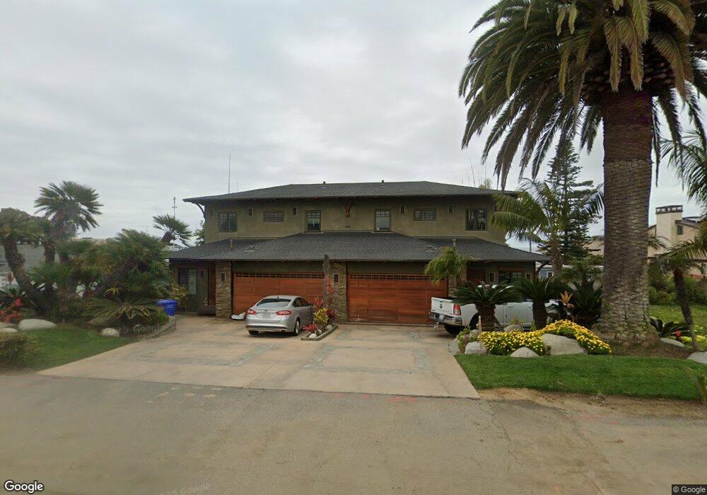
5225 Carlsbad Blvd Carlsbad, CA 92008
South Beach NeighborhoodEstimated Value: $1,244,000 - $2,910,319
3
Beds
3
Baths
1,800
Sq Ft
$1,185/Sq Ft
Est. Value
About This Home
This home is located at 5225 Carlsbad Blvd, Carlsbad, CA 92008 and is currently estimated at $2,133,080, approximately $1,185 per square foot. 5225 Carlsbad Blvd is a home located in San Diego County with nearby schools including Carlsbad High School, Sage Creek High, and St. Patrick Catholic School.
Ownership History
Date
Name
Owned For
Owner Type
Purchase Details
Closed on
Aug 1, 2000
Sold by
Kevin Forsyth and Kevin Kristine D
Bought by
Lang Gary Michael
Current Estimated Value
Home Financials for this Owner
Home Financials are based on the most recent Mortgage that was taken out on this home.
Original Mortgage
$220,000
Interest Rate
7.9%
Purchase Details
Closed on
Nov 21, 1997
Sold by
Kevin Forsyth and Stougaard Gary A
Bought by
Forsyth Kevin and Forsyth Kristine D
Home Financials for this Owner
Home Financials are based on the most recent Mortgage that was taken out on this home.
Original Mortgage
$194,000
Interest Rate
7.33%
Purchase Details
Closed on
Aug 27, 1986
Create a Home Valuation Report for This Property
The Home Valuation Report is an in-depth analysis detailing your home's value as well as a comparison with similar homes in the area
Home Values in the Area
Average Home Value in this Area
Purchase History
| Date | Buyer | Sale Price | Title Company |
|---|---|---|---|
| Lang Gary Michael | $275,000 | American Title Ins Co | |
| Forsyth Kevin | -- | Southland Title | |
| -- | $165,000 | -- |
Source: Public Records
Mortgage History
| Date | Status | Borrower | Loan Amount |
|---|---|---|---|
| Previous Owner | Lang Gary Michael | $220,000 | |
| Previous Owner | Forsyth Kevin | $194,000 |
Source: Public Records
Tax History Compared to Growth
Tax History
| Year | Tax Paid | Tax Assessment Tax Assessment Total Assessment is a certain percentage of the fair market value that is determined by local assessors to be the total taxable value of land and additions on the property. | Land | Improvement |
|---|---|---|---|---|
| 2025 | $13,220 | $1,259,179 | $678,071 | $581,108 |
| 2024 | $13,220 | $1,234,490 | $664,776 | $569,714 |
| 2023 | $13,153 | $1,210,286 | $651,742 | $558,544 |
| 2022 | $12,951 | $1,186,556 | $638,963 | $547,593 |
| 2021 | $12,854 | $1,163,291 | $626,435 | $536,856 |
| 2020 | $12,768 | $1,151,364 | $620,012 | $531,352 |
| 2019 | $12,538 | $1,128,789 | $607,855 | $520,934 |
| 2018 | $12,008 | $1,106,657 | $595,937 | $510,720 |
| 2017 | $90 | $1,084,958 | $584,252 | $500,706 |
| 2016 | $11,336 | $1,063,686 | $572,797 | $490,889 |
| 2015 | $11,291 | $1,047,710 | $564,194 | $483,516 |
| 2014 | $11,102 | $1,027,188 | $553,143 | $474,045 |
Source: Public Records
Map
Nearby Homes
- 5301 Los Robles Dr
- 5335 Los Robles Dr
- 5390 Carlsbad Blvd
- 5183 El Arbol Dr
- 5140 Los Robles Dr
- 5143 Shore Dr
- 3056 & 3162 Carlsbad Blvd
- 6536 Oceanview Dr Unit T
- 6494 Friendly Place
- 6508 Easy St Unit T
- 6503 Friendly Place
- 0 Adams St Unit OC24201399
- 4747 Marina Dr Unit 23
- 4705 Marina Dr Unit 10
- 4735 Bryce Cir
- 801 Kalpati Cir Unit B
- 4007 Canario St Unit E
- 334 Date Ave
- 1095 Hoover St
- 111 Sequoia Ave Unit C
- 5262 Shore Dr
- 5226 Shore Dr
- 5208 Shore Dr
- 5236 Shore Dr
- 5195 Carlsbad Blvd Unit 97
- 5198 Shore Dr
- 5238 Carlsbad Blvd
- 5234 Carlsbad Blvd
- 5262 Carlsbad Blvd
- 5194 Carlsbad Blvd Unit ID1248698P
- 5194 Carlsbad Blvd Unit ID1248700P
- 5194 Carlsbad Blvd Unit ID1248699P
- 5185 Carlsbad Blvd
- 5285 Shore Dr Unit ID1248655P
- 5285 Shore Dr
- 5220 Carlsbad Blvd
- 5283 Shore Dr
- 5276 Carlsbad Blvd
- 5229 Shore Dr
- 5190 Shore Dr