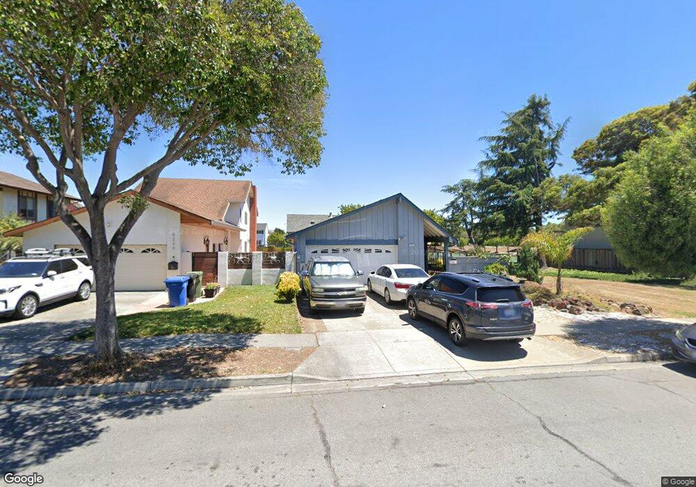
5238 Ramsgate Dr Newark, CA 94560
Estimated Value: $1,150,000 - $1,321,000
3
Beds
2
Baths
1,186
Sq Ft
$1,048/Sq Ft
Est. Value
About This Home
This home is located at 5238 Ramsgate Dr, Newark, CA 94560 and is currently estimated at $1,242,759, approximately $1,047 per square foot. 5238 Ramsgate Dr is a home located in Alameda County with nearby schools including John F. Kennedy Elementary School, Newark Junior High School, and Newark Memorial High School.
Ownership History
Date
Name
Owned For
Owner Type
Purchase Details
Closed on
Aug 18, 2023
Sold by
Beliso Rodney and Beliso Sylvia
Bought by
Beliso Family Trust and Beliso
Current Estimated Value
Purchase Details
Closed on
Sep 16, 2001
Sold by
Burkhead Jean A
Bought by
Beliso Rodney and Beliso Sylvia
Home Financials for this Owner
Home Financials are based on the most recent Mortgage that was taken out on this home.
Original Mortgage
$370,800
Interest Rate
6.9%
Purchase Details
Closed on
Jul 19, 1999
Sold by
Koppelow Heidi Trust and Gisela
Bought by
Burkhead Jean A
Home Financials for this Owner
Home Financials are based on the most recent Mortgage that was taken out on this home.
Original Mortgage
$272,000
Interest Rate
7.51%
Mortgage Type
Balloon
Create a Home Valuation Report for This Property
The Home Valuation Report is an in-depth analysis detailing your home's value as well as a comparison with similar homes in the area
Home Values in the Area
Average Home Value in this Area
Purchase History
| Date | Buyer | Sale Price | Title Company |
|---|---|---|---|
| Beliso Family Trust | -- | None Listed On Document | |
| Beliso Rodney | $412,000 | North American Title Co | |
| Burkhead Jean A | $340,000 | Commonwealth Land Title Co |
Source: Public Records
Mortgage History
| Date | Status | Borrower | Loan Amount |
|---|---|---|---|
| Previous Owner | Beliso Rodney | $370,800 | |
| Previous Owner | Burkhead Jean A | $272,000 | |
| Closed | Burkhead Jean A | $68,000 |
Source: Public Records
Tax History
| Year | Tax Paid | Tax Assessment Tax Assessment Total Assessment is a certain percentage of the fair market value that is determined by local assessors to be the total taxable value of land and additions on the property. | Land | Improvement |
|---|---|---|---|---|
| 2025 | $7,664 | $608,605 | $182,581 | $426,024 |
| 2024 | $7,664 | $596,674 | $179,002 | $417,672 |
| 2023 | $7,455 | $584,977 | $175,493 | $409,484 |
| 2022 | $7,355 | $573,507 | $172,052 | $401,455 |
| 2021 | $7,173 | $562,264 | $168,679 | $393,585 |
| 2020 | $7,067 | $556,500 | $166,950 | $389,550 |
| 2019 | $6,968 | $545,590 | $163,677 | $381,913 |
| 2018 | $6,864 | $534,894 | $160,468 | $374,426 |
| 2017 | $6,691 | $524,410 | $157,323 | $367,087 |
| 2016 | $6,622 | $514,130 | $154,239 | $359,891 |
| 2015 | $6,601 | $506,408 | $151,922 | $354,486 |
| 2014 | $6,423 | $496,492 | $148,947 | $347,545 |
Source: Public Records
Map
Nearby Homes
- 5136 Ramsgate Dr
- 35605 Scarborough Dr
- 35415 Blackburn Dr
- 5030 Chelsea Dr
- 4987 Winchester Place
- 5298 Sussex Place
- 5228 Falmouth Place
- 35345 Cabral Dr
- 35952 Rosewood Dr
- 4628 Capitan Dr
- 36302 Tunbridge Dr
- 36255 Casey Ct
- 36057 Dalewood Dr
- 5585 Fernwood Dr
- 4862 Garnet Common
- 34767 Shalimar Terrace
- 35050 Lido Blvd Unit B
- 34631 Pueblo Terrace Unit 99
- 34607 Pueblo Terrace
- 34590 Falls Terrace
- 5230 Ramsgate Dr
- 5222 Ramsgate Dr
- 5250 Ramsgate Dr
- 5214 Ramsgate Dr
- 5258 Ramsgate Dr
- 5206 Ramsgate Dr
- 35380 Rutland Ct
- 5266 Ramsgate Dr
- 35383 Rutland Ct
- 35385 Cheviot Ct
- 5274 Ramsgate Dr
- 35368 Rutland Ct
- 5184 Ramsgate Dr
- 35359 Rutland Ct
- 35363 Cheviot Ct
- 5282 Ramsgate Dr
- 35438 Lake Blvd
- 5221 Orkney Ct
- 5237 Orkney Ct
- 5176 Ramsgate Dr
Your Personal Tour Guide
Ask me questions while you tour the home.