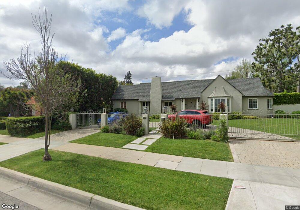
527 N Rexford Dr Beverly Hills, CA 90210
Estimated Value: $6,671,200 - $8,119,000
3
Beds
4
Baths
3,781
Sq Ft
$1,968/Sq Ft
Est. Value
About This Home
This home is located at 527 N Rexford Dr, Beverly Hills, CA 90210 and is currently estimated at $7,442,550, approximately $1,968 per square foot. 527 N Rexford Dr is a home located in Los Angeles County with nearby schools including Hawthorne Elementary School, Beverly Hills High School, and Good Shepherd Catholic School.
Ownership History
Date
Name
Owned For
Owner Type
Purchase Details
Closed on
Sep 25, 2024
Sold by
Ming L Lai Personal Residence Trust and Lai Ming Lii
Bought by
Lai Residence Trust and Kaiserman
Current Estimated Value
Purchase Details
Closed on
Dec 11, 2012
Sold by
Lai Ming Lii and Ching Hsiang Lai
Bought by
Lai Ming Lii and Ming L Lai Personal Residence Trust
Purchase Details
Closed on
Dec 15, 2003
Sold by
Lai Ching Hsiang and Lai Ming Lii
Bought by
Lai Ching Hsiang
Home Financials for this Owner
Home Financials are based on the most recent Mortgage that was taken out on this home.
Original Mortgage
$1,050,000
Interest Rate
6.03%
Mortgage Type
Purchase Money Mortgage
Create a Home Valuation Report for This Property
The Home Valuation Report is an in-depth analysis detailing your home's value as well as a comparison with similar homes in the area
Home Values in the Area
Average Home Value in this Area
Purchase History
| Date | Buyer | Sale Price | Title Company |
|---|---|---|---|
| Lai Residence Trust | -- | None Listed On Document | |
| Lai Ming Lii | -- | None Available | |
| Lai Ming Lii | -- | None Available | |
| Lai Ching Hsiang | -- | Ticor Title Co Glendale |
Source: Public Records
Mortgage History
| Date | Status | Borrower | Loan Amount |
|---|---|---|---|
| Previous Owner | Lai Ching Hsiang | $1,050,000 |
Source: Public Records
Tax History Compared to Growth
Tax History
| Year | Tax Paid | Tax Assessment Tax Assessment Total Assessment is a certain percentage of the fair market value that is determined by local assessors to be the total taxable value of land and additions on the property. | Land | Improvement |
|---|---|---|---|---|
| 2025 | $13,471 | $1,103,988 | $822,229 | $281,759 |
| 2024 | $13,471 | $1,082,342 | $806,107 | $276,235 |
| 2023 | $13,237 | $1,061,120 | $790,301 | $270,819 |
| 2022 | $12,867 | $1,040,314 | $774,805 | $265,509 |
| 2021 | $12,481 | $1,019,916 | $759,613 | $260,303 |
| 2019 | $12,129 | $989,667 | $737,084 | $252,583 |
| 2018 | $11,457 | $970,263 | $722,632 | $247,631 |
| 2016 | $10,963 | $932,588 | $694,572 | $238,016 |
| 2015 | $10,500 | $918,580 | $684,139 | $234,441 |
| 2014 | $10,166 | $900,587 | $670,738 | $229,849 |
Source: Public Records
Map
Nearby Homes
- 525 N Rexford Dr
- 604 N Alpine Dr
- 610 N Canon Dr
- 523 N Canon Dr
- 602 N Beverly Dr
- 503 N Elm Dr
- 1405 Park Way
- 707 N Crescent Dr
- 701 N Beverly Dr
- 512 N Palm Dr
- 9321 Burton Way Unit A
- 515 N Hillcrest Rd
- 716 N Beverly Dr
- 710 N Rodeo Dr
- 713 N Elm Dr
- 620 N Bedford Dr
- 611 N Hillcrest Rd
- 425 N Maple Dr Unit 602
- 701 N Camden Dr
- 706 N Maple Dr
- 601 N Rexford Dr
- 523 N Rexford Dr
- 528 N Crescent Dr
- 526 N Crescent Dr
- 526 N Rexford Dr
- 602 N Crescent Dr
- 524 N Rexford Dr
- 524 N Crescent Dr
- 603 N Rexford Dr
- 521 N Rexford Dr
- 522 N Rexford Dr
- 602 N Rexford Dr
- 604 N Crescent Dr
- 522 N Crescent Dr
- 520 N Rexford Dr
- 519 N Rexford Dr
- 604 N Rexford Dr
- 520 N Crescent Dr
- 606 N Crescent Dr