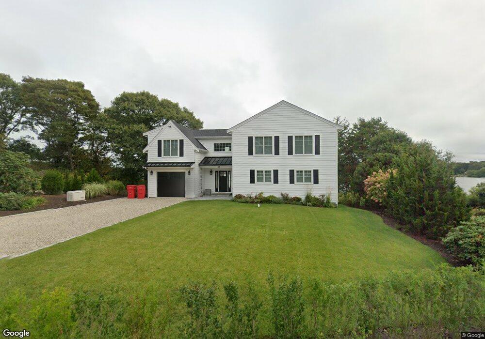
53 James Cir Mashpee, MA 02649
Estimated Value: $906,000 - $1,321,000
4
Beds
5
Baths
2,516
Sq Ft
$458/Sq Ft
Est. Value
About This Home
This home is located at 53 James Cir, Mashpee, MA 02649 and is currently estimated at $1,151,300, approximately $457 per square foot. 53 James Cir is a home located in Barnstable County with nearby schools including Kenneth C. Coombs School, Quashnet School, and Mashpee Middle School.
Ownership History
Date
Name
Owned For
Owner Type
Purchase Details
Closed on
Mar 11, 2020
Sold by
Jessen Terri L and Jessen George
Bought by
True Cindy L and Woodcock Michael
Current Estimated Value
Home Financials for this Owner
Home Financials are based on the most recent Mortgage that was taken out on this home.
Original Mortgage
$337,500
Outstanding Balance
$298,334
Interest Rate
3.4%
Mortgage Type
New Conventional
Estimated Equity
$852,966
Purchase Details
Closed on
Dec 3, 2010
Sold by
True Donald S
Bought by
Jessen Terri Lee and True James K
Create a Home Valuation Report for This Property
The Home Valuation Report is an in-depth analysis detailing your home's value as well as a comparison with similar homes in the area
Home Values in the Area
Average Home Value in this Area
Purchase History
| Date | Buyer | Sale Price | Title Company |
|---|---|---|---|
| True Cindy L | $450,000 | None Available | |
| Jessen Terri Lee | -- | -- | |
| True Donald S | -- | -- |
Source: Public Records
Mortgage History
| Date | Status | Borrower | Loan Amount |
|---|---|---|---|
| Open | True Cindy L | $337,500 |
Source: Public Records
Tax History Compared to Growth
Tax History
| Year | Tax Paid | Tax Assessment Tax Assessment Total Assessment is a certain percentage of the fair market value that is determined by local assessors to be the total taxable value of land and additions on the property. | Land | Improvement |
|---|---|---|---|---|
| 2025 | $7,249 | $1,095,000 | $461,100 | $633,900 |
| 2024 | $4,774 | $742,500 | $419,200 | $323,300 |
| 2023 | $4,632 | $660,800 | $399,200 | $261,600 |
| 2022 | $4,662 | $570,600 | $357,000 | $213,600 |
| 2021 | $4,111 | $453,300 | $292,300 | $161,000 |
| 2020 | $3,964 | $436,100 | $281,100 | $155,000 |
| 2019 | $3,692 | $408,000 | $264,300 | $143,700 |
| 2018 | $3,464 | $388,300 | $264,300 | $124,000 |
| 2017 | $3,464 | $376,900 | $264,300 | $112,600 |
| 2016 | $3,409 | $368,900 | $264,300 | $104,600 |
| 2015 | $3,309 | $363,200 | $264,300 | $98,900 |
| 2014 | $3,363 | $358,100 | $259,200 | $98,900 |
Source: Public Records
Map
Nearby Homes
- 4 Florence Ave
- 211 James Cir
- 45 Pond Cir
- 83 Pond Cir
- 54 Sassacus Rd
- 42 Cayuga Ave
- 84 Hooppole Rd
- 152 Algonquin Ave
- 44 Twin Oaks Dr
- 44 Twin Oaks Dr Unit 44
- 116 Grey Hawk Dr Unit 116
- 116 Grey Hawk Dr
- 20 Twin Oaks Dr Unit 20
- 20 Twin Oaks Dr
- 18 Stony Brook Dr
- 18 Stony Brook Dr Unit 18
- 409 Currier Rd
- 72 Grey Hawk Dr Unit 670
- 72 Grey Hawk Dr
- 23 Sea Spray Ave Unit 563