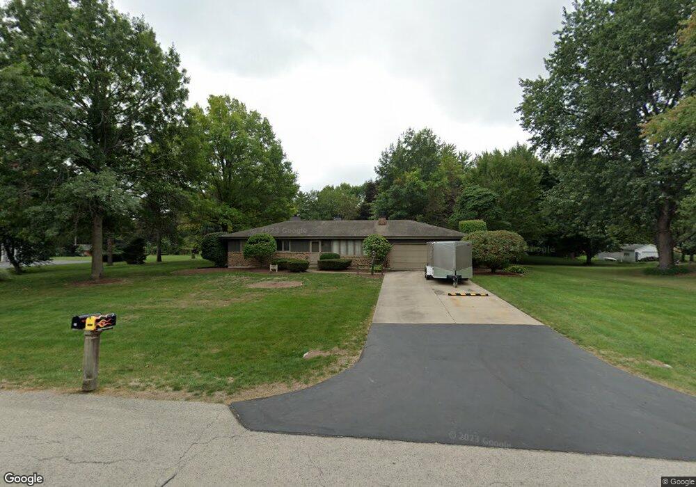
53 Osage Ct Oswego, IL 60543
Northwest Oswego NeighborhoodEstimated Value: $324,000 - $369,000
3
Beds
2
Baths
1,260
Sq Ft
$278/Sq Ft
Est. Value
About This Home
This home is located at 53 Osage Ct, Oswego, IL 60543 and is currently estimated at $350,854, approximately $278 per square foot. 53 Osage Ct is a home located in Kendall County with nearby schools including Fox Chase Elementary School, Traughber Junior High School, and Oswego High School.
Ownership History
Date
Name
Owned For
Owner Type
Purchase Details
Closed on
Mar 21, 2002
Sold by
Schmidt Barbara R
Bought by
Tracy William Alfred
Current Estimated Value
Home Financials for this Owner
Home Financials are based on the most recent Mortgage that was taken out on this home.
Original Mortgage
$172,500
Outstanding Balance
$71,398
Interest Rate
6.93%
Estimated Equity
$279,456
Purchase Details
Closed on
Feb 2, 2002
Sold by
Parlow Joseph Edward and Parlow Cheryl L
Bought by
Schmidt Barbara R and Tracy William Alfred
Home Financials for this Owner
Home Financials are based on the most recent Mortgage that was taken out on this home.
Original Mortgage
$172,500
Outstanding Balance
$71,398
Interest Rate
6.93%
Estimated Equity
$279,456
Create a Home Valuation Report for This Property
The Home Valuation Report is an in-depth analysis detailing your home's value as well as a comparison with similar homes in the area
Home Values in the Area
Average Home Value in this Area
Purchase History
| Date | Buyer | Sale Price | Title Company |
|---|---|---|---|
| Tracy William Alfred | -- | Law Title Insurance Co Inc | |
| Schmidt Barbara R | $187,500 | -- |
Source: Public Records
Mortgage History
| Date | Status | Borrower | Loan Amount |
|---|---|---|---|
| Open | Tracy William Alfred | $172,500 | |
| Previous Owner | Schmidt Barbara R | $172,500 |
Source: Public Records
Tax History Compared to Growth
Tax History
| Year | Tax Paid | Tax Assessment Tax Assessment Total Assessment is a certain percentage of the fair market value that is determined by local assessors to be the total taxable value of land and additions on the property. | Land | Improvement |
|---|---|---|---|---|
| 2024 | $7,631 | $102,409 | $24,394 | $78,015 |
| 2023 | $7,184 | $91,576 | $21,212 | $70,364 |
| 2022 | $7,184 | $89,780 | $20,796 | $68,984 |
| 2021 | $6,694 | $81,618 | $18,905 | $62,713 |
| 2020 | $6,331 | $74,094 | $17,835 | $56,259 |
| 2019 | $6,433 | $74,094 | $17,835 | $56,259 |
| 2018 | $6,480 | $74,094 | $17,835 | $56,259 |
| 2017 | $6,258 | $67,976 | $16,362 | $51,614 |
| 2016 | $6,148 | $65,996 | $15,885 | $50,111 |
| 2015 | $5,599 | $64,073 | $15,422 | $48,651 |
| 2014 | -- | $60,446 | $14,549 | $45,897 |
| 2013 | -- | $61,057 | $14,696 | $46,361 |
Source: Public Records
Map
Nearby Homes
- 5055 U S 34
- 114 Riverview Ct
- 123 W Benton St
- 505 Parkland Ct
- 147 Eisenhower Dr
- 403 Lake Ct
- 613 Murdock Place
- 421 Hathaway Ln
- 423 Hathaway Ln
- 377 Danforth Dr
- 19 E Benton St
- 34 N Adams St
- 466 Greenview Ln
- 418-420 Monroe St
- 170 Chicago Rd
- 411 Bayberry Dr
- 131 E Jackson St
- 156 River Mist Dr
- 206 E Washington St
- 135 River Mist Dr Unit 2