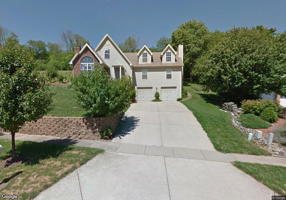
530 Leo Dr Hamilton, OH 45013
Estimated Value: $312,000 - $349,000
3
Beds
3
Baths
2,611
Sq Ft
$128/Sq Ft
Est. Value
About This Home
This home is located at 530 Leo Dr, Hamilton, OH 45013 and is currently estimated at $335,455, approximately $128 per square foot. 530 Leo Dr is a home located in Butler County with nearby schools including Bridgeport Elementary School, Wilson Middle School, and Hamilton High School Main Campus.
Ownership History
Date
Name
Owned For
Owner Type
Purchase Details
Closed on
Mar 24, 2004
Sold by
Mccoy Edward G
Bought by
Mccoy Edward G
Current Estimated Value
Purchase Details
Closed on
Jan 29, 1997
Sold by
Fred Estep Trst
Bought by
Mccoy Edward G
Home Financials for this Owner
Home Financials are based on the most recent Mortgage that was taken out on this home.
Original Mortgage
$122,200
Outstanding Balance
$14,052
Interest Rate
7.75%
Mortgage Type
New Conventional
Estimated Equity
$321,403
Purchase Details
Closed on
Apr 27, 1995
Sold by
Sanders Mark L
Bought by
Fred Estep Trustee
Home Financials for this Owner
Home Financials are based on the most recent Mortgage that was taken out on this home.
Original Mortgage
$38,400
Interest Rate
8.42%
Mortgage Type
New Conventional
Create a Home Valuation Report for This Property
The Home Valuation Report is an in-depth analysis detailing your home's value as well as a comparison with similar homes in the area
Home Values in the Area
Average Home Value in this Area
Purchase History
| Date | Buyer | Sale Price | Title Company |
|---|---|---|---|
| Mccoy Edward G | -- | -- | |
| Mccoy Edward G | -- | -- | |
| Mccoy Edward G | $21,900 | -- | |
| Fred Estep Trustee | $38,400 | -- |
Source: Public Records
Mortgage History
| Date | Status | Borrower | Loan Amount |
|---|---|---|---|
| Open | Mccoy Edward G | $122,200 | |
| Previous Owner | Fred Estep Trustee | $38,400 |
Source: Public Records
Tax History Compared to Growth
Tax History
| Year | Tax Paid | Tax Assessment Tax Assessment Total Assessment is a certain percentage of the fair market value that is determined by local assessors to be the total taxable value of land and additions on the property. | Land | Improvement |
|---|---|---|---|---|
| 2024 | $4,160 | $98,060 | $14,150 | $83,910 |
| 2023 | $4,142 | $98,060 | $14,150 | $83,910 |
| 2022 | $3,437 | $69,030 | $14,150 | $54,880 |
| 2021 | $3,022 | $66,720 | $14,150 | $52,570 |
| 2020 | $3,148 | $66,720 | $14,150 | $52,570 |
| 2019 | $4,505 | $61,530 | $14,230 | $47,300 |
| 2018 | $2,860 | $61,530 | $14,230 | $47,300 |
| 2017 | $2,885 | $61,530 | $14,230 | $47,300 |
| 2016 | $2,751 | $55,920 | $14,230 | $41,690 |
| 2015 | $2,736 | $55,920 | $14,230 | $41,690 |
| 2014 | $2,580 | $55,920 | $14,230 | $41,690 |
| 2013 | $2,580 | $54,580 | $11,650 | $42,930 |
Source: Public Records
Map
Nearby Homes
- 748 Beeler Blvd
- 1319 Peregrine Way
- 4 Peregrine Way
- 1331 Peregrine Way
- 850 NW Washington Blvd
- 720 Shultz Dr
- 14 Justin Place
- 721 Gordon Smith Blvd
- 655 Devanshae Ct
- 628 Beeler Blvd
- 706 Mark Ave
- 121 Random Dr
- 155 Crowthers Dr
- 160 Crowthers Dr
- 1321 Cleveland Ave
- 71 Livingston Dr
- 1229 Cleveland Ave
- 1421 Helma Ave
- 1252 Cleveland Ave
- 1369 Alexander Dr