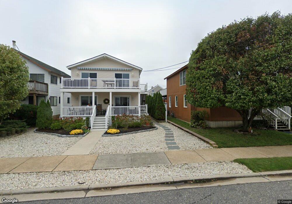
532 21st St Avalon, NJ 08202
Estimated Value: $1,299,000 - $2,010,000
--
Bed
2
Baths
960
Sq Ft
$1,649/Sq Ft
Est. Value
About This Home
This home is located at 532 21st St, Avalon, NJ 08202 and is currently estimated at $1,583,156, approximately $1,649 per square foot. 532 21st St is a home located in Cape May County with nearby schools including Avalon Elementary School.
Ownership History
Date
Name
Owned For
Owner Type
Purchase Details
Closed on
Jul 7, 2021
Sold by
Cooley-Dugan Rosemarie and Dugan James P
Bought by
Schantz Terry L and Schantz Tammy L
Current Estimated Value
Home Financials for this Owner
Home Financials are based on the most recent Mortgage that was taken out on this home.
Original Mortgage
$728,000
Outstanding Balance
$660,547
Interest Rate
2.9%
Mortgage Type
Purchase Money Mortgage
Estimated Equity
$922,609
Purchase Details
Closed on
Apr 27, 2018
Sold by
Schiller Kevin C
Bought by
Cooley-Dugan Rosemarie and Dugan James P
Home Financials for this Owner
Home Financials are based on the most recent Mortgage that was taken out on this home.
Original Mortgage
$35,000
Interest Rate
4.44%
Mortgage Type
Credit Line Revolving
Create a Home Valuation Report for This Property
The Home Valuation Report is an in-depth analysis detailing your home's value as well as a comparison with similar homes in the area
Home Values in the Area
Average Home Value in this Area
Purchase History
| Date | Buyer | Sale Price | Title Company |
|---|---|---|---|
| Schantz Terry L | $950,000 | None Available | |
| Cooley-Dugan Rosemarie | $69,000 | -- |
Source: Public Records
Mortgage History
| Date | Status | Borrower | Loan Amount |
|---|---|---|---|
| Open | Schantz Terry L | $728,000 | |
| Previous Owner | Cooley-Dugan Rosemarie | $35,000 | |
| Previous Owner | Cooley-Dugan Rosemarie | $453,100 |
Source: Public Records
Tax History Compared to Growth
Tax History
| Year | Tax Paid | Tax Assessment Tax Assessment Total Assessment is a certain percentage of the fair market value that is determined by local assessors to be the total taxable value of land and additions on the property. | Land | Improvement |
|---|---|---|---|---|
| 2025 | $2,904 | $473,000 | $400,000 | $73,000 |
| 2024 | $2,904 | $473,000 | $400,000 | $73,000 |
| 2023 | $2,881 | $473,000 | $400,000 | $73,000 |
| 2022 | $2,687 | $473,000 | $400,000 | $73,000 |
| 2021 | $2,587 | $473,000 | $400,000 | $73,000 |
| 2020 | $2,488 | $473,000 | $400,000 | $73,000 |
| 2019 | $2,412 | $473,000 | $400,000 | $73,000 |
| 2018 | $2,308 | $473,000 | $400,000 | $73,000 |
| 2017 | $2,582 | $464,300 | $325,000 | $139,300 |
| 2016 | $2,554 | $464,300 | $325,000 | $139,300 |
Source: Public Records
Map
Nearby Homes
- 503 20th St
- 647 Barry Rd
- 440 21st St Unit South (B)
- 415 20th St
- 431 24th St
- 890 21st St
- 389 22nd St
- 297 24th St Unit 297
- 297 24th St
- 2425 Harbor Ave Unit 2425
- 211 23rd St
- 212 25th St
- 212 25th St Unit East Unit
- 178 19th St
- 174 23rd St
- 161 24th St
- 279 13th St Unit C-6
- 279 13th St
- 179 27th St
- 128 16th St