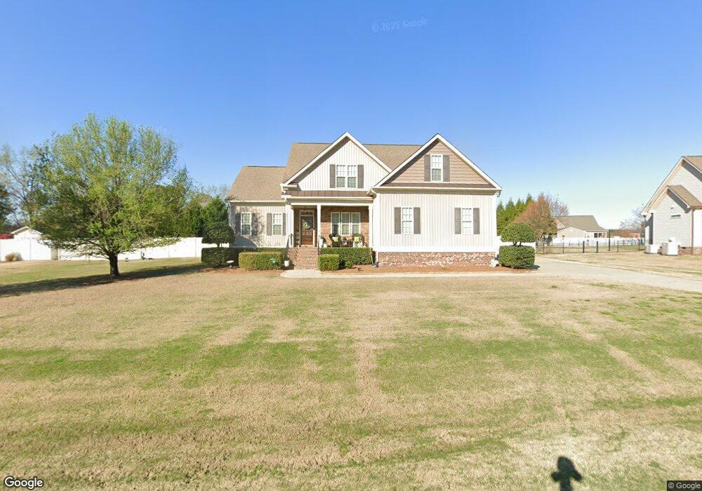
54 Dalry Ln Willow Spring, NC 27592
Pleasant Grove NeighborhoodEstimated Value: $439,000 - $489,000
3
Beds
3
Baths
2,430
Sq Ft
$189/Sq Ft
Est. Value
About This Home
This home is located at 54 Dalry Ln, Willow Spring, NC 27592 and is currently estimated at $459,634, approximately $189 per square foot. 54 Dalry Ln is a home located in Johnston County with nearby schools including Dixon Road Elementary School, McGee's Crossroads Middle School, and West Johnston High School.
Ownership History
Date
Name
Owned For
Owner Type
Purchase Details
Closed on
Dec 30, 2009
Sold by
Christopher Boyd Homes Inc
Bought by
Byars Douglas A and Byars Kate Ellen
Current Estimated Value
Home Financials for this Owner
Home Financials are based on the most recent Mortgage that was taken out on this home.
Original Mortgage
$197,500
Outstanding Balance
$127,882
Interest Rate
4.68%
Mortgage Type
New Conventional
Estimated Equity
$331,752
Purchase Details
Closed on
Sep 25, 2009
Sold by
S & S Land Development Llc
Bought by
Christopher Boyd Homes Inc
Home Financials for this Owner
Home Financials are based on the most recent Mortgage that was taken out on this home.
Original Mortgage
$197,520
Interest Rate
5.1%
Mortgage Type
Future Advance Clause Open End Mortgage
Create a Home Valuation Report for This Property
The Home Valuation Report is an in-depth analysis detailing your home's value as well as a comparison with similar homes in the area
Home Values in the Area
Average Home Value in this Area
Purchase History
| Date | Buyer | Sale Price | Title Company |
|---|---|---|---|
| Byars Douglas A | $247,000 | None Available | |
| Christopher Boyd Homes Inc | $54,000 | Chicago Title Insurance Co |
Source: Public Records
Mortgage History
| Date | Status | Borrower | Loan Amount |
|---|---|---|---|
| Open | Byars Douglas A | $197,500 | |
| Previous Owner | Christopher Boyd Homes Inc | $197,520 |
Source: Public Records
Tax History
| Year | Tax Paid | Tax Assessment Tax Assessment Total Assessment is a certain percentage of the fair market value that is determined by local assessors to be the total taxable value of land and additions on the property. | Land | Improvement |
|---|---|---|---|---|
| 2025 | $2,662 | $419,140 | $75,000 | $344,140 |
| 2024 | $2,169 | $267,820 | $45,000 | $222,820 |
| 2023 | $2,102 | $267,820 | $45,000 | $222,820 |
| 2022 | $2,169 | $267,820 | $45,000 | $222,820 |
| 2021 | $2,169 | $267,820 | $45,000 | $222,820 |
| 2020 | $2,250 | $267,820 | $45,000 | $222,820 |
| 2019 | $2,196 | $267,820 | $45,000 | $222,820 |
| 2018 | $2,021 | $240,600 | $40,000 | $200,600 |
| 2017 | $2,021 | $240,600 | $40,000 | $200,600 |
| 2016 | $2,021 | $240,600 | $40,000 | $200,600 |
| 2015 | $2,021 | $240,600 | $40,000 | $200,600 |
| 2014 | $2,021 | $240,600 | $40,000 | $200,600 |
Source: Public Records
Map
Nearby Homes
- 55 Dolores Ct
- 200 Reese Dr
- 115 Edmondson Dr
- 222 Susan Dr
- 50 Linden Ct
- 368 Artic Cir
- 304 Artic Cir
- 58 Tractor Place
- 131 Artic Cir
- 102 Ina Joe Place
- 111 Artic Cir
- 909 Mount Pleasant Rd
- 181 Fawn Hill Ct
- 232 Fawn Hill Ct
- 160 W Fountainhead Ln
- 122 Fountainhead Ln
- 16 Saddle Ridge Dr
- 268 Tennyson Dr
- 623 Ravensworth Dr Unit Lot 149
- 595 Ravensworth Dr
Your Personal Tour Guide
Ask me questions while you tour the home.