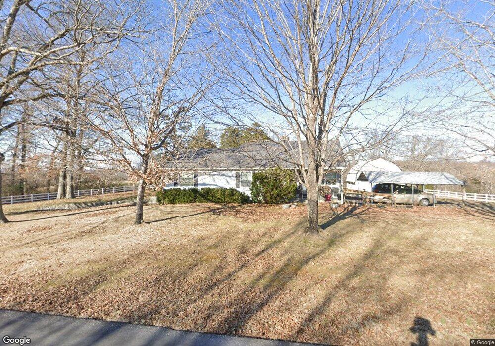
541 Aplin Branch Rd Cottontown, TN 37048
Estimated Value: $452,000 - $1,452,653
--
Bed
2
Baths
1,612
Sq Ft
$591/Sq Ft
Est. Value
About This Home
This home is located at 541 Aplin Branch Rd, Cottontown, TN 37048 and is currently estimated at $952,327, approximately $590 per square foot. 541 Aplin Branch Rd is a home located in Sumner County with nearby schools including Portland Gateview Elementary School, Portland West Middle School, and Portland High School.
Ownership History
Date
Name
Owned For
Owner Type
Purchase Details
Closed on
Mar 29, 2006
Sold by
Link Shelby L
Bought by
Moseley Shyla L
Current Estimated Value
Purchase Details
Closed on
Jun 23, 2003
Sold by
Jernigan William D and Jernigan Jessie B
Bought by
Jernigan William D and Jernigan Jessie B
Purchase Details
Closed on
Nov 4, 2002
Sold by
Jernigan William D and Jernigan Jessie B
Bought by
Jernigan William D and Jernigan Jessie B
Create a Home Valuation Report for This Property
The Home Valuation Report is an in-depth analysis detailing your home's value as well as a comparison with similar homes in the area
Home Values in the Area
Average Home Value in this Area
Purchase History
| Date | Buyer | Sale Price | Title Company |
|---|---|---|---|
| Moseley Shyla L | -- | None Available | |
| Jernigan William D | -- | -- | |
| Jernigan William D | -- | -- | |
| Jernigan William D | -- | -- |
Source: Public Records
Tax History Compared to Growth
Tax History
| Year | Tax Paid | Tax Assessment Tax Assessment Total Assessment is a certain percentage of the fair market value that is determined by local assessors to be the total taxable value of land and additions on the property. | Land | Improvement |
|---|---|---|---|---|
| 2024 | $1,798 | $126,525 | $78,975 | $47,550 |
| 2023 | $1,735 | $77,025 | $50,300 | $26,725 |
| 2022 | $1,742 | $77,025 | $50,300 | $26,725 |
| 2021 | $1,742 | $77,025 | $50,300 | $26,725 |
| 2020 | $1,742 | $77,025 | $50,300 | $26,725 |
| 2019 | $1,742 | $0 | $0 | $0 |
| 2018 | $1,374 | $0 | $0 | $0 |
| 2017 | $1,374 | $0 | $0 | $0 |
| 2016 | $1,374 | $0 | $0 | $0 |
| 2015 | -- | $0 | $0 | $0 |
| 2014 | -- | $0 | $0 | $0 |
Source: Public Records
Map
Nearby Homes
- 293 Aplin Branch Rd
- 572 Buntin Mill Rd
- 686 Clearview Rd
- 267 Aplin Branch Rd
- 1 Clearview Rd
- 1502 New Deal Potts Rd
- 0 W Harper Rd Unit RTC3031920
- 0 W Harper Rd Unit RTC3031918
- 0 W Harper Rd Unit RTC3031917
- 0 W Harper Rd Unit RTC3031919
- 0 W Harper Rd Unit RTC3031921
- 541 Clearview Rd
- 782 New Deal Potts Rd
- 1003 Roland Ct
- 0 New Deal Pots Rd
- 721 New Deal Potts Rd
- 105 Riggs Rd
- 101 Riggs Rd
- 432 Crafton Rd
- 1014 Somerville Dr
- 532 Aplin Branch Rd
- 565 Aplin Branch Rd
- 569 Aplin Branch Rd
- 152 Marcin Ln
- 150 Marcin Ln
- 575 Aplin Branch Rd
- 156 Marcin Ln
- 151 Marcin Ln
- 595 Aplin Branch Rd
- 315 Lamberth Rd
- 498 Aplin Branch Rd
- 365 Aplin Branch Rd
- 365 Aplin Branch Rd
- 632 Aplin Branch Rd
- 570 Aplin Branch Rd
- 215 Lamberth Rd
- 1209 New Deal Potts Rd
- 169 Lamberth Rd
- 199 Lamberth Rd
- 170 Lamberth Rd