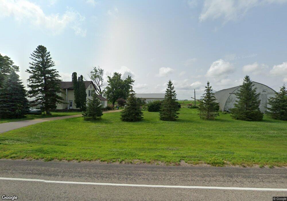
54257 153rd St Good Thunder, MN 56037
Estimated Value: $298,896 - $375,000
3
Beds
2
Baths
1,800
Sq Ft
$191/Sq Ft
Est. Value
About This Home
This home is located at 54257 153rd St, Good Thunder, MN 56037 and is currently estimated at $343,974, approximately $191 per square foot. 54257 153rd St is a home located in Blue Earth County with nearby schools including Lake Crystal Wellcome Memorial Elementary School, Lake Crystal Wellcome Memorial Secondary School, and St. John Lutheran School.
Ownership History
Date
Name
Owned For
Owner Type
Purchase Details
Closed on
Jan 7, 2020
Sold by
Depuydt Elijah and Depuydt Rachal
Bought by
Blue Earth County
Current Estimated Value
Purchase Details
Closed on
Oct 24, 2014
Sold by
Mountain David M and Mountain Beveree
Bought by
Depuydt Elijah and Depuydt Rachal
Home Financials for this Owner
Home Financials are based on the most recent Mortgage that was taken out on this home.
Original Mortgage
$191,250
Interest Rate
4.75%
Mortgage Type
New Conventional
Create a Home Valuation Report for This Property
The Home Valuation Report is an in-depth analysis detailing your home's value as well as a comparison with similar homes in the area
Home Values in the Area
Average Home Value in this Area
Purchase History
| Date | Buyer | Sale Price | Title Company |
|---|---|---|---|
| Blue Earth County | $6,500 | None Available | |
| Depuydt Elijah | $225,000 | Agstar Title |
Source: Public Records
Mortgage History
| Date | Status | Borrower | Loan Amount |
|---|---|---|---|
| Previous Owner | Depuydt Elijah | $191,250 |
Source: Public Records
Tax History Compared to Growth
Tax History
| Year | Tax Paid | Tax Assessment Tax Assessment Total Assessment is a certain percentage of the fair market value that is determined by local assessors to be the total taxable value of land and additions on the property. | Land | Improvement |
|---|---|---|---|---|
| 2025 | $1,968 | $297,000 | $68,300 | $228,700 |
| 2024 | $1,968 | $275,400 | $68,300 | $207,100 |
| 2023 | $2,192 | $317,200 | $83,500 | $233,700 |
| 2022 | $2,152 | $279,300 | $79,000 | $200,300 |
| 2021 | $2,082 | $242,500 | $76,700 | $165,800 |
| 2020 | $1,988 | $233,800 | $68,900 | $164,900 |
| 2019 | $1,860 | $233,800 | $68,900 | $164,900 |
| 2018 | $1,612 | $217,800 | $67,800 | $150,000 |
| 2017 | $1,552 | $202,200 | $68,900 | $133,300 |
| 2016 | $1,472 | $197,100 | $68,900 | $128,200 |
| 2015 | $14 | $186,400 | $69,800 | $116,600 |
| 2014 | $1,510 | $190,300 | $72,000 | $118,300 |
Source: Public Records
Map
Nearby Homes
- 721 Main St
- 211 211 S Houk St
- 305 E Main St
- 16225 563rd Ave
- 205 Park Ave N
- 201 201 N Park Ave
- 14118 521st Ave
- 55997 132nd St
- 56273 185th Ln
- 57400 178th Ln
- 120 Mapleridge Dr
- 120 T-639
- 324 North St W
- 324 324 W St N
- 300 South St E
- 0 Tbd E 161st St
- 200 200 W Maine St
- 413 413 W St N
- 0 Tbd E Tbd Unit 7038384
- 17172 17172 State 22 Hwy Unit 17172 State Highway