
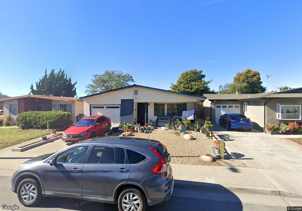
543 Bridge St Watsonville, CA 95076
Estimated Value: $520,000 - $550,670
2
Beds
1
Bath
908
Sq Ft
$592/Sq Ft
Est. Value
Highlights
- Eat-In Kitchen
- Level Lot
- 1-Story Property
- Dining Room
About This Home
As of January 2015Nice 2 bedroom 1 bath home in Watsonville's Adult community. Front yard, and rear yard for gardening if you choose or just a place to be outdoors. Attached 1 car garage to get you out of the weather and into the house. Age restricted to 55 plus. Owner can be younger but can't live there.
Last Listed By
CENTURY 21 Real Estate Alliance License #01338271 Listed on: 07/19/2014
Home Details
Home Type
- Single Family
Est. Annual Taxes
- $3,376
Year Built
- Built in 1972
Lot Details
- Level Lot
- Zoning described as R1
Parking
- 1 Car Garage
Home Design
- Slab Foundation
- Composition Roof
Interior Spaces
- 908 Sq Ft Home
- 1-Story Property
- Dining Room
- Eat-In Kitchen
Bedrooms and Bathrooms
- 2 Bedrooms
- 1 Full Bathroom
Utilities
- Wall Furnace
- Sewer Within 50 Feet
Listing and Financial Details
- Assessor Parcel Number 017-372-027
Ownership History
Date
Name
Owned For
Owner Type
Purchase Details
Closed on
Jul 22, 2021
Sold by
Masters Michael A and Masters Marylou
Bought by
Masters Michael A and Masters Marylou
Total Days on Market
129
Current Estimated Value
Purchase Details
Listed on
Jul 19, 2014
Closed on
Dec 29, 2014
Sold by
Riordan O Brien and The O Brien Riordan 1999 Trust
Bought by
Masters Mike and Masters Mary Lou
Seller's Agent
Randy Turnquist
CENTURY 21 Real Estate Alliance
Buyer's Agent
RECIP
Out of Area Office
List Price
$249,000
Sold Price
$220,000
Premium/Discount to List
-$29,000
-11.65%
Purchase Details
Closed on
Oct 28, 1999
Sold by
Riordan O Brien Um
Bought by
Riordan Obrien and Obrien Riordan 1999 Trust
Create a Home Valuation Report for This Property
The Home Valuation Report is an in-depth analysis detailing your home's value as well as a comparison with similar homes in the area
Similar Homes in Watsonville, CA
Home Values in the Area
Average Home Value in this Area
Purchase History
| Date | Buyer | Sale Price | Title Company |
|---|---|---|---|
| Masters Michael A | -- | None Available | |
| Masters Mike | $220,000 | Old Republic Title Company | |
| Riordan Obrien | -- | -- |
Source: Public Records
Property History
| Date | Event | Price | Change | Sq Ft Price |
|---|---|---|---|---|
| 01/09/2015 01/09/15 | Sold | $220,000 | -4.3% | $242 / Sq Ft |
| 11/25/2014 11/25/14 | Pending | -- | -- | -- |
| 11/01/2014 11/01/14 | Price Changed | $230,000 | -3.8% | $253 / Sq Ft |
| 10/23/2014 10/23/14 | Price Changed | $239,000 | -4.0% | $263 / Sq Ft |
| 08/31/2014 08/31/14 | Price Changed | $249,000 | +13.2% | $274 / Sq Ft |
| 08/31/2014 08/31/14 | Off Market | $220,000 | -- | -- |
| 08/31/2014 08/31/14 | For Sale | $249,000 | -28.7% | $274 / Sq Ft |
| 07/24/2014 07/24/14 | Price Changed | $349,000 | +40.2% | $384 / Sq Ft |
| 07/19/2014 07/19/14 | For Sale | $249,000 | -- | $274 / Sq Ft |
Source: MLSListings
Tax History Compared to Growth
Tax History
| Year | Tax Paid | Tax Assessment Tax Assessment Total Assessment is a certain percentage of the fair market value that is determined by local assessors to be the total taxable value of land and additions on the property. | Land | Improvement |
|---|---|---|---|---|
| 2023 | $3,376 | $254,140 | $165,191 | $88,949 |
| 2022 | $3,310 | $249,157 | $161,952 | $87,205 |
| 2021 | $2,977 | $244,271 | $158,776 | $85,495 |
| 2020 | $2,935 | $241,766 | $157,148 | $84,618 |
| 2019 | $2,883 | $237,026 | $154,067 | $82,959 |
| 2018 | $2,811 | $232,378 | $151,046 | $81,332 |
| 2017 | $2,786 | $227,822 | $148,085 | $79,737 |
| 2016 | $2,714 | $223,355 | $145,181 | $78,174 |
| 2015 | $1,597 | $132,982 | $57,998 | $74,984 |
| 2014 | $1,561 | $130,377 | $56,862 | $73,515 |
Source: Public Records
Agents Affiliated with this Home
-
Randy Turnquist
Seller's Agent in 2015
Randy Turnquist
CENTURY 21 Real Estate Alliance
(831) 566-2590
13 Total Sales
-
R
Buyer's Agent in 2015
RECIP
Out of Area Office
Map
Source: MLSListings
MLS Number: ML81426077
APN: 017-372-27-000
Disclaimer: Certain information contained herein is derived from information provided by parties other than Homes.com. All information provided is deemed reliable, but is not guaranteed to be accurate and should be independently verified.
![]() Property Information © 2025 MLSListings Inc. All rights reserved. Listing information is deemed reliable but not guaranteed. Certain information contained herein is derived from information which is the licensed property of, and copyrighted by, MLSListings Inc. The viewer acknowledges ownership and validity of its copyright. Information provided is for personal, non-commercial use by a viewer with a bona fide interest in the purchase or sale of real estate of the type being offered via this website or other electronic means. The viewer is prohibited from copying, redistributing or retransmitting any of the data or information provided by MLSListing, Inc.
Property Information © 2025 MLSListings Inc. All rights reserved. Listing information is deemed reliable but not guaranteed. Certain information contained herein is derived from information which is the licensed property of, and copyrighted by, MLSListings Inc. The viewer acknowledges ownership and validity of its copyright. Information provided is for personal, non-commercial use by a viewer with a bona fide interest in the purchase or sale of real estate of the type being offered via this website or other electronic means. The viewer is prohibited from copying, redistributing or retransmitting any of the data or information provided by MLSListing, Inc.
Nearby Homes
- 563 Argos Cir
- 262 Hushbeck Ave
- 515 Mckenzie Ave
- 626 Ester Way
- 30 Riverside Rd
- 443 Tuttle Ave
- 229 Elm St
- 630 California St
- 764 Bronte Ave
- 786 Bronte Ave
- 1007 1015 E Lake Ave
- 133 Trafton St
- 1017 E Lake Ave
- 22 Roosevelt St
- 41 Wagner Ave
- 41 Bronson St
- 728 Brewington Ave
- 101 Bronson St
- 12 Eastern Dr
- 1037 Freedom Blvd