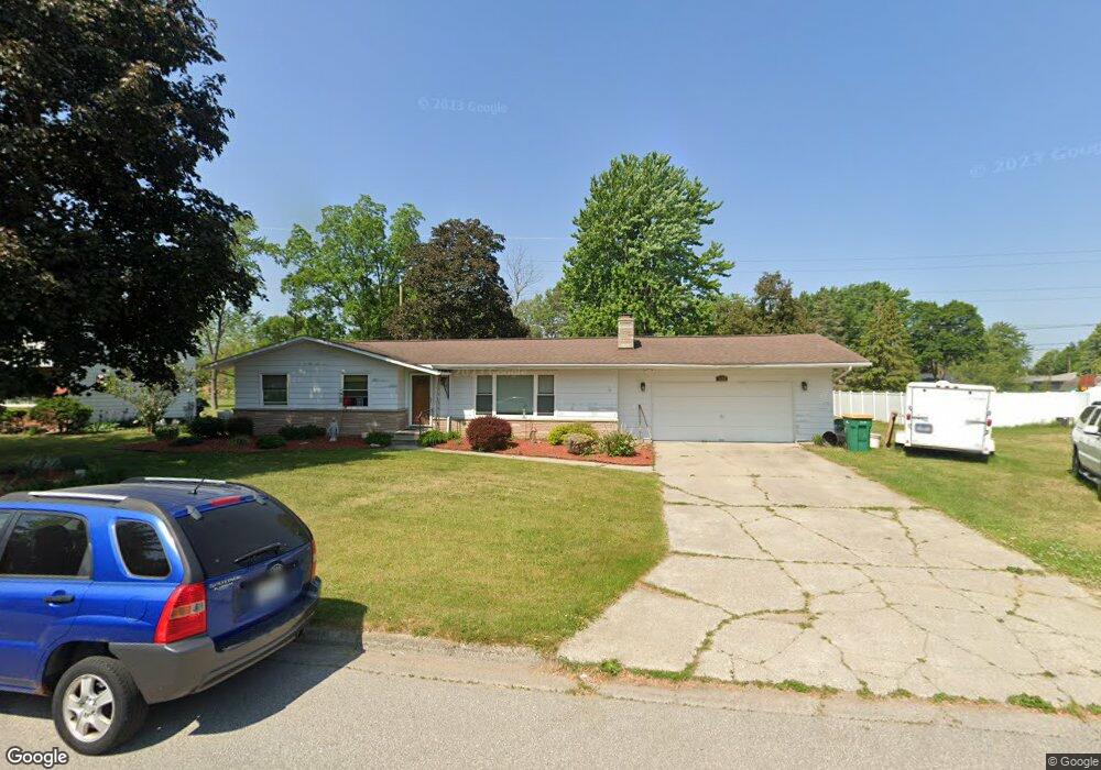
5436 Michael Rd Bay City, MI 48706
Estimated Value: $222,166 - $253,000
--
Bed
1
Bath
1,418
Sq Ft
$163/Sq Ft
Est. Value
About This Home
This home is located at 5436 Michael Rd, Bay City, MI 48706 and is currently estimated at $230,792, approximately $162 per square foot. 5436 Michael Rd is a home located in Bay County with nearby schools including Mackensen Elementary School, Western Middle School, and Bay City Western High School.
Ownership History
Date
Name
Owned For
Owner Type
Purchase Details
Closed on
Mar 6, 2006
Sold by
George Randall F and George Norma Jean
Bought by
Osterhout Kathleen M and Osterhout James J
Current Estimated Value
Home Financials for this Owner
Home Financials are based on the most recent Mortgage that was taken out on this home.
Original Mortgage
$100,000
Outstanding Balance
$57,612
Interest Rate
6.5%
Mortgage Type
Fannie Mae Freddie Mac
Estimated Equity
$173,180
Create a Home Valuation Report for This Property
The Home Valuation Report is an in-depth analysis detailing your home's value as well as a comparison with similar homes in the area
Home Values in the Area
Average Home Value in this Area
Purchase History
| Date | Buyer | Sale Price | Title Company |
|---|---|---|---|
| Osterhout Kathleen M | $125,000 | Titlequest Ins Agency Inc |
Source: Public Records
Mortgage History
| Date | Status | Borrower | Loan Amount |
|---|---|---|---|
| Open | Osterhout Kathleen M | $100,000 |
Source: Public Records
Tax History Compared to Growth
Tax History
| Year | Tax Paid | Tax Assessment Tax Assessment Total Assessment is a certain percentage of the fair market value that is determined by local assessors to be the total taxable value of land and additions on the property. | Land | Improvement |
|---|---|---|---|---|
| 2025 | $2,492 | $98,400 | $0 | $0 |
| 2024 | $978 | $94,200 | $0 | $0 |
| 2023 | $931 | $91,600 | $0 | $0 |
| 2022 | $2,279 | $70,900 | $0 | $0 |
| 2021 | $2,128 | $75,900 | $75,900 | $0 |
| 2020 | $2,120 | $69,900 | $69,900 | $0 |
| 2019 | $2,011 | $59,800 | $0 | $0 |
| 2018 | $1,947 | $62,100 | $0 | $0 |
| 2017 | $1,852 | $63,300 | $0 | $0 |
| 2016 | $1,858 | $61,500 | $0 | $61,500 |
| 2015 | $780 | $60,500 | $0 | $60,500 |
| 2014 | $780 | $52,500 | $0 | $52,500 |
Source: Public Records
Map
Nearby Homes
- 2924 Imperial Dr
- 5136 Baxman Rd
- 5115 Baxman Rd
- 5231 Parkway Dr
- 39 E Salzburg Rd
- 3343 Parkway Dr
- 2777 E Fisher Rd
- 3176 E Fisher Rd
- 0 2 Mile Rd Unit 50169642
- 0 Fisher Rd
- 0 S Two Mile Rd Unit 50142051
- 5989 Red Feather Dr
- 1901 S Mountain St
- 4848 W Westgate Dr
- 1711 Raymond St
- 3106 S Euclid Ave
- 2491 E Meadow Dr
- 1801 S Warner St
- 4738 Maplewood Dr
- 6025 E Meadow Dr
- 5426 Michael Dr
- 5426 Michael Rd
- 5444 Michael Rd
- 5431 Michael Rd
- 5439 Michael Rd
- 5456 Michael Rd
- 5416 Michael Rd
- 5449 Michael Rd
- 5416 Michael Dr
- 5421 Michael Rd
- 5440 Easy St
- 5432 Easy St
- 5441 Harvest Ct
- 5429 Harvest Ct
- 5411 Michael Rd
- 5408 Michael Rd
- 5450 Easy St
- 5422 Easy St
- 2906 Easy St
- 5455 Harvest Ct