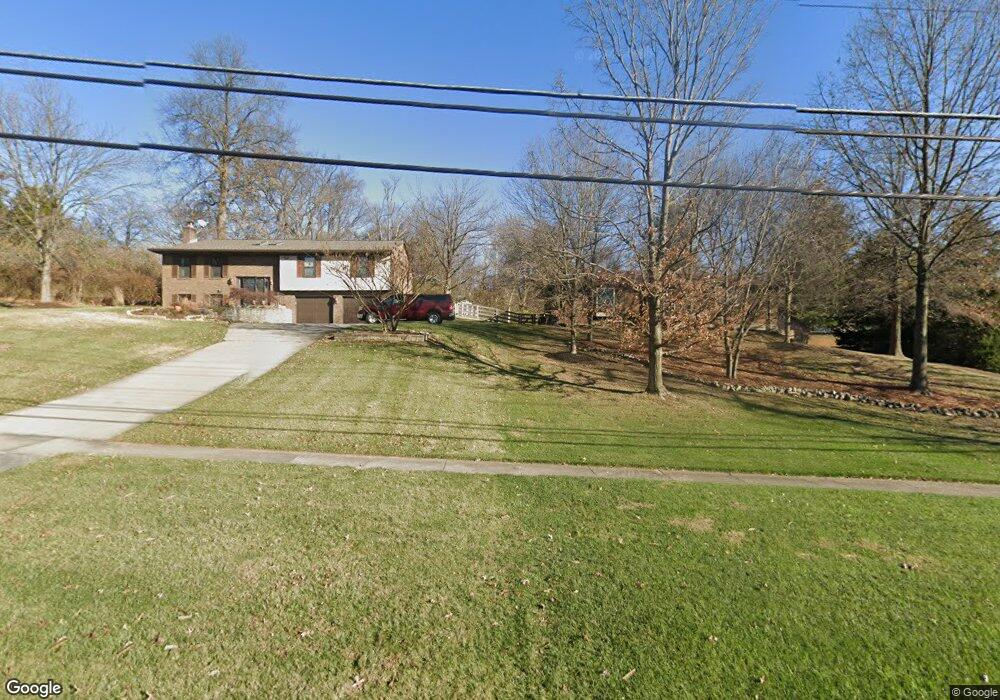
5448 Race Rd Cincinnati, OH 45247
West Monfort Heights NeighborhoodEstimated Value: $412,000 - $502,000
3
Beds
2
Baths
2,173
Sq Ft
$206/Sq Ft
Est. Value
About This Home
This home is located at 5448 Race Rd, Cincinnati, OH 45247 and is currently estimated at $446,711, approximately $205 per square foot. 5448 Race Rd is a home located in Hamilton County with nearby schools including Monfort Heights Elementary School, White Oak Middle School, and Colerain High School.
Ownership History
Date
Name
Owned For
Owner Type
Purchase Details
Closed on
Nov 7, 2005
Sold by
Smith John H and Smith Patricia L
Bought by
Guck Tony J and Guck Michele
Current Estimated Value
Home Financials for this Owner
Home Financials are based on the most recent Mortgage that was taken out on this home.
Original Mortgage
$246,000
Outstanding Balance
$134,169
Interest Rate
6.36%
Mortgage Type
Fannie Mae Freddie Mac
Estimated Equity
$312,542
Create a Home Valuation Report for This Property
The Home Valuation Report is an in-depth analysis detailing your home's value as well as a comparison with similar homes in the area
Home Values in the Area
Average Home Value in this Area
Purchase History
| Date | Buyer | Sale Price | Title Company |
|---|---|---|---|
| Guck Tony J | -- | Vintage Title Agency |
Source: Public Records
Mortgage History
| Date | Status | Borrower | Loan Amount |
|---|---|---|---|
| Open | Guck Tony J | $246,000 |
Source: Public Records
Tax History
| Year | Tax Paid | Tax Assessment Tax Assessment Total Assessment is a certain percentage of the fair market value that is determined by local assessors to be the total taxable value of land and additions on the property. | Land | Improvement |
|---|---|---|---|---|
| 2025 | $7,778 | $143,007 | $35,382 | $107,625 |
| 2024 | $7,630 | $143,007 | $35,382 | $107,625 |
| 2023 | $7,649 | $143,007 | $35,382 | $107,625 |
| 2022 | $6,675 | $101,875 | $34,458 | $67,417 |
| 2021 | $6,140 | $101,875 | $34,458 | $67,417 |
| 2020 | $6,178 | $101,875 | $34,458 | $67,417 |
| 2019 | $6,097 | $90,958 | $30,765 | $60,193 |
| 2018 | $5,433 | $90,958 | $30,765 | $60,193 |
| 2017 | $5,147 | $90,958 | $30,765 | $60,193 |
| 2016 | $5,305 | $92,215 | $30,457 | $61,758 |
| 2015 | $5,340 | $92,215 | $30,457 | $61,758 |
| 2014 | $5,351 | $92,215 | $30,457 | $61,758 |
| 2013 | $5,057 | $93,146 | $30,765 | $62,381 |
Source: Public Records
Map
Nearby Homes
- 5588 W Fork Rd
- 5563 Haft Rd
- 5339 Race Rd
- 5525 Whispering Way
- 4491 W Fork Rd
- 5876 Sutters Mill Dr
- 5804 Cedaridge Dr
- 4192 Timberpoint Dr
- 4366 Runningfawn Dr
- 4643 Whispering Oak Trail
- 4600 Farcrest Ct
- 4252 Runningfawn Dr
- 3899 Ridgedale Dr
- 5182 Michael Anthony Ln
- 4575 Boomer Rd
- 5225 Ivy Rose Ln
- 5080 Jessup Rd
- 5165 Rowan Dr
- 5320 Meadow Walk Ln
- 5220 Valley Ridge Rd
Your Personal Tour Guide
Ask me questions while you tour the home.