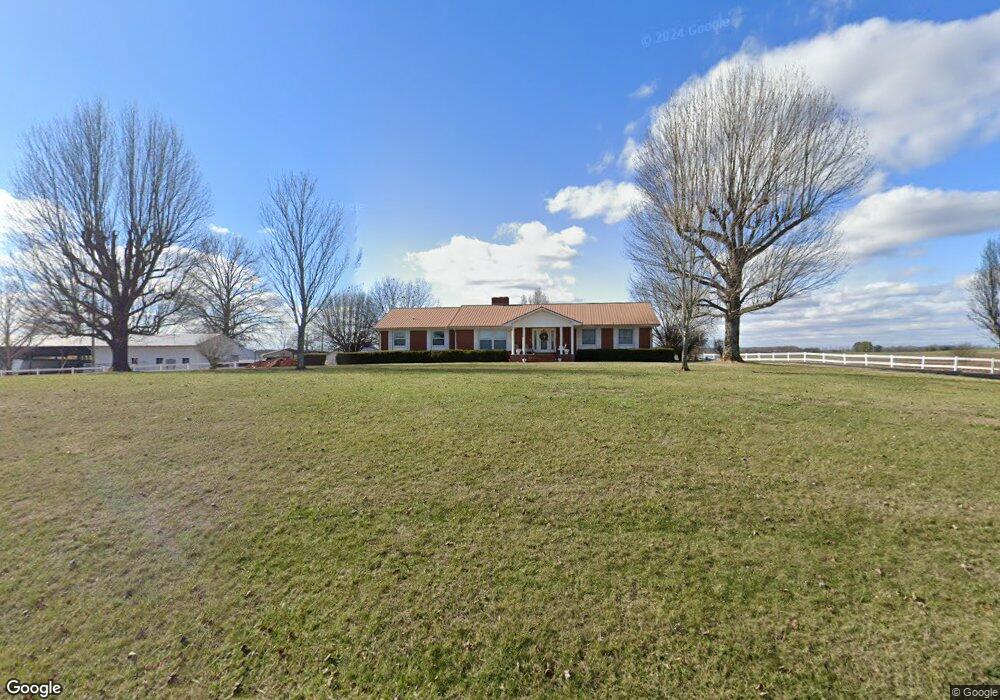
549 Swann Ln Decherd, TN 37324
Estimated Value: $321,528 - $355,000
Studio
2
Baths
2,016
Sq Ft
$169/Sq Ft
Est. Value
About This Home
This home is located at 549 Swann Ln, Decherd, TN 37324 and is currently estimated at $341,382, approximately $169 per square foot. 549 Swann Ln is a home located in Franklin County with nearby schools including North Middle School and Franklin County High School.
Ownership History
Date
Name
Owned For
Owner Type
Purchase Details
Closed on
Jul 17, 2017
Sold by
Swann Thomas D and Swann Alan W
Bought by
Swann Russell Todd
Current Estimated Value
Purchase Details
Closed on
Mar 11, 2013
Sold by
Swann Thomas D Tru
Bought by
Swann Thomas Denny and Swann Mona Farmer
Purchase Details
Closed on
Sep 6, 2002
Sold by
Swann Thomas D
Bought by
Swann Thomas D
Purchase Details
Closed on
May 10, 1988
Purchase Details
Closed on
Sep 21, 1968
Purchase Details
Closed on
Dec 4, 1967
Bought by
Swann Beatrice D
Purchase Details
Closed on
Jan 16, 1962
Create a Home Valuation Report for This Property
The Home Valuation Report is an in-depth analysis detailing your home's value as well as a comparison with similar homes in the area
Purchase History
| Date | Buyer | Sale Price | Title Company |
|---|---|---|---|
| Swann Russell Todd | $157,000 | None Available | |
| Swann Thomas Denny | $118,967 | -- | |
| Swann Thomas Denny | $566,000 | -- | |
| Swann Thomas D | -- | -- | |
| -- | $152,000 | -- | |
| -- | -- | -- | |
| Swann Beatrice D | -- | -- | |
| -- | -- | -- |
Source: Public Records
Tax History
| Year | Tax Paid | Tax Assessment Tax Assessment Total Assessment is a certain percentage of the fair market value that is determined by local assessors to be the total taxable value of land and additions on the property. | Land | Improvement |
|---|---|---|---|---|
| 2025 | $1,503 | $75,325 | $11,450 | $63,875 |
| 2024 | $1,503 | $75,325 | $11,450 | $63,875 |
| 2023 | $1,503 | $75,325 | $11,450 | $63,875 |
| 2022 | $1,413 | $75,325 | $11,450 | $63,875 |
| 2021 | $1,146 | $75,325 | $11,450 | $63,875 |
| 2020 | $1,146 | $39,825 | $7,525 | $32,300 |
| 2019 | $1,146 | $39,825 | $7,525 | $32,300 |
| 2018 | $1,063 | $39,825 | $7,525 | $32,300 |
| 2017 | $1,063 | $39,750 | $7,525 | $32,225 |
| 2016 | $995 | $37,200 | $7,150 | $30,050 |
| 2015 | $995 | $37,200 | $7,150 | $30,050 |
| 2014 | $995 | $37,197 | $0 | $0 |
Source: Public Records
Map
Nearby Homes
- 1191 Knights Church Rd
- 159 Hesselly Rd
- 93 Hesselly Rd
- 12 Hesselly Rd
- 146 Hesselly Rd
- 406 Asia Rd
- 2864 Old Alto Hwy
- 2846 Old Alto Hwy
- 150 N Fork Branch Rd
- 21 Bartow St
- 41 Bartow St
- 26 Mimosa Dr
- 435 Penile Dr
- 599 Mimosa Dr
- 296 Penile Dr
- 3770 Penile Hill Rd
- 325 Francis Rd
- 25 Billy Goat Hill Rd
- 25 Glasner Ln
- 585 Paynes Church Rd
- 413 Swann Ln
- 3236 Shelly Rd
- 756 Swann Ln
- 804 Swann Ln
- 880 Swann Ln
- 170 Swann Ln
- 116 Swann Ln
- 201 Swann Ln
- 82 Swann Ln
- 1147 Knights Church Rd
- 50 Swann Ln
- 1024 Swann Ln
- 1068 Swann Ln
- 1505 Knights Church Rd
- 0 Swann Ln Unit 1827532
- 1404 Knights Church Rd
- 2661 Shelly Rd
- 2661 Shelly Rd
- 2560 Shelly Rd
- 4352 Knights Church Rd
Your Personal Tour Guide
Ask me questions while you tour the home.