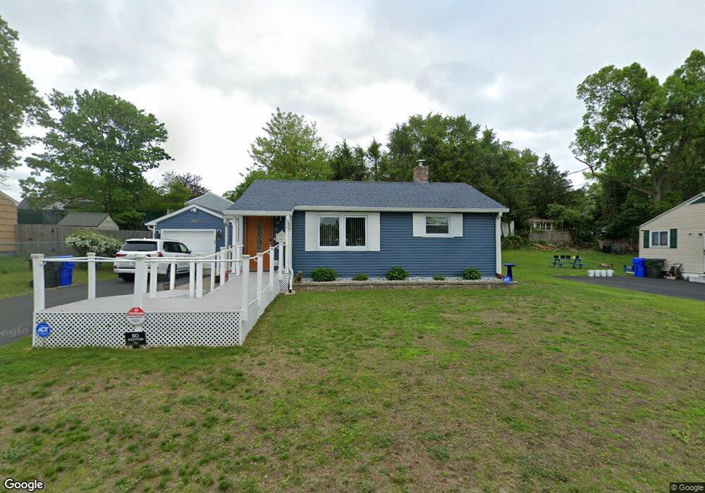
55 Loretta St Springfield, MA 01118
East Forest Park NeighborhoodEstimated Value: $303,000 - $312,811
3
Beds
1
Bath
1,076
Sq Ft
$285/Sq Ft
Est. Value
About This Home
This home is located at 55 Loretta St, Springfield, MA 01118 and is currently estimated at $306,703, approximately $285 per square foot. 55 Loretta St is a home located in Hampden County with nearby schools including Mary A. Dryden Veterans Memorial School, M Marcus Kiley Middle, and Springfield High School of Science and Technology.
Create a Home Valuation Report for This Property
The Home Valuation Report is an in-depth analysis detailing your home's value as well as a comparison with similar homes in the area
Home Values in the Area
Average Home Value in this Area
Tax History
| Year | Tax Paid | Tax Assessment Tax Assessment Total Assessment is a certain percentage of the fair market value that is determined by local assessors to be the total taxable value of land and additions on the property. | Land | Improvement |
|---|---|---|---|---|
| 2025 | $4,723 | $301,200 | $47,400 | $253,800 |
| 2024 | $4,195 | $261,200 | $47,400 | $213,800 |
| 2023 | $3,604 | $211,400 | $45,100 | $166,300 |
| 2022 | $3,275 | $174,000 | $45,100 | $128,900 |
| 2021 | $3,132 | $165,700 | $41,000 | $124,700 |
| 2020 | $2,992 | $153,200 | $41,000 | $112,200 |
| 2019 | $2,911 | $147,900 | $41,000 | $106,900 |
| 2018 | $2,850 | $144,800 | $41,000 | $103,800 |
| 2017 | $2,688 | $136,700 | $41,000 | $95,700 |
| 2016 | $2,601 | $132,300 | $41,000 | $91,300 |
| 2015 | $2,622 | $133,300 | $41,000 | $92,300 |
Source: Public Records
Map
Nearby Homes
- 44 Amanda St
- 22 Amanda St
- 118 Pilgrim Rd
- 55 Mandalay Rd
- 410 Allen St
- 0 NS (24) Alden St
- 134 Eddywood St
- 67 Perkins St
- 59 Daviston St
- 192 White St
- 236 Pondview Dr
- 7 Ashbrook St
- 327 Orange St
- 867 Roosevelt Ave
- 79 Arvilla St
- 854-856 Sumner Ave
- 79 Roosevelt Ave
- 135-137 Suffolk St
- 124-126 Westford Cir
- 15 Malden St
Your Personal Tour Guide
Ask me questions while you tour the home.