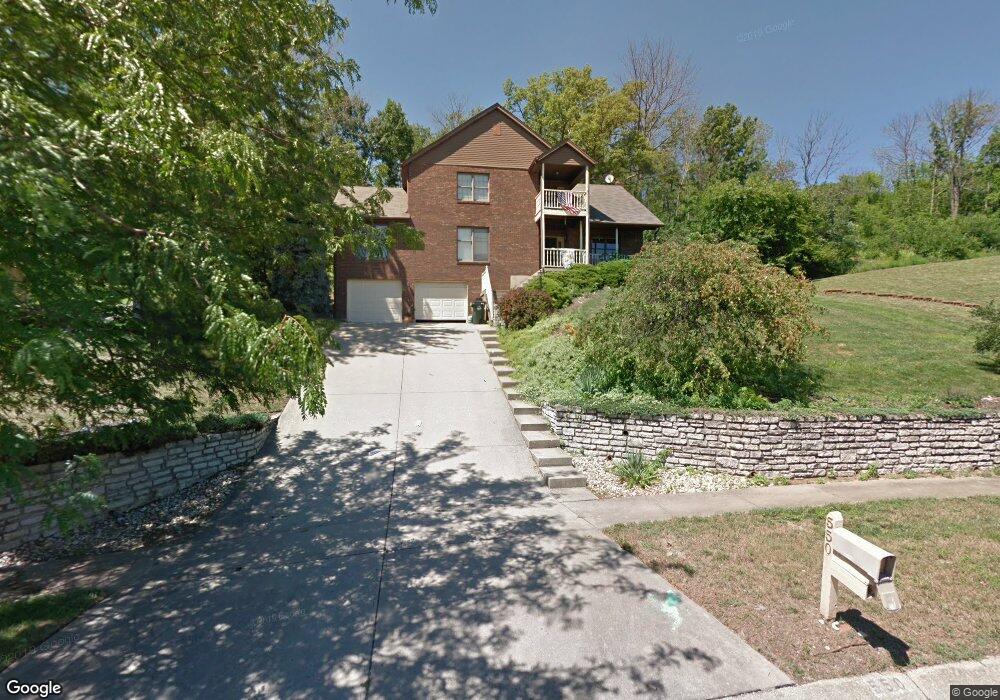
550 Leo Dr Hamilton, OH 45013
Estimated Value: $319,000 - $393,557
3
Beds
4
Baths
2,522
Sq Ft
$146/Sq Ft
Est. Value
About This Home
This home is located at 550 Leo Dr, Hamilton, OH 45013 and is currently estimated at $367,639, approximately $145 per square foot. 550 Leo Dr is a home located in Butler County with nearby schools including Bridgeport Elementary School, Wilson Middle School, and Hamilton High School Main Campus.
Ownership History
Date
Name
Owned For
Owner Type
Purchase Details
Closed on
Jul 11, 2018
Sold by
Lane Monique Denise
Bought by
Lane Brandon Scott
Current Estimated Value
Purchase Details
Closed on
Jun 23, 2003
Sold by
Madden Bobby and Madden Ruth J
Bought by
Lane Brandon and Lane Monique
Home Financials for this Owner
Home Financials are based on the most recent Mortgage that was taken out on this home.
Original Mortgage
$136,800
Outstanding Balance
$58,750
Interest Rate
5.51%
Mortgage Type
Purchase Money Mortgage
Estimated Equity
$308,889
Purchase Details
Closed on
Oct 1, 1985
Create a Home Valuation Report for This Property
The Home Valuation Report is an in-depth analysis detailing your home's value as well as a comparison with similar homes in the area
Home Values in the Area
Average Home Value in this Area
Purchase History
| Date | Buyer | Sale Price | Title Company |
|---|---|---|---|
| Lane Brandon Scott | -- | None Available | |
| Lane Brandon | $171,000 | -- | |
| -- | $15,500 | -- |
Source: Public Records
Mortgage History
| Date | Status | Borrower | Loan Amount |
|---|---|---|---|
| Open | Lane Brandon | $136,800 | |
| Closed | Lane Brandon | $34,200 |
Source: Public Records
Tax History Compared to Growth
Tax History
| Year | Tax Paid | Tax Assessment Tax Assessment Total Assessment is a certain percentage of the fair market value that is determined by local assessors to be the total taxable value of land and additions on the property. | Land | Improvement |
|---|---|---|---|---|
| 2024 | $4,744 | $111,590 | $13,840 | $97,750 |
| 2023 | $4,723 | $111,590 | $13,840 | $97,750 |
| 2022 | $3,881 | $77,770 | $13,840 | $63,930 |
| 2021 | $3,400 | $75,070 | $13,840 | $61,230 |
| 2020 | $3,542 | $75,070 | $13,840 | $61,230 |
| 2019 | $3,344 | $70,070 | $13,530 | $56,540 |
| 2018 | $3,257 | $70,070 | $13,530 | $56,540 |
| 2017 | $3,285 | $70,070 | $13,530 | $56,540 |
| 2016 | $3,117 | $63,360 | $13,530 | $49,830 |
| 2015 | $3,100 | $63,360 | $13,530 | $49,830 |
| 2014 | $2,615 | $63,360 | $13,530 | $49,830 |
| 2013 | $2,615 | $56,910 | $13,670 | $43,240 |
Source: Public Records
Map
Nearby Homes
- 748 Beeler Blvd
- 1319 Peregrine Way
- 4 Peregrine Way
- 1331 Peregrine Way
- 14 Justin Place
- 850 NW Washington Blvd
- 720 Shultz Dr
- 721 Gordon Smith Blvd
- 655 Devanshae Ct
- 628 Beeler Blvd
- 706 Mark Ave
- 121 Random Dr
- 71 Livingston Dr
- 155 Crowthers Dr
- 160 Crowthers Dr
- 1321 Cleveland Ave
- 1421 Helma Ave
- 1230 Stephanie Dr
- 1229 Cleveland Ave
- 1210 Stephanie Dr