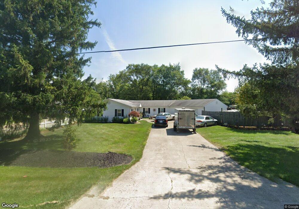
5510 Cosgray Rd Dublin, OH 43016
Estimated Value: $330,695 - $428,000
3
Beds
1
Bath
1,821
Sq Ft
$201/Sq Ft
Est. Value
About This Home
This home is located at 5510 Cosgray Rd, Dublin, OH 43016 and is currently estimated at $365,924, approximately $200 per square foot. 5510 Cosgray Rd is a home located in Franklin County with nearby schools including Washington Elementary School, Hilliard Tharp Sixth Grade Elementary School, and Hilliard Weaver Middle School.
Ownership History
Date
Name
Owned For
Owner Type
Purchase Details
Closed on
Jun 23, 2000
Sold by
Mccarty Timothy B and Case #99Cve05 4384
Bought by
Cit Group/Consumer Finance Inc
Current Estimated Value
Purchase Details
Closed on
Jun 6, 2000
Sold by
The Cit Group/Consumer Finance Inc
Bought by
Legg Dorian R
Purchase Details
Closed on
Nov 12, 1992
Bought by
Mccarty Paul and Mccarty Elma J
Purchase Details
Closed on
Aug 4, 1992
Purchase Details
Closed on
Apr 1, 1985
Create a Home Valuation Report for This Property
The Home Valuation Report is an in-depth analysis detailing your home's value as well as a comparison with similar homes in the area
Home Values in the Area
Average Home Value in this Area
Purchase History
| Date | Buyer | Sale Price | Title Company |
|---|---|---|---|
| Cit Group/Consumer Finance Inc | $50,000 | -- | |
| Legg Dorian R | $44,000 | Midland Celtic Title | |
| Mccarty Paul | -- | -- | |
| -- | $49,000 | -- | |
| -- | $13,000 | -- |
Source: Public Records
Tax History Compared to Growth
Tax History
| Year | Tax Paid | Tax Assessment Tax Assessment Total Assessment is a certain percentage of the fair market value that is determined by local assessors to be the total taxable value of land and additions on the property. | Land | Improvement |
|---|---|---|---|---|
| 2024 | $4,604 | $77,600 | $18,200 | $59,400 |
| 2023 | $4,014 | $77,595 | $18,200 | $59,395 |
| 2022 | $2,661 | $40,710 | $13,650 | $27,060 |
| 2021 | $2,623 | $40,710 | $13,650 | $27,060 |
| 2020 | $2,655 | $40,710 | $13,650 | $27,060 |
| 2019 | $2,490 | $32,550 | $10,920 | $21,630 |
| 2018 | $1,241 | $32,550 | $10,920 | $21,630 |
| 2017 | $4,297 | $56,350 | $10,920 | $45,430 |
| 2016 | $2,452 | $29,760 | $18,730 | $11,030 |
| 2015 | $1,155 | $29,760 | $18,730 | $11,030 |
| 2014 | $3,671 | $47,190 | $18,730 | $28,460 |
| 2013 | $1,865 | $47,180 | $18,725 | $28,455 |
Source: Public Records
Map
Nearby Homes
- 5524 Eva Loop N
- 5451 Ruffed Grouse Cir
- 5598 Ballantrae Woods Dr
- 5497 Colling Dr Unit 87
- 5656 Newtonmore Place
- 6844 Ballantrae Place
- 5275 Cosgray Rd
- 5747 Glendavon Place
- 5797 Glendavon Loop
- 5751 Cosgray Rd
- 5495 Houchard Rd
- 5876 Myrick Rd
- 5646 Spring River Ave
- 5617 Cardin Blvd
- 5791 Crighton Dr Unit 15
- 5884 Dunheath Loop
- 5759 Crighton Dr
- 5834 Vandeleur Place
- 5940 Tarrin Ct
- 5787 Aderholt Rd
- 5518 Cosgray Rd
- 7218 Pheasant Run Blvd
- 7060 Rings Rd
- 7224 Pheasant Run Blvd
- 5464 Wood Duck Dr
- 5470 Wood Duck Dr Unit 108
- 5470 Wood Duck Dr
- 7100 Rings Rd
- 7040 Rings Rd
- 7248 Partridge Dr
- 5511 Wood Duck Dr
- 5469 Wood Duck Dr
- 5416 Ruffed Grouse Cir
- 5553 Ballantrae Woods Dr
- 5559 Ballantrae Woods Dr
- 5565 Ballantrae Woods Dr
- 5571 Ballantrae Woods Dr
- 5468 Coopers Hawk Cir
- 5547 Ballantrae Woods Dr
- 7283 Partridge Dr