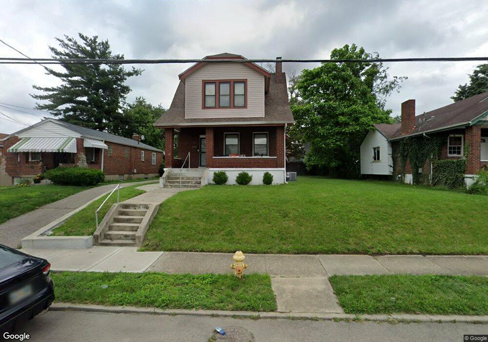
5510 Section Ave Cincinnati, OH 45212
Estimated Value: $202,000 - $267,000
3
Beds
1
Bath
1,609
Sq Ft
$144/Sq Ft
Est. Value
About This Home
This home is located at 5510 Section Ave, Cincinnati, OH 45212 and is currently estimated at $230,924, approximately $143 per square foot. 5510 Section Ave is a home located in Hamilton County with nearby schools including Norwood High School, Summit Academy Community School - Cincinnati, and Horizon Science Academy-Cincinnati.
Ownership History
Date
Name
Owned For
Owner Type
Purchase Details
Closed on
Feb 1, 2000
Sold by
Isaacs Tony N
Bought by
Isaacs Alfreda
Current Estimated Value
Home Financials for this Owner
Home Financials are based on the most recent Mortgage that was taken out on this home.
Original Mortgage
$19,100
Outstanding Balance
$5,772
Interest Rate
7.84%
Estimated Equity
$225,153
Purchase Details
Closed on
Sep 16, 1998
Sold by
Hooks Derry L
Bought by
Isaacs Tony N and Isaacs Alfreda
Create a Home Valuation Report for This Property
The Home Valuation Report is an in-depth analysis detailing your home's value as well as a comparison with similar homes in the area
Home Values in the Area
Average Home Value in this Area
Purchase History
| Date | Buyer | Sale Price | Title Company |
|---|---|---|---|
| Isaacs Alfreda | -- | Mid America Land Title Agenc | |
| Isaacs Tony N | $58,500 | -- |
Source: Public Records
Mortgage History
| Date | Status | Borrower | Loan Amount |
|---|---|---|---|
| Open | Isaacs Alfreda | $19,100 |
Source: Public Records
Tax History
| Year | Tax Paid | Tax Assessment Tax Assessment Total Assessment is a certain percentage of the fair market value that is determined by local assessors to be the total taxable value of land and additions on the property. | Land | Improvement |
|---|---|---|---|---|
| 2025 | $2,182 | $52,266 | $14,102 | $38,164 |
| 2024 | $2,122 | $52,266 | $14,102 | $38,164 |
| 2023 | $2,223 | $52,266 | $14,102 | $38,164 |
| 2022 | $1,498 | $33,100 | $10,651 | $22,449 |
| 2021 | $1,437 | $33,100 | $10,651 | $22,449 |
| 2020 | $1,455 | $33,100 | $10,651 | $22,449 |
| 2019 | $1,311 | $29,033 | $9,342 | $19,691 |
| 2018 | $1,313 | $29,033 | $9,342 | $19,691 |
| 2017 | $1,236 | $29,033 | $9,342 | $19,691 |
| 2016 | $1,821 | $28,704 | $8,785 | $19,919 |
| 2015 | $1,620 | $28,704 | $8,785 | $19,919 |
| 2014 | $1,620 | $28,704 | $8,785 | $19,919 |
| 2013 | $1,704 | $30,534 | $9,345 | $21,189 |
Source: Public Records
Map
Nearby Homes
- 2011 Dale Rd
- 5621 Rolston Ave
- 5716 Section Ave
- 1966 Avonlea Ave
- 1855 Dalewood Place
- 1847 Andina Ave
- 5721 Carthage Ave
- 2115 Quatman Ave
- 1946 Berkley Ave
- 5255 Rolston Ave
- 2119 Cathedral Ave
- 5258 Hunter Ave
- 5310 Globe Ave
- 2206 Varelman Ave
- 2156 Quatman Ave
- 2210 Varelman Ave
- 2171 Glenside Ave
- 1730 Dale Rd
- 1832 Catalina Ave
- 2106 Lawn Ave
- 5512 Section Ave
- 5506 Section Ave
- 5514 Section Ave
- 5518 Section Ave
- 5500 Section Ave
- 5509 Warren Ave
- 5515 Warren Ave
- 5505 Warren Ave
- 5517 Warren Ave
- 5520 Section Ave
- 5503 Warren Ave
- 5519 Warren Ave
- 1978 Garden Ln
- 1979 Garden Ln
- 5501 Warren Ave
- 5428 Section Ave
- 5521 Warren Ave
- 5522 Section Ave
- 1974 Garden Ln
- 5429 Warren Ave
