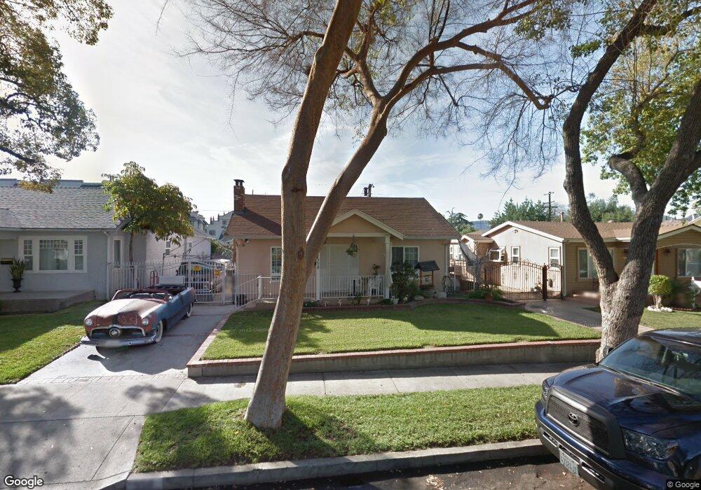
558 Palm Dr Glendale, CA 91202
Glenwood NeighborhoodEstimated Value: $719,835 - $1,340,000
4
Beds
3
Baths
2,097
Sq Ft
$555/Sq Ft
Est. Value
About This Home
This home is located at 558 Palm Dr, Glendale, CA 91202 and is currently estimated at $1,163,459, approximately $554 per square foot. 558 Palm Dr is a home located in Los Angeles County with nearby schools including Balboa Elementary School, Eleanor J. Toll Middle School, and Herbert Hoover High School.
Ownership History
Date
Name
Owned For
Owner Type
Purchase Details
Closed on
Nov 13, 2025
Sold by
Darakjian Adonis and Darakjian Samia
Bought by
Darakjian Living Trust and Darakjian
Current Estimated Value
Purchase Details
Closed on
Oct 22, 1993
Sold by
Lucas David and The Estate Of Virginia M Lucas
Bought by
Darakjian Adonis
Home Financials for this Owner
Home Financials are based on the most recent Mortgage that was taken out on this home.
Original Mortgage
$156,600
Interest Rate
6.89%
Create a Home Valuation Report for This Property
The Home Valuation Report is an in-depth analysis detailing your home's value as well as a comparison with similar homes in the area
Home Values in the Area
Average Home Value in this Area
Purchase History
| Date | Buyer | Sale Price | Title Company |
|---|---|---|---|
| Darakjian Living Trust | -- | None Listed On Document | |
| Darakjian Adonis | $174,000 | Guardian Title Company |
Source: Public Records
Mortgage History
| Date | Status | Borrower | Loan Amount |
|---|---|---|---|
| Previous Owner | Darakjian Adonis | $156,600 |
Source: Public Records
Tax History
| Year | Tax Paid | Tax Assessment Tax Assessment Total Assessment is a certain percentage of the fair market value that is determined by local assessors to be the total taxable value of land and additions on the property. | Land | Improvement |
|---|---|---|---|---|
| 2025 | $5,540 | $503,356 | $236,584 | $266,772 |
| 2024 | $5,540 | $493,488 | $231,946 | $261,542 |
| 2023 | $3,181 | $284,236 | $227,399 | $56,837 |
| 2022 | $3,122 | $278,664 | $222,941 | $55,723 |
| 2021 | $3,066 | $273,201 | $218,570 | $54,631 |
| 2019 | $2,948 | $265,099 | $212,088 | $53,011 |
| 2018 | $2,862 | $259,902 | $207,930 | $51,972 |
| 2016 | $2,722 | $249,810 | $199,856 | $49,954 |
| 2015 | $2,666 | $246,058 | $196,854 | $49,204 |
| 2014 | $2,649 | $241,239 | $192,998 | $48,241 |
Source: Public Records
Map
Nearby Homes
- 545 W Dryden St
- 570 W Stocker St
- 543 W Stocker St Unit 5
- 0 N Idlewood Rd
- 1151 N Columbus Ave
- 1230 Dorothy Dr
- 1207 N Columbus Ave
- 409 Burchett St Unit 220
- 409 Burchett St Unit 210
- 1236 N Columbus Ave Unit 16
- 1339 N Columbus Ave Unit 304
- 1431 N Pacific Ave
- 1313 Valley View Rd Unit 213
- 608 Pioneer Dr
- 250 W Fairview Ave Unit 301
- 1443 Dorothy Dr
- 303 W Loraine St Unit 2
- 1431 Montgomery Ave
- 350 Burchett St Unit 101
- 1361 Virginia Ave
- 558 Palm Dr Unit A
- 554 Palm Dr
- 562 Palm Dr
- 566 Palm Dr
- 550 Palm Dr
- 563 W Dryden St
- 561 W Dryden St
- 567 W Dryden St
- 546 Palm Dr
- 570 Palm Dr
- 571 W Dryden St
- 555 W Dryden St Unit 9
- 555 W Dryden St Unit 4
- 555 W Dryden St
- 555 W Dryden St Unit 12
- 555 W Dryden St Unit 2
- 555 W Dryden St Unit 5
- 559 Palm Dr
- 561 Palm Dr
- 555 Palm Dr
Your Personal Tour Guide
Ask me questions while you tour the home.