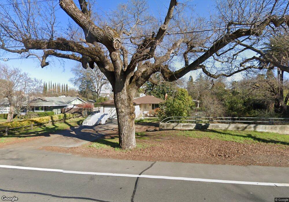
5636 Kenneth Ave Fair Oaks, CA 95628
Estimated Value: $515,000 - $589,000
3
Beds
2
Baths
1,977
Sq Ft
$278/Sq Ft
Est. Value
About This Home
This home is located at 5636 Kenneth Ave, Fair Oaks, CA 95628 and is currently estimated at $548,930, approximately $277 per square foot. 5636 Kenneth Ave is a home located in Sacramento County with nearby schools including Northridge Elementary School, Andrew Carnegie Middle School, and Bella Vista High School.
Ownership History
Date
Name
Owned For
Owner Type
Purchase Details
Closed on
Feb 26, 2008
Sold by
Amato Ronnie Jeanne
Bought by
Amato Ronnie Jeanne and The Ronnie Jeanne Amato Living
Current Estimated Value
Purchase Details
Closed on
Nov 16, 1998
Sold by
Amato Ronnie Jeanne
Bought by
Amato Ronnie Jeanne
Home Financials for this Owner
Home Financials are based on the most recent Mortgage that was taken out on this home.
Original Mortgage
$40,000
Interest Rate
6.42%
Create a Home Valuation Report for This Property
The Home Valuation Report is an in-depth analysis detailing your home's value as well as a comparison with similar homes in the area
Home Values in the Area
Average Home Value in this Area
Purchase History
| Date | Buyer | Sale Price | Title Company |
|---|---|---|---|
| Amato Ronnie Jeanne | -- | None Available | |
| Amato Ronnie Jeanne | -- | -- |
Source: Public Records
Mortgage History
| Date | Status | Borrower | Loan Amount |
|---|---|---|---|
| Closed | Amato Ronnie Jeanne | $40,000 |
Source: Public Records
Tax History
| Year | Tax Paid | Tax Assessment Tax Assessment Total Assessment is a certain percentage of the fair market value that is determined by local assessors to be the total taxable value of land and additions on the property. | Land | Improvement |
|---|---|---|---|---|
| 2025 | $1,018 | $87,009 | $10,673 | $76,336 |
| 2024 | $1,018 | $85,304 | $10,464 | $74,840 |
| 2023 | $987 | $83,632 | $10,259 | $73,373 |
| 2022 | $981 | $81,993 | $10,058 | $71,935 |
| 2021 | $960 | $80,386 | $9,861 | $70,525 |
| 2020 | $945 | $79,562 | $9,760 | $69,802 |
| 2019 | $920 | $78,003 | $9,569 | $68,434 |
| 2018 | $898 | $76,475 | $9,382 | $67,093 |
| 2017 | $851 | $72,036 | $9,199 | $62,837 |
| 2016 | $796 | $70,624 | $9,019 | $61,605 |
| 2015 | $781 | $69,564 | $8,884 | $60,680 |
| 2014 | $763 | $68,202 | $8,710 | $59,492 |
Source: Public Records
Map
Nearby Homes
- 8488 Mallee Cir
- 8497 Mallee Cir
- 8493 Mallee Cir
- 8489 Mallee Cir
- 5605 Ritz Way
- 8472 Mallee Cir
- 8483 Wattle Way
- 8490 Wattle Way
- 8479 Wattle Way
- 8475 Wattle Way
- 8486 Wattle Way
- 8482 Wattle Way
- 8478 Wattle Way
- 8474 Wattle Way
- 8463 Wattle Way
- 8470 Wattle Way
- 5555 Kamala Way
- 8466 Wattle Way
- 8462 Wattle Way
- 5526 Kamala Way
- 5640 Kenneth Ave
- 5620 Kenneth Ave
- 8508 Pershing Ave
- 8500 Pershing Ave
- 8516 Pershing Ave
- 8523 Oak Harbour Ct
- 5643 Marchese Ct
- 5637 Marchese Ct
- 5649 Marchese Ct
- 8506 Oak Harbour Ct
- 8500 Oak Harbour Ct
- 8512 Oak Harbour Ct
- 8518 Oak Harbour Ct
- 5631 Marchese Ct
- 8507 Pershing Ave
- 8501 Pershing Ave
- 8513 Pershing Ave
- 8532 Pershing Ave
- 8519 Pershing Ave
- 8530 Oak Harbour Ct
Your Personal Tour Guide
Ask me questions while you tour the home.