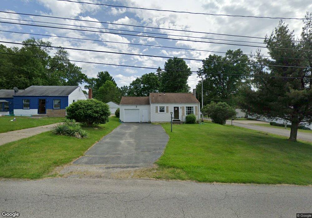
5711 Kirk Rd Canfield, OH 44406
Austintown NeighborhoodEstimated Value: $89,022 - $135,000
3
Beds
1
Bath
576
Sq Ft
$195/Sq Ft
Est. Value
About This Home
This home is located at 5711 Kirk Rd, Canfield, OH 44406 and is currently estimated at $112,506, approximately $195 per square foot. 5711 Kirk Rd is a home located in Mahoning County with nearby schools including Austintown Elementary School, Austintown Intermediate School, and Austintown Middle School.
Ownership History
Date
Name
Owned For
Owner Type
Purchase Details
Closed on
Apr 4, 2011
Sold by
Willoughby Bernard and Willoughby Judith
Bought by
Boyd Ann H
Current Estimated Value
Purchase Details
Closed on
Apr 1, 2011
Sold by
Porter Caroline and Porter Gilbert H
Bought by
Boyd Ann H
Purchase Details
Closed on
Apr 18, 2007
Sold by
Sharp David W and Sharp Christina L
Bought by
Boyd Ann H
Home Financials for this Owner
Home Financials are based on the most recent Mortgage that was taken out on this home.
Original Mortgage
$45,400
Interest Rate
6.18%
Mortgage Type
Purchase Money Mortgage
Purchase Details
Closed on
Feb 8, 2002
Sold by
Willett Joseph L and Willett O H
Bought by
Sharp David W
Home Financials for this Owner
Home Financials are based on the most recent Mortgage that was taken out on this home.
Original Mortgage
$41,595
Interest Rate
7.24%
Mortgage Type
FHA
Create a Home Valuation Report for This Property
The Home Valuation Report is an in-depth analysis detailing your home's value as well as a comparison with similar homes in the area
Home Values in the Area
Average Home Value in this Area
Purchase History
| Date | Buyer | Sale Price | Title Company |
|---|---|---|---|
| Boyd Ann H | -- | Attorney | |
| Boyd Ann H | $36,300 | Attorney | |
| Boyd Ann H | $64,900 | Attorney | |
| Sharp David W | $41,500 | -- |
Source: Public Records
Mortgage History
| Date | Status | Borrower | Loan Amount |
|---|---|---|---|
| Previous Owner | Boyd Ann H | $45,400 | |
| Previous Owner | Sharp David W | $41,595 |
Source: Public Records
Tax History
| Year | Tax Paid | Tax Assessment Tax Assessment Total Assessment is a certain percentage of the fair market value that is determined by local assessors to be the total taxable value of land and additions on the property. | Land | Improvement |
|---|---|---|---|---|
| 2025 | $600 | $22,620 | $2,670 | $19,950 |
| 2024 | $589 | $22,620 | $2,670 | $19,950 |
| 2023 | $608 | $22,620 | $2,670 | $19,950 |
| 2022 | $469 | $17,050 | $3,820 | $13,230 |
| 2021 | $469 | $17,050 | $3,820 | $13,230 |
| 2020 | $471 | $17,050 | $3,820 | $13,230 |
| 2019 | $478 | $16,390 | $3,670 | $12,720 |
| 2018 | $460 | $16,390 | $3,670 | $12,720 |
| 2017 | $457 | $16,390 | $3,670 | $12,720 |
| 2016 | $440 | $16,030 | $3,670 | $12,360 |
| 2015 | $427 | $16,030 | $3,670 | $12,360 |
| 2014 | $429 | $16,030 | $3,670 | $12,360 |
| 2013 | $424 | $16,030 | $3,670 | $12,360 |
Source: Public Records
Map
Nearby Homes
- 6343 Gibson Rd
- 3313 Starwick Dr
- 2351 Birch Trace Dr
- 1556 Pimlico Dr Unit 15
- 1540 Pimlico Dr
- 6581 Country Ridge Ave
- 2063 Woodland Trace
- 3121 Meanderwood Dr
- 6919 Kirk Rd
- 5362 Willow Crest Ave
- 1707 Westhampton Dr
- 5365 Oakcrest Ave
- 2612 Frostwood Dr
- 1130 Fox Den Trail
- 21 Timber Run Ct
- 4829 New Rd
- 0 Collingwood Place
- 68 Timber Run Dr
- 6948 Meander Reserve Ct
- 5630 Stanford Ave
Your Personal Tour Guide
Ask me questions while you tour the home.