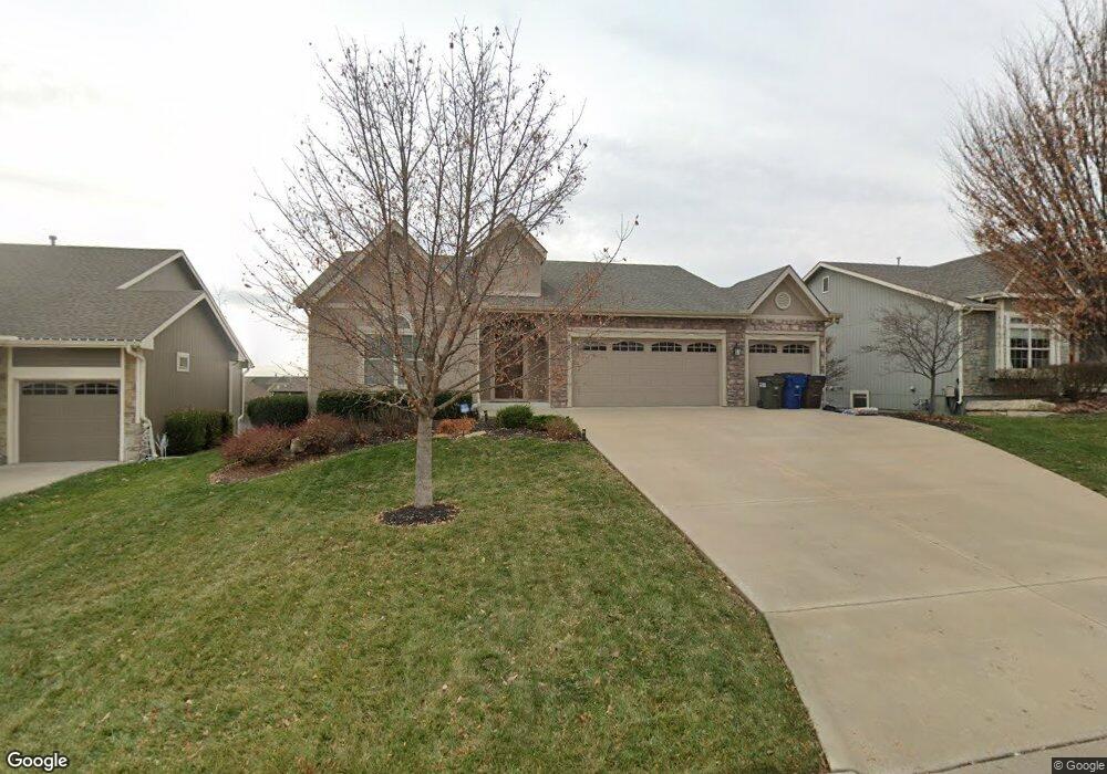
5715 Westfield Dr Unit Stoneridge North Lawrence, KS 66049
West Lawrence NeighborhoodEstimated Value: $563,977 - $622,000
5
Beds
4
Baths
1,556
Sq Ft
$379/Sq Ft
Est. Value
About This Home
This home is located at 5715 Westfield Dr Unit Stoneridge North, Lawrence, KS 66049 and is currently estimated at $589,244, approximately $378 per square foot. 5715 Westfield Dr Unit Stoneridge North is a home located in Douglas County with nearby schools including Langston Hughes Elementary School, Southwest Middle School, and Lawrence Free State High School.
Ownership History
Date
Name
Owned For
Owner Type
Purchase Details
Closed on
Jun 18, 2021
Sold by
Gorup Jennifer M
Bought by
Li Xiaoli and Fan Zhaoqi
Current Estimated Value
Home Financials for this Owner
Home Financials are based on the most recent Mortgage that was taken out on this home.
Original Mortgage
$300,000
Outstanding Balance
$227,778
Interest Rate
2.9%
Mortgage Type
New Conventional
Estimated Equity
$361,466
Purchase Details
Closed on
Jul 31, 2012
Sold by
Garber Enterprises Inc
Bought by
Gorup Jennifer M
Create a Home Valuation Report for This Property
The Home Valuation Report is an in-depth analysis detailing your home's value as well as a comparison with similar homes in the area
Home Values in the Area
Average Home Value in this Area
Purchase History
| Date | Buyer | Sale Price | Title Company |
|---|---|---|---|
| Li Xiaoli | -- | Kansas Secured Title | |
| Gorup Jennifer M | -- | Commerce Title |
Source: Public Records
Mortgage History
| Date | Status | Borrower | Loan Amount |
|---|---|---|---|
| Open | Li Xiaoli | $300,000 |
Source: Public Records
Tax History Compared to Growth
Tax History
| Year | Tax Paid | Tax Assessment Tax Assessment Total Assessment is a certain percentage of the fair market value that is determined by local assessors to be the total taxable value of land and additions on the property. | Land | Improvement |
|---|---|---|---|---|
| 2025 | $8,028 | $63,952 | $9,200 | $54,752 |
| 2024 | $7,661 | $61,054 | $7,475 | $53,579 |
| 2023 | $7,111 | $54,970 | $7,475 | $47,495 |
| 2022 | $6,966 | $53,475 | $7,475 | $46,000 |
| 2021 | $5,927 | $44,229 | $6,334 | $37,895 |
| 2020 | $5,729 | $42,423 | $6,334 | $36,089 |
| 2019 | $5,725 | $42,400 | $6,334 | $36,066 |
| 2018 | $5,761 | $42,320 | $6,334 | $35,986 |
| 2017 | $5,595 | $40,687 | $6,334 | $34,353 |
| 2016 | $5,252 | $39,836 | $5,753 | $34,083 |
| 2015 | -- | $38,973 | $5,753 | $33,220 |
| 2014 | -- | $37,674 | $5,750 | $31,924 |
Source: Public Records
Map
Nearby Homes
- 1033 Stonecreek Dr
- 1017 Stoneridge Dr
- 1040 Stonecreek Dr
- 6204 Berando Ct
- 5614 Chimney Rocks Cir
- 5204 Fox Chase Dr
- 5204 Foxchase Dr
- 5117 Harvard Rd
- 1120 Klein Ct
- 5245 Overland Dr Unit A15
- 5245 Overland Dr Unit C12
- 5245 Overland Dr Unit D4
- 1115 Renaissance Dr
- 311 Headwaters Dr
- 1347 Kanza Dr
- 5024 Cedar Grove Way
- 1202 Little Knife
- 1549 Legend Trail Dr Unit A
- 5710 Goff Ct
- 1526 Legend Trail Dr Unit B
- 5715 Westfield Dr
- 5719 Westfield Dr
- 5719 Westfield Dr Unit Stoneridge North
- 5711 Westfield Dr
- 5707 Westfield Dr
- 5832 Simple Ln
- 5723 Westfield Dr
- 5828 Simple Ln
- 5904 Simple Ln
- 5824 Simple Ln
- 5716 Westfield Dr
- 5908 Simple Ln
- 5703 Westfield Dr Unit Stoneridge North
- 5703 Westfield Dr
- 5712 Westfield Dr
- 5727 Westfield Dr
- 5820 Simple Ln
- 5912 Simple Ln
- 5711 Silverstone Dr
- 911 Westfield Ct