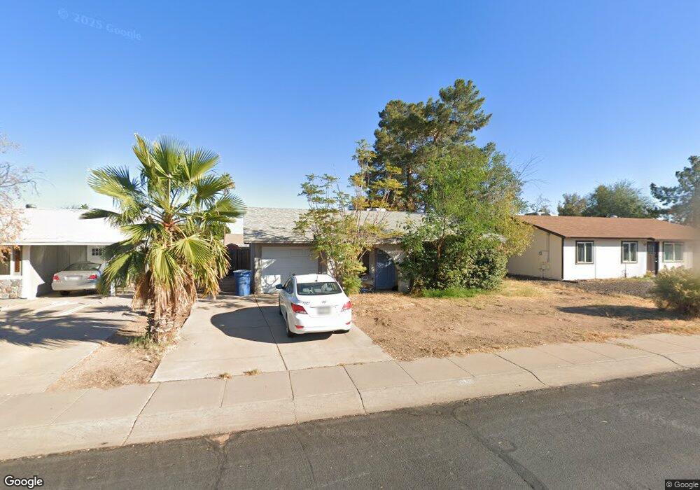
5745 S Wilson St Tempe, AZ 85283
West Tempe NeighborhoodEstimated Value: $320,551 - $482,000
--
Bed
2
Baths
1,408
Sq Ft
$292/Sq Ft
Est. Value
About This Home
This home is located at 5745 S Wilson St, Tempe, AZ 85283 and is currently estimated at $411,388, approximately $292 per square foot. 5745 S Wilson St is a home located in Maricopa County with nearby schools including Wood Elementary School, Fees College Preparatory Middle School, and Marcos De Niza High School.
Ownership History
Date
Name
Owned For
Owner Type
Purchase Details
Closed on
Apr 18, 2013
Sold by
Tabor Troy Nelson
Bought by
Tabor Polly Lynn
Current Estimated Value
Home Financials for this Owner
Home Financials are based on the most recent Mortgage that was taken out on this home.
Original Mortgage
$107,200
Interest Rate
3.6%
Mortgage Type
New Conventional
Purchase Details
Closed on
Nov 4, 1994
Sold by
Brown Timothy A and Brown Cheryll D
Bought by
Husemann Polly L
Create a Home Valuation Report for This Property
The Home Valuation Report is an in-depth analysis detailing your home's value as well as a comparison with similar homes in the area
Home Values in the Area
Average Home Value in this Area
Purchase History
| Date | Buyer | Sale Price | Title Company |
|---|---|---|---|
| Tabor Polly Lynn | -- | Grand Canyon Title Agency In | |
| Tabor Polly Lynn | -- | Grand Canyon Title Agency In | |
| Husemann Polly L | $78,000 | Chicago Title Insurance Co |
Source: Public Records
Mortgage History
| Date | Status | Borrower | Loan Amount |
|---|---|---|---|
| Previous Owner | Tabor Polly Lynn | $107,200 |
Source: Public Records
Tax History Compared to Growth
Tax History
| Year | Tax Paid | Tax Assessment Tax Assessment Total Assessment is a certain percentage of the fair market value that is determined by local assessors to be the total taxable value of land and additions on the property. | Land | Improvement |
|---|---|---|---|---|
| 2025 | $1,286 | $13,283 | -- | -- |
| 2024 | $1,271 | $12,650 | -- | -- |
| 2023 | $1,271 | $29,480 | $5,890 | $23,590 |
| 2022 | $1,213 | $22,060 | $4,410 | $17,650 |
| 2021 | $1,237 | $19,930 | $3,980 | $15,950 |
| 2020 | $1,196 | $18,720 | $3,740 | $14,980 |
| 2019 | $1,173 | $16,630 | $3,320 | $13,310 |
| 2018 | $1,142 | $14,830 | $2,960 | $11,870 |
| 2017 | $1,106 | $13,400 | $2,680 | $10,720 |
| 2016 | $1,101 | $12,620 | $2,520 | $10,100 |
| 2015 | $1,065 | $11,380 | $2,270 | $9,110 |
Source: Public Records
Map
Nearby Homes
- 632 W Fordham Dr
- 5335 S Mitchell Dr
- 834 W Julie Dr
- 5317 S Mitchell Dr
- 1019 W Cornell Dr
- 932 W Julie Dr
- 9103 S Hardy Dr
- 5400 S Hardy Dr Unit 110
- 1105 W Tulane Dr
- 1118 W Tulane Dr
- 5918 S Parkside Dr
- 31 W Duke Dr
- 5046 S Roosevelt St
- 1 W Rice Dr
- 400 W Baseline Rd Unit 202
- 400 W Baseline Rd Unit 281
- 400 W Baseline Rd Unit 100
- 400 W Baseline Rd Unit 201
- 400 W Baseline Rd Unit 29
- 400 W Baseline Rd Unit 48
- 5741 S Wilson St
- 5751 S Wilson St
- 5744 S Farmer Ave
- 5735 S Wilson St
- 5750 S Farmer Ave
- 5738 S Farmer Ave
- 5742 S Wilson St
- 5736 S Wilson St
- 5750 S Wilson St
- 554 W Yale Dr
- 5732 S Farmer Ave
- 548 W Yale Dr
- 542 W Yale Dr
- 564 W Yale Dr
- 5647 S Wilson St
- 5743 S Roosevelt St
- 5648 S Wilson St
- 5743 S Farmer Ave
- 5757 S Roosevelt St
- 570 W Yale Dr