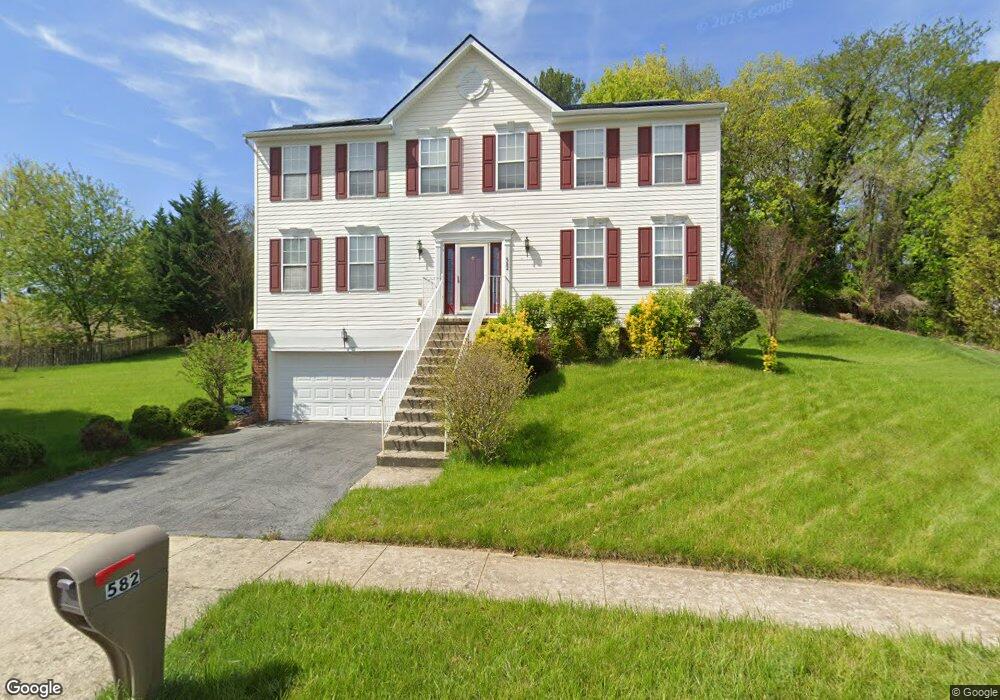
582 Kentland Ave Dover, DE 19901
Kent Acres NeighborhoodEstimated Value: $429,000 - $527,000
4
Beds
3
Baths
2,605
Sq Ft
$181/Sq Ft
Est. Value
About This Home
This home is located at 582 Kentland Ave, Dover, DE 19901 and is currently estimated at $470,966, approximately $180 per square foot. 582 Kentland Ave is a home located in Kent County with nearby schools including W. Reily Brown Elementary School, Fred Fifer Middle School, and Caesar Rodney High School.
Ownership History
Date
Name
Owned For
Owner Type
Purchase Details
Closed on
Aug 24, 2005
Sold by
Nvr Inc
Bought by
Antoh Martin A and Agyeman Antoh Pelisa
Current Estimated Value
Home Financials for this Owner
Home Financials are based on the most recent Mortgage that was taken out on this home.
Original Mortgage
$254,200
Outstanding Balance
$134,819
Interest Rate
5.81%
Mortgage Type
New Conventional
Estimated Equity
$336,147
Purchase Details
Closed on
Apr 15, 2005
Sold by
Gulfstream Development Corp
Bought by
Nvr Inc
Create a Home Valuation Report for This Property
The Home Valuation Report is an in-depth analysis detailing your home's value as well as a comparison with similar homes in the area
Home Values in the Area
Average Home Value in this Area
Purchase History
| Date | Buyer | Sale Price | Title Company |
|---|---|---|---|
| Antoh Martin A | $267,600 | None Available | |
| Nvr Inc | $51,800 | None Available |
Source: Public Records
Mortgage History
| Date | Status | Borrower | Loan Amount |
|---|---|---|---|
| Open | Antoh Martin A | $254,200 |
Source: Public Records
Tax History Compared to Growth
Tax History
| Year | Tax Paid | Tax Assessment Tax Assessment Total Assessment is a certain percentage of the fair market value that is determined by local assessors to be the total taxable value of land and additions on the property. | Land | Improvement |
|---|---|---|---|---|
| 2025 | $2,022 | $413,300 | $81,000 | $332,300 |
| 2024 | $2,022 | $413,300 | $81,000 | $332,300 |
| 2023 | $2,187 | $71,700 | $15,200 | $56,500 |
| 2022 | $2,073 | $71,700 | $15,200 | $56,500 |
| 2021 | $2,049 | $71,700 | $15,200 | $56,500 |
| 2020 | $2,004 | $71,700 | $15,200 | $56,500 |
| 2019 | $1,937 | $71,700 | $15,200 | $56,500 |
| 2018 | $1,880 | $71,700 | $15,200 | $56,500 |
| 2017 | $1,835 | $71,700 | $0 | $0 |
| 2016 | $1,746 | $71,700 | $0 | $0 |
| 2015 | $1,505 | $71,700 | $0 | $0 |
| 2014 | $1,502 | $71,700 | $0 | $0 |
Source: Public Records
Map
Nearby Homes
- 648 Kentland Ave
- 282 Beechwood Ave
- 1679 S State St Unit A55
- 1679 S State St Unit A48
- 286 Kentland Ave
- 97 Glenda Rd
- 200 Beechwood Ave
- 200 Beechwood Ave Unit 2
- 12 Lots Wolf Creek Cir
- 223 President Dr
- 1 Congress Place
- 129 Roosevelt Ave
- 127 Roosevelt Ave
- 161 President Dr
- 1694 S State St
- 190 Evergreen Dr
- 153 President Dr
- 5 Stuart Dr
- 127 Saxton Rd
- 5 Crossley Dr
- 564 Kentland Ave
- 596 Kentland Ave
- 601 Kentland Ave
- 12 Porcher St
- 606 Kentland Ave
- 41 McBry Dr
- 217 Highview Ave
- 28 Porcher St
- 25 McBry Dr
- 534 Kentland Ave
- 635 Kentland Ave
- 618 Kentland Ave
- 13 Porcher St
- 3 McBry Dr
- 42 Porcher St
- 29 Porcher St
- 520 Kentland Ave
- 632 Kentland Ave
- 12 Peyton St
- 56 Porcher St