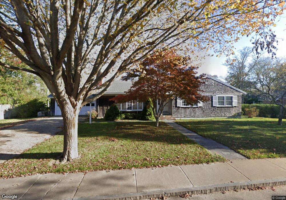
59 Cooke St Edgartown, MA 02539
Edgartown NeighborhoodEstimated Value: $2,498,000 - $4,103,000
3
Beds
2
Baths
1,508
Sq Ft
$2,109/Sq Ft
Est. Value
About This Home
This home is located at 59 Cooke St, Edgartown, MA 02539 and is currently estimated at $3,180,145, approximately $2,108 per square foot. 59 Cooke St is a home located in Dukes County with nearby schools including Edgartown Elementary School and Martha's Vineyard Regional High School.
Ownership History
Date
Name
Owned For
Owner Type
Purchase Details
Closed on
May 16, 2008
Sold by
Fuller Rt and Sarandopolis Mary A
Bought by
Fuller Stuart F
Current Estimated Value
Purchase Details
Closed on
Oct 24, 2006
Sold by
Fuller Wayland S
Bought by
Fuller Rt and Sarandopolis M Alice
Purchase Details
Closed on
Sep 7, 2006
Sold by
Fuller Wayland S
Bought by
Fuller Rt and Sarandopolis Mary A
Create a Home Valuation Report for This Property
The Home Valuation Report is an in-depth analysis detailing your home's value as well as a comparison with similar homes in the area
Home Values in the Area
Average Home Value in this Area
Purchase History
| Date | Buyer | Sale Price | Title Company |
|---|---|---|---|
| Fuller Stuart F | -- | -- | |
| Fuller Rt | -- | -- | |
| Fuller Rt | -- | -- |
Source: Public Records
Tax History
| Year | Tax Paid | Tax Assessment Tax Assessment Total Assessment is a certain percentage of the fair market value that is determined by local assessors to be the total taxable value of land and additions on the property. | Land | Improvement |
|---|---|---|---|---|
| 2025 | $6,801 | $2,566,300 | $1,780,700 | $785,600 |
| 2024 | $6,438 | $2,524,900 | $1,780,700 | $744,200 |
| 2023 | $5,984 | $2,374,500 | $1,809,000 | $565,500 |
| 2022 | $6,971 | $2,300,800 | $1,936,200 | $364,600 |
| 2021 | $6,607 | $2,014,400 | $1,618,800 | $395,600 |
| 2020 | $6,116 | $1,825,700 | $1,541,800 | $283,900 |
| 2019 | $7,065 | $1,825,700 | $1,541,800 | $283,900 |
| 2018 | $6,245 | $1,613,800 | $1,362,500 | $251,300 |
| 2017 | $5,605 | $1,579,000 | $1,362,500 | $216,500 |
| 2016 | $5,649 | $1,560,600 | $1,362,500 | $198,100 |
| 2015 | $5,220 | $1,504,400 | $1,334,000 | $170,400 |
Source: Public Records
Map
Nearby Homes
- 43 Peases Point Way S
- 52 S Summer St
- 69 School St
- 10 Peases Point Way N
- 99 Cooke St
- 32 Norton Orchard Rd
- 44 Plantingfield Way Unit 2
- 44 Plantingfield Way
- 68 N Water St
- 23 Pinehurst Rd
- 218 Upper Main St
- 15 Chapman Ln Unit 111.1
- 38 Pinehurst Rd
- 17 Chapman Ln
- 17 Chapman La
- 114 N Water St
- 117 N Water St
- 14 Thayer St
- 5 Louis Field Rd Unit 121.3
- 5 Louis Field Rd
- 55 Cooke St
- 70 Davis Ln
- 60 Cooke St
- 51 Cooke St
- 68 Davis Ln
- 72 Davis Ln
- 52 Cooke St
- 71 Davis Ln
- 27 Peases Point Way S
- 47 Cooke St
- 71 Davis Lane 14 Pent Lane 7 Peases Point Way
- 130132134 Cooke St
- 126 Cooke St
- 87A Cooke St
- 73 Davis Ln
- 50 Cooke St
- 54 Cooke St
- 31 Peases Point Way S
- 65 Davis Ln
- 77 Cooke St
Your Personal Tour Guide
Ask me questions while you tour the home.