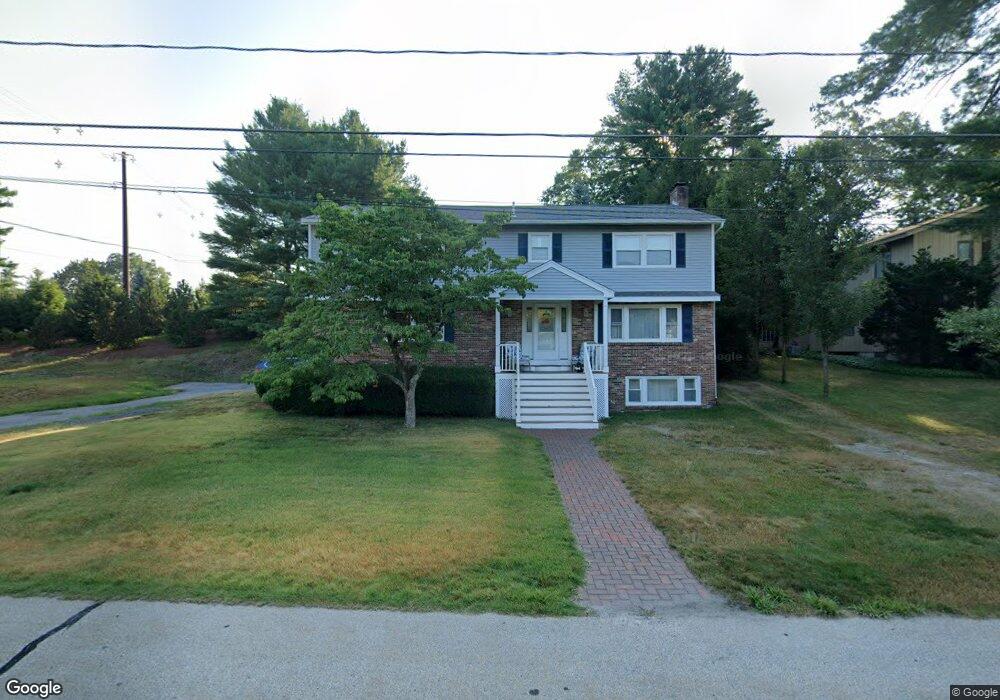
59 Northwood Dr Nashua, NH 03063
Northwest Nashua NeighborhoodEstimated Value: $649,000 - $795,000
5
Beds
3
Baths
2,688
Sq Ft
$261/Sq Ft
Est. Value
About This Home
This home is located at 59 Northwood Dr, Nashua, NH 03063 and is currently estimated at $701,166, approximately $260 per square foot. 59 Northwood Dr is a home located in Hillsborough County with nearby schools including Birch Hill Elementary School, Elm Street Middle School, and Nashua High School North.
Ownership History
Date
Name
Owned For
Owner Type
Purchase Details
Closed on
Dec 5, 2023
Sold by
Jackson Ronald L and Jackson Maureen A
Bought by
Jackson Ft and Jackson
Current Estimated Value
Purchase Details
Closed on
Oct 28, 1994
Bought by
Jackson Ronald L and Jackson Maureen A
Create a Home Valuation Report for This Property
The Home Valuation Report is an in-depth analysis detailing your home's value as well as a comparison with similar homes in the area
Home Values in the Area
Average Home Value in this Area
Purchase History
| Date | Buyer | Sale Price | Title Company |
|---|---|---|---|
| Jackson Ft | -- | None Available | |
| Jackson Ronald L | $150,000 | -- |
Source: Public Records
Mortgage History
| Date | Status | Borrower | Loan Amount |
|---|---|---|---|
| Previous Owner | Jackson Ronald L | $250,200 | |
| Previous Owner | Jackson Ronald L | $247,500 | |
| Previous Owner | Jackson Ronald L | $254,200 |
Source: Public Records
Tax History Compared to Growth
Tax History
| Year | Tax Paid | Tax Assessment Tax Assessment Total Assessment is a certain percentage of the fair market value that is determined by local assessors to be the total taxable value of land and additions on the property. | Land | Improvement |
|---|---|---|---|---|
| 2024 | $9,364 | $588,900 | $166,500 | $422,400 |
| 2023 | $8,809 | $483,200 | $133,200 | $350,000 |
| 2022 | $8,731 | $483,200 | $133,200 | $350,000 |
| 2021 | $7,560 | $325,600 | $93,200 | $232,400 |
| 2020 | $7,314 | $323,500 | $93,200 | $230,300 |
| 2019 | $7,039 | $323,500 | $93,200 | $230,300 |
| 2018 | $6,861 | $323,500 | $93,200 | $230,300 |
| 2017 | $7,820 | $303,200 | $75,000 | $228,200 |
| 2016 | $7,601 | $303,200 | $75,000 | $228,200 |
| 2015 | $7,437 | $303,200 | $75,000 | $228,200 |
| 2014 | $7,292 | $303,200 | $75,000 | $228,200 |
Source: Public Records
Map
Nearby Homes
- 19 Dunloggin Rd
- 7 Robert Dr
- 3 Wright Rd
- 44 Broad St
- 239 Broad St
- 74 Profile Cir
- 11 Amherst Terrace
- 123 Cannongate III
- 5 Chatfield Dr Unit U18
- 4 Jared Cir Unit U21
- 30 Burgess St
- 33 Ferry Rd
- 31 Ashland St
- 0 Baldwin St
- 7 Bitirnas St Unit U7
- 17 Danbury Rd
- 2 Broadcrest Ln
- 61 Manchester St
- 4 Reservoir St
- 11 Charles St
- 156 Cypress Ln
- 57 Northwood Dr
- 60 Northwood Dr
- 39 Dunloggin Rd
- 56 Northwood Dr
- 17 High Pine Ave
- 58 Northwood Dr
- 161 Cypress Ln
- 40 Dunloggin Rd
- 19 High Pine Ave
- 15 High Pine Ave
- 55 Northwood Dr
- 162 Cypress Ln
- 14 Logan Rd
- 163 Cypress Ln
- 21 High Pine Ave
- 35 Dunloggin Rd
- 52 Northwood Dr
- 38 Dunloggin Rd
- 11 High Pine Ave