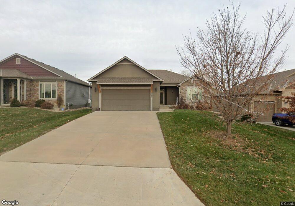
5916 Simple Ln Lawrence, KS 66049
West Lawrence NeighborhoodEstimated Value: $500,000 - $651,000
4
Beds
3
Baths
3,300
Sq Ft
$171/Sq Ft
Est. Value
About This Home
This home is located at 5916 Simple Ln, Lawrence, KS 66049 and is currently estimated at $563,490, approximately $170 per square foot. 5916 Simple Ln is a home located in Douglas County with nearby schools including Langston Hughes Elementary School, Southwest Middle School, and Lawrence Free State High School.
Ownership History
Date
Name
Owned For
Owner Type
Purchase Details
Closed on
Jul 31, 2014
Sold by
Mamid Harith M and Landstar Development Lc
Bought by
Guerrero Clara Soraya and Guerrero Alexis A
Current Estimated Value
Home Financials for this Owner
Home Financials are based on the most recent Mortgage that was taken out on this home.
Original Mortgage
$263,200
Outstanding Balance
$190,009
Interest Rate
2.75%
Mortgage Type
Adjustable Rate Mortgage/ARM
Estimated Equity
$373,481
Create a Home Valuation Report for This Property
The Home Valuation Report is an in-depth analysis detailing your home's value as well as a comparison with similar homes in the area
Home Values in the Area
Average Home Value in this Area
Purchase History
| Date | Buyer | Sale Price | Title Company |
|---|---|---|---|
| Guerrero Clara Soraya | -- | Continental Title Company | |
| Landstar Development Lc | -- | Continental Title Company |
Source: Public Records
Mortgage History
| Date | Status | Borrower | Loan Amount |
|---|---|---|---|
| Open | Landstar Development Lc | $263,200 |
Source: Public Records
Tax History Compared to Growth
Tax History
| Year | Tax Paid | Tax Assessment Tax Assessment Total Assessment is a certain percentage of the fair market value that is determined by local assessors to be the total taxable value of land and additions on the property. | Land | Improvement |
|---|---|---|---|---|
| 2025 | $7,143 | $57,052 | $9,200 | $47,852 |
| 2024 | $6,796 | $54,315 | $7,475 | $46,840 |
| 2023 | $6,564 | $50,796 | $7,475 | $43,321 |
| 2022 | $6,167 | $47,415 | $7,475 | $39,940 |
| 2021 | $5,411 | $40,411 | $6,334 | $34,077 |
| 2020 | $5,392 | $39,928 | $6,334 | $33,594 |
| 2019 | $5,330 | $39,468 | $6,334 | $33,134 |
| 2018 | $5,260 | $38,628 | $6,334 | $32,294 |
| 2017 | $5,235 | $38,065 | $6,334 | $31,731 |
| 2016 | $5,574 | $37,582 | $5,753 | $31,829 |
| 2015 | -- | $37,835 | $5,753 | $32,082 |
| 2014 | -- | $5,400 | $5,400 | $0 |
Source: Public Records
Map
Nearby Homes
- 1033 Stonecreek Dr
- 1017 Stoneridge Dr
- 6204 Berando Ct
- 1040 Stonecreek Dr
- 5614 Chimney Rocks Cir
- 5204 Fox Chase Dr
- 5204 Foxchase Dr
- 1120 Klein Ct
- 5117 Harvard Rd
- 1115 Renaissance Dr
- 5245 Overland Dr Unit A15
- 5245 Overland Dr Unit C12
- 5245 Overland Dr Unit D4
- 1347 Kanza Dr
- 1549 Legend Trail Dr Unit A
- 5024 Cedar Grove Way
- 1202 Little Knife
- 1526 Legend Trail Dr Unit B
- 1528 Legend Trail Dr Unit A
- 5710 Goff Ct
- 5912 Simple Ln
- 5920 Simple Ln
- 5924 Simple Ln
- 5908 Simple Ln
- 908 Drum Dr
- 5809 Silverstone Dr
- 5723 Westfield Dr
- 5928 Simple Ln
- 5904 Simple Ln
- 5815 Silverstone Dr
- 5727 Westfield Dr
- 5909 Simple Ln
- 5719 Westfield Dr
- 5719 Westfield Dr Unit Stoneridge North
- 914 Drum Dr
- 5832 Simple Ln
- 5932 Simple Ln
- 5731 Westfield Dr
- 5903 Simple Ln
- 903 Drum Dr