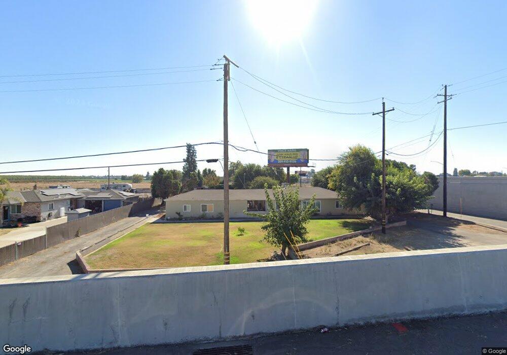
5936 E Lathrop Rd Manteca, CA 95336
Estimated Value: $519,000 - $804,000
4
Beds
3
Baths
3,153
Sq Ft
$221/Sq Ft
Est. Value
About This Home
This home is located at 5936 E Lathrop Rd, Manteca, CA 95336 and is currently estimated at $695,622, approximately $220 per square foot. 5936 E Lathrop Rd is a home located in San Joaquin County with nearby schools including New Haven Elementary School and East Union High School.
Ownership History
Date
Name
Owned For
Owner Type
Purchase Details
Closed on
Mar 2, 2022
Sold by
Hull John M and Hull Cinda D
Bought by
Hull John M and Hull Cinda D
Current Estimated Value
Purchase Details
Closed on
Aug 18, 2021
Sold by
Abrew Melvin Manuel and Abrew Judith Ann
Bought by
Hull John and Hull Cindae
Purchase Details
Closed on
Nov 21, 2012
Sold by
Abrew Melvin M and Abrew Judith Ann
Bought by
Abrew Melvin Manuel and Abrew Judith Ann
Purchase Details
Closed on
Nov 28, 2000
Sold by
Abrew Melvin M
Bought by
Abrew Melvin M and Abrew Judith Ann
Home Financials for this Owner
Home Financials are based on the most recent Mortgage that was taken out on this home.
Original Mortgage
$130,000
Interest Rate
7.86%
Purchase Details
Closed on
May 19, 1996
Sold by
Abrew Joann M
Bought by
Abrew Melvin M
Create a Home Valuation Report for This Property
The Home Valuation Report is an in-depth analysis detailing your home's value as well as a comparison with similar homes in the area
Purchase History
| Date | Buyer | Sale Price | Title Company |
|---|---|---|---|
| Hull John M | -- | None Listed On Document | |
| Hull John | $475,000 | Placer Title Company | |
| Abrew Melvin Manuel | -- | None Available | |
| Abrew Melvin M | -- | Commonwealth Land Title Co | |
| Abrew Melvin M | -- | -- |
Source: Public Records
Mortgage History
| Date | Status | Borrower | Loan Amount |
|---|---|---|---|
| Previous Owner | Abrew Melvin M | $130,000 |
Source: Public Records
Tax History
| Year | Tax Paid | Tax Assessment Tax Assessment Total Assessment is a certain percentage of the fair market value that is determined by local assessors to be the total taxable value of land and additions on the property. | Land | Improvement |
|---|---|---|---|---|
| 2025 | $4,438 | $393,946 | $217,250 | $176,696 |
| 2024 | $4,315 | $386,223 | $212,991 | $173,232 |
| 2023 | $4,259 | $378,651 | $208,815 | $169,836 |
| 2022 | $4,200 | $265,158 | $106,063 | $159,095 |
| 2021 | $3,064 | $259,960 | $103,984 | $155,976 |
| 2020 | $2,945 | $257,295 | $102,918 | $154,377 |
| 2019 | $2,908 | $252,250 | $100,900 | $151,350 |
| 2018 | $2,872 | $247,305 | $98,922 | $148,383 |
| 2017 | $2,832 | $242,457 | $96,983 | $145,474 |
| 2016 | $2,766 | $237,703 | $95,081 | $142,622 |
| 2014 | $2,577 | $229,548 | $91,819 | $137,729 |
Source: Public Records
Map
Nearby Homes
- 6288 E Lathrop Rd
- 1859 Elmwood Ln
- 1350 Laurel Dr
- 2041 Holbrook Place
- 1496 Crimson Ln
- 2016 Westboro Ln
- 1479 Santini Ave
- 1449 Dorona Ln
- 598 Southland Rd
- 1415 Crimson Ln
- 484 Pinehurst St
- 1648 Olivewood Ave
- 619 Heathridge St
- 756 Conrad St
- 1275 Sweetbrier Place
- 1255 Sweetbrier Place
- 854 Conrad St
- 927 Conrad St
- 701 Victoria Dr
- 1414 Pajaro Ave Unit 41
- 6006 E Lathrop Rd
- 6000 E Lathrop Rd
- 6000 E Lathrop Rd Unit C
- 6000 E Lathrop Rd Unit B1
- 6000 E Lathrop Rd Unit B
- 15100 S Highway 99
- 14900 S Highway 99
- 15230 S Inheritance Way
- 14844 S Highway 99
- 1990 N Main St
- 15258 S Highway 99
- 15292 Inheritance Way
- 15392 S Highway 99
- 15392 S State Route 99 E Frontage Road Hwy
- 1941 N Main St
- 14680 S State Route 99 E Fron Road Hwy
- 1923 N Main St
- 1873 N Main St
- 1850 N Main St
- 1828 N Main St
Your Personal Tour Guide
Ask me questions while you tour the home.