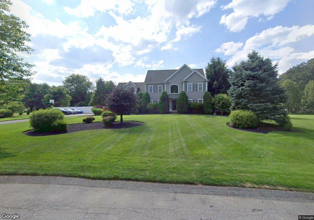
6 Harvest Rd Rehoboth, MA 02769
Estimated Value: $841,928 - $970,000
4
Beds
3
Baths
2,941
Sq Ft
$304/Sq Ft
Est. Value
About This Home
This home is located at 6 Harvest Rd, Rehoboth, MA 02769 and is currently estimated at $893,232, approximately $303 per square foot. 6 Harvest Rd is a home located in Bristol County with nearby schools including Dighton-Rehoboth Regional High School.
Ownership History
Date
Name
Owned For
Owner Type
Purchase Details
Closed on
Sep 25, 2024
Sold by
Gesner Andrew W and Gesner Nicole M
Bought by
Gesner Ret and Gesner
Current Estimated Value
Purchase Details
Closed on
Nov 18, 2005
Sold by
Clarewood Homes Inc
Bought by
Gesner Andrew W and Gesner Nicole M
Home Financials for this Owner
Home Financials are based on the most recent Mortgage that was taken out on this home.
Original Mortgage
$519,900
Interest Rate
6.07%
Mortgage Type
Purchase Money Mortgage
Create a Home Valuation Report for This Property
The Home Valuation Report is an in-depth analysis detailing your home's value as well as a comparison with similar homes in the area
Home Values in the Area
Average Home Value in this Area
Purchase History
| Date | Buyer | Sale Price | Title Company |
|---|---|---|---|
| Gesner Ret | -- | None Available | |
| Gesner Ret | -- | None Available | |
| Gesner Andrew W | $649,900 | -- | |
| Gesner Andrew W | $649,900 | -- |
Source: Public Records
Mortgage History
| Date | Status | Borrower | Loan Amount |
|---|---|---|---|
| Previous Owner | Gesner Andrew W | $519,900 |
Source: Public Records
Tax History Compared to Growth
Tax History
| Year | Tax Paid | Tax Assessment Tax Assessment Total Assessment is a certain percentage of the fair market value that is determined by local assessors to be the total taxable value of land and additions on the property. | Land | Improvement |
|---|---|---|---|---|
| 2025 | $84 | $749,900 | $172,900 | $577,000 |
| 2024 | $8,109 | $713,800 | $207,500 | $506,300 |
| 2023 | $7,628 | $658,700 | $203,100 | $455,600 |
| 2022 | $7,249 | $572,100 | $186,200 | $385,900 |
| 2021 | $3,835 | $524,500 | $169,600 | $354,900 |
| 2020 | $6,986 | $532,500 | $177,600 | $354,900 |
| 2018 | $6,023 | $503,200 | $169,100 | $334,100 |
| 2017 | $2,801 | $463,200 | $169,100 | $294,100 |
| 2016 | $5,471 | $450,300 | $176,700 | $273,600 |
| 2015 | $5,210 | $423,200 | $168,500 | $254,700 |
| 2014 | $5,161 | $414,900 | $160,200 | $254,700 |
Source: Public Records
Map
Nearby Homes
- 32 Providence St
- 198 Brook St
- 267 Chestnut St
- 36 Columbine Rd
- 17 Sassafras Rd
- 127 Mason St
- 203 Providence St Bldr Lot 5
- 205 Providence St Bldr Lot 3
- 92 Martin St
- 129 Cameron Way
- 3a Johnnies Way
- 3b Johnnies Way
- 1 Cedarbrook Unit A
- 3 Johnnies Way
- 75 Martin St
- 7 Johnnies Way
- 42 Linden Ln
- 10 Quaker Ln
- 0 Winter St
- 120 Plain St
- 10 Harvest Rd
- 72 Providence St
- 5 Harvest Rd
- 82 Providence St
- 9 Harvest Rd
- 76 Providence St
- 1 Harvest Rd
- 14 Harvest Rd
- 13 Harvest Rd
- 2 Willard Ave
- 88 Providence St
- 64 Providence St
- 67 Providence St
- 7 Willard Ave
- 60 Providence St
- 89 Providence St
- 61 Providence St
- 94 Providence St
- 8 Willard Ave
- 9 Willard Ave