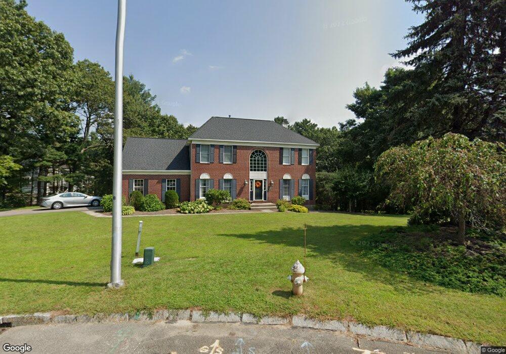
6 Phillips Pond Rd Franklin, MA 02038
Estimated Value: $1,109,000 - $1,156,000
5
Beds
4
Baths
3,240
Sq Ft
$350/Sq Ft
Est. Value
About This Home
This home is located at 6 Phillips Pond Rd, Franklin, MA 02038 and is currently estimated at $1,135,157, approximately $350 per square foot. 6 Phillips Pond Rd is a home located in Norfolk County with nearby schools including Oak Street Elementary School, Horace Mann Middle School, and Franklin High School.
Ownership History
Date
Name
Owned For
Owner Type
Purchase Details
Closed on
Sep 13, 2021
Sold by
Elliott Marc L
Bought by
Regan Barry N and Regan Kerrin M
Current Estimated Value
Home Financials for this Owner
Home Financials are based on the most recent Mortgage that was taken out on this home.
Original Mortgage
$724,500
Outstanding Balance
$659,241
Interest Rate
2.8%
Mortgage Type
Purchase Money Mortgage
Estimated Equity
$475,916
Purchase Details
Closed on
Jan 16, 2009
Sold by
Yaskoff Francis and Yaskoff Suzanne
Bought by
Elliott Marc L
Home Financials for this Owner
Home Financials are based on the most recent Mortgage that was taken out on this home.
Original Mortgage
$320,000
Interest Rate
5.52%
Mortgage Type
Purchase Money Mortgage
Purchase Details
Closed on
Dec 8, 2005
Sold by
Phillips Pond Lane Rt
Bought by
Yaskoff Francis and Yaskoff Suzanne
Home Financials for this Owner
Home Financials are based on the most recent Mortgage that was taken out on this home.
Original Mortgage
$510,000
Interest Rate
6.17%
Mortgage Type
Purchase Money Mortgage
Purchase Details
Closed on
May 24, 2004
Sold by
Relocation Dynamics In
Bought by
Phillips Pond Lane Rt
Home Financials for this Owner
Home Financials are based on the most recent Mortgage that was taken out on this home.
Original Mortgage
$491,200
Interest Rate
5.75%
Mortgage Type
Purchase Money Mortgage
Purchase Details
Closed on
Mar 13, 1995
Sold by
Franklin Farms Lp
Bought by
Kumar K Sharvan and Kumar Seema
Home Financials for this Owner
Home Financials are based on the most recent Mortgage that was taken out on this home.
Original Mortgage
$251,750
Interest Rate
9.09%
Mortgage Type
Purchase Money Mortgage
Create a Home Valuation Report for This Property
The Home Valuation Report is an in-depth analysis detailing your home's value as well as a comparison with similar homes in the area
Purchase History
| Date | Buyer | Sale Price | Title Company |
|---|---|---|---|
| Regan Barry N | $926,000 | None Available | |
| Elliott Marc L | $520,000 | -- | |
| Yaskoff Francis | $680,000 | -- | |
| Phillips Pond Lane Rt | $616,500 | -- | |
| Kumar K Sharvan | $314,716 | -- |
Source: Public Records
Mortgage History
| Date | Status | Borrower | Loan Amount |
|---|---|---|---|
| Open | Regan Barry N | $724,500 | |
| Previous Owner | Elliott Marc L | $320,000 | |
| Previous Owner | Yaskoff Francis | $510,000 | |
| Previous Owner | Phillips Pond Lane Rt | $491,200 | |
| Previous Owner | Kumar K Sharvan | $15,000 | |
| Previous Owner | Kumar K Sharvan | $227,000 | |
| Previous Owner | Kumar K Sharvan | $251,750 |
Source: Public Records
Tax History
| Year | Tax Paid | Tax Assessment Tax Assessment Total Assessment is a certain percentage of the fair market value that is determined by local assessors to be the total taxable value of land and additions on the property. | Land | Improvement |
|---|---|---|---|---|
| 2025 | $10,710 | $921,700 | $364,400 | $557,300 |
| 2024 | $10,867 | $921,700 | $364,400 | $557,300 |
| 2023 | $10,649 | $846,500 | $338,200 | $508,300 |
| 2022 | $10,308 | $733,700 | $291,500 | $442,200 |
| 2021 | $9,813 | $669,800 | $279,600 | $390,200 |
| 2020 | $9,481 | $653,400 | $282,400 | $371,000 |
| 2019 | $9,530 | $650,100 | $279,600 | $370,500 |
| 2018 | $8,920 | $608,900 | $276,700 | $332,200 |
| 2017 | $9,003 | $617,500 | $285,300 | $332,200 |
| 2016 | $8,336 | $574,900 | $246,900 | $328,000 |
| 2015 | $8,401 | $566,100 | $238,100 | $328,000 |
| 2014 | $7,897 | $546,500 | $218,500 | $328,000 |
Source: Public Records
Map
Nearby Homes
- 41 Kimberlee Ave
- 27 Dover Cir
- 276 Pond St
- 201 Crossfield Rd
- 1801 Franklin Crossing Rd Unit 1801
- 602 Franklin Crossing Rd Unit 602
- 8 Riverstone Way
- 25 Brookview Rd
- 204 Lincoln St
- 70 Oak St
- 17 Longhill Rd
- 8 Woodhaven Dr
- 91 Oliver Pond Cir Unit 3
- 83 Oliver Pond Cir Unit 7
- 29 Elm St
- 33 Elm St
- 24 Shayne Rd Unit 110
- 14 Pleasant St Unit B
- 214 Conlyn Ave
- 254 Daniels St
- 6 Phillips Pond Ln
- 3 Phillips Pond Rd
- 383 Oakland Pkwy
- 381 Oakland Pkwy
- 1 Phillips Pond Rd
- 4 Phillips Pond Rd
- 385 Oakland Pkwy
- 11 Laurinda Ln
- 15 Laurinda Ln
- 14 Norumbega Cir
- 16 Norumbega Cir
- 387 Oakland Pkwy
- 388 Oakland Pkwy
- 3 Downingwood Dr
- 468 Maple St
- 7 Laurinda Ln
- 18 Norumbega Cir
- 389 Oakland Pkwy
- 9 Norumbega Cir
- 10 Laurinda Ln
Your Personal Tour Guide
Ask me questions while you tour the home.