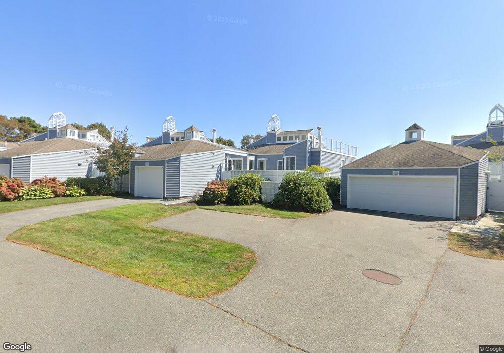
6 Sand Dunes Ct Mashpee, MA 02649
New Seabury-Popponesset Island NeighborhoodEstimated Value: $1,162,000 - $1,255,883
4
Beds
4
Baths
2,455
Sq Ft
$496/Sq Ft
Est. Value
About This Home
This home is located at 6 Sand Dunes Ct, Mashpee, MA 02649 and is currently estimated at $1,216,471, approximately $495 per square foot. 6 Sand Dunes Ct is a home located in Barnstable County with nearby schools including Kenneth C. Coombs School, Quashnet School, and Mashpee Middle School.
Ownership History
Date
Name
Owned For
Owner Type
Purchase Details
Closed on
Apr 29, 1994
Sold by
Warshaver Elaine B
Bought by
Bavdanza Anthony J
Current Estimated Value
Purchase Details
Closed on
Jan 21, 1993
Sold by
Minor Edward T and Leary Paul T
Bought by
Warshaver Elaine B
Home Financials for this Owner
Home Financials are based on the most recent Mortgage that was taken out on this home.
Original Mortgage
$235,000
Interest Rate
8.15%
Mortgage Type
Purchase Money Mortgage
Create a Home Valuation Report for This Property
The Home Valuation Report is an in-depth analysis detailing your home's value as well as a comparison with similar homes in the area
Home Values in the Area
Average Home Value in this Area
Purchase History
| Date | Buyer | Sale Price | Title Company |
|---|---|---|---|
| Bavdanza Anthony J | $375,000 | -- | |
| Warshaver Elaine B | $370,000 | -- |
Source: Public Records
Mortgage History
| Date | Status | Borrower | Loan Amount |
|---|---|---|---|
| Previous Owner | Warshaver Elaine B | $235,000 |
Source: Public Records
Tax History Compared to Growth
Tax History
| Year | Tax Paid | Tax Assessment Tax Assessment Total Assessment is a certain percentage of the fair market value that is determined by local assessors to be the total taxable value of land and additions on the property. | Land | Improvement |
|---|---|---|---|---|
| 2025 | $7,535 | $1,138,200 | $0 | $1,138,200 |
| 2024 | $6,552 | $1,018,900 | $0 | $1,018,900 |
| 2023 | $6,332 | $903,300 | $0 | $903,300 |
| 2022 | $5,610 | $686,700 | $0 | $686,700 |
| 2021 | $5,189 | $572,100 | $0 | $572,100 |
| 2020 | $5,138 | $565,200 | $0 | $565,200 |
| 2019 | $4,796 | $529,900 | $0 | $529,900 |
| 2018 | $4,489 | $503,200 | $0 | $503,200 |
| 2017 | $4,558 | $496,000 | $0 | $496,000 |
| 2016 | $5,155 | $557,900 | $0 | $557,900 |
| 2015 | $5,104 | $560,300 | $0 | $560,300 |
| 2014 | $5,049 | $537,700 | $0 | $537,700 |
Source: Public Records
Map
Nearby Homes
- 4 Lanyard Way Unit 7242C
- 7 Brassie Way
- 90 Shore Dr W Unit 16D
- 236 Glenneagle Dr
- 51 Fairway Ln
- 3 Niblick Ln
- 59 Mashie Cir
- 89 Troon Way
- 28 Quinns Way
- 40 Triton Way
- 16 Slice Way
- 51 Walton Heath Way
- 5 Tide Run
- 72 Walton Heath Way
- 25 Milestone Way Unit 25
- 25 Milestone Way
- 4 Colemans Way Unit 702
- 4 Colemans Way
- 33 Landmark Ave
- 2 Brant Rock Rd Unit 722
- 8 Sand Dunes Ct
- 10 Sand Dunes Ct
- 12 Sand Dunes Ct
- 14 Sand Dunes Ct
- 12 Sand Dunes Ct Unit 8011
- 14 Sand Dunes Ct Unit 14
- 14 Sand Dunes Ct Unit 8010
- 8025 Seanest Dr Unit 8025
- 17 Snead Dr
- 16 Sand Dunes Ct
- 16 Sand Dunes Ct Unit 1
- 16 Sand Dunes Ct Unit 8009
- 16 Sand Dunes Ct Unit 16
- 2 Sand Dunes Ct
- 4 Sand Dunes Ct
- 2 Sand Dunes Ct Unit 2
- 2 Sand Dunes Ct Unit 8016
- 4 Sand Dunes Ct Unit 8015
- 17 Sand Dunes Ct
- 7 Sand Dunes Ct