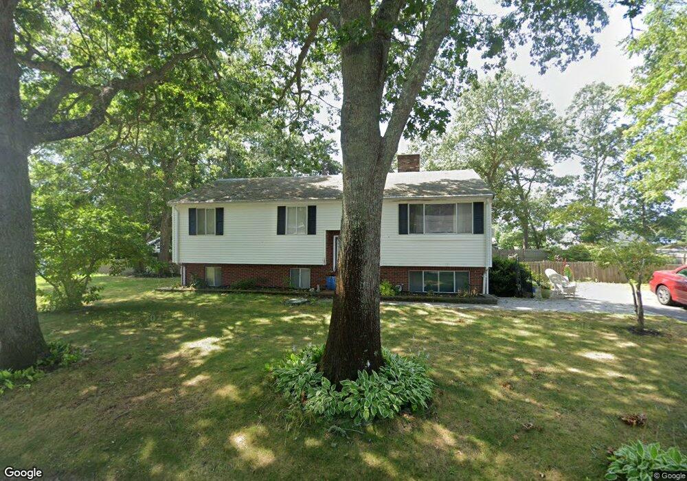
6 Spruce St Wareham, MA 02571
Estimated Value: $420,000 - $514,000
3
Beds
2
Baths
1,130
Sq Ft
$429/Sq Ft
Est. Value
About This Home
This home is located at 6 Spruce St, Wareham, MA 02571 and is currently estimated at $484,784, approximately $429 per square foot. 6 Spruce St is a home located in Plymouth County.
Ownership History
Date
Name
Owned For
Owner Type
Purchase Details
Closed on
Aug 12, 1999
Sold by
Guinier Patricia J and Sylvester Robert J
Bought by
Faniel Sharon L
Current Estimated Value
Home Financials for this Owner
Home Financials are based on the most recent Mortgage that was taken out on this home.
Original Mortgage
$86,240
Interest Rate
7.65%
Mortgage Type
Purchase Money Mortgage
Purchase Details
Closed on
Apr 11, 1988
Sold by
Scholz Elinor J
Bought by
Guinier Patricia J
Create a Home Valuation Report for This Property
The Home Valuation Report is an in-depth analysis detailing your home's value as well as a comparison with similar homes in the area
Purchase History
| Date | Buyer | Sale Price | Title Company |
|---|---|---|---|
| Faniel Sharon L | $107,800 | -- | |
| Faniel Sharon L | $107,800 | -- | |
| Guinier Patricia J | $125,000 | -- |
Source: Public Records
Mortgage History
| Date | Status | Borrower | Loan Amount |
|---|---|---|---|
| Open | Guinier Patricia J | $95,750 | |
| Closed | Guinier Patricia J | $64,000 | |
| Closed | Guinier Patricia J | $86,240 |
Source: Public Records
Tax History
| Year | Tax Paid | Tax Assessment Tax Assessment Total Assessment is a certain percentage of the fair market value that is determined by local assessors to be the total taxable value of land and additions on the property. | Land | Improvement |
|---|---|---|---|---|
| 2025 | $4,775 | $458,300 | $125,100 | $333,200 |
| 2024 | $4,756 | $423,500 | $99,100 | $324,400 |
| 2023 | $4,561 | $379,100 | $90,000 | $289,100 |
| 2022 | $4,368 | $331,400 | $90,000 | $241,400 |
| 2021 | $4,237 | $315,000 | $90,000 | $225,000 |
| 2020 | $4,276 | $315,000 | $90,000 | $225,000 |
| 2019 | $11,618 | $264,900 | $90,500 | $174,400 |
| 2018 | $3,499 | $256,700 | $90,500 | $166,200 |
| 2017 | $3,235 | $240,500 | $90,500 | $150,000 |
| 2016 | $3,117 | $230,400 | $90,500 | $139,900 |
| 2015 | $2,702 | $206,700 | $90,500 | $116,200 |
| 2014 | $2,952 | $229,700 | $90,500 | $139,200 |
Source: Public Records
Map
Nearby Homes
- 2711 Cranberry Hwy
- 2697 Cranberry Hwy Unit 21
- 2743 Cranberry Hwy Unit 5D
- 156 Sandwich Rd
- 2645 Cranberry Hwy Unit A
- 12 Oakdale St
- 0 Charge Pond Rd
- 110 Mayflower Ridge Dr
- 2838 Cranberry Hwy
- 10 Oak St
- 102 Maple Springs Rd
- 91 Agawam Lake Shore Dr
- 124 Minot Ave Unit 1
- 9 Old Glen Charlie Rd
- 437 Main St
- 7 Knowles Ave
- 7 Cranberry Ln
- 3 Michael Dr
- 223 Charge Pond Rd
- 106 Circuit Ave
- 4 Spring Ave
- 2712 Cranberry Hwy
- 2710 Cranberry Hwy
- 2714 Cranberry Hwy
- 3 Spruce St
- 2708 Cranberry Hwy
- 1 Spruce St
- 2880 Cranberry Hwy
- 3250 Cranberry Hwy
- 2404 Massachusetts 28
- 5-19 Spring
- 3 Division Ave
- Lot C-1B Spring Ave
- 2706 Cranberry Hwy
- 000 Rte 28
- 2718 Cranberry Hwy
- 5 Division Ave
- 4 Fall St
- 4 Division Ave
- 4 Division St
Your Personal Tour Guide
Ask me questions while you tour the home.