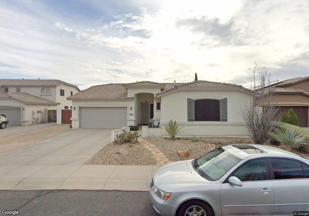
6007 W Blue Sky Dr Phoenix, AZ 85083
Stetson Valley NeighborhoodEstimated Value: $510,857 - $665,000
--
Bed
3
Baths
2,139
Sq Ft
$266/Sq Ft
Est. Value
About This Home
This home is located at 6007 W Blue Sky Dr, Phoenix, AZ 85083 and is currently estimated at $567,964, approximately $265 per square foot. 6007 W Blue Sky Dr is a home located in Maricopa County with nearby schools including Hillcrest Middle School, Sandra Day O'connor High School, and Happy Valley School.
Ownership History
Date
Name
Owned For
Owner Type
Purchase Details
Closed on
Dec 4, 2019
Sold by
Hauer William Q and Hauer Janis A
Bought by
Hauer William Q and Hauer Janis A
Current Estimated Value
Purchase Details
Closed on
May 9, 2011
Sold by
Hauer William Q and Hauer Janis A
Bought by
Hauer William Q and Hauer Janis A
Home Financials for this Owner
Home Financials are based on the most recent Mortgage that was taken out on this home.
Original Mortgage
$123,000
Outstanding Balance
$85,322
Interest Rate
4.84%
Mortgage Type
New Conventional
Estimated Equity
$482,642
Purchase Details
Closed on
Apr 5, 2002
Sold by
Maracay Pyramid Llc
Bought by
Hauer William Q and Hauer Jana A
Home Financials for this Owner
Home Financials are based on the most recent Mortgage that was taken out on this home.
Original Mortgage
$97,638
Interest Rate
6.87%
Mortgage Type
New Conventional
Create a Home Valuation Report for This Property
The Home Valuation Report is an in-depth analysis detailing your home's value as well as a comparison with similar homes in the area
Home Values in the Area
Average Home Value in this Area
Purchase History
| Date | Buyer | Sale Price | Title Company |
|---|---|---|---|
| Hauer William Q | -- | None Available | |
| Hauer William Q | -- | Old Republic Title Agency | |
| Hauer William Q | $193,638 | First American Title |
Source: Public Records
Mortgage History
| Date | Status | Borrower | Loan Amount |
|---|---|---|---|
| Open | Hauer William Q | $123,000 | |
| Closed | Hauer William Q | $97,638 |
Source: Public Records
Tax History Compared to Growth
Tax History
| Year | Tax Paid | Tax Assessment Tax Assessment Total Assessment is a certain percentage of the fair market value that is determined by local assessors to be the total taxable value of land and additions on the property. | Land | Improvement |
|---|---|---|---|---|
| 2025 | $2,200 | $25,563 | -- | -- |
| 2024 | $2,163 | $24,346 | -- | -- |
| 2023 | $2,163 | $40,380 | $8,070 | $32,310 |
| 2022 | $2,083 | $31,270 | $6,250 | $25,020 |
| 2021 | $2,175 | $29,010 | $5,800 | $23,210 |
| 2020 | $2,136 | $27,500 | $5,500 | $22,000 |
| 2019 | $2,070 | $25,860 | $5,170 | $20,690 |
| 2018 | $1,998 | $24,550 | $4,910 | $19,640 |
| 2017 | $2,198 | $22,900 | $4,580 | $18,320 |
| 2016 | $2,074 | $23,180 | $4,630 | $18,550 |
| 2015 | $1,851 | $23,370 | $4,670 | $18,700 |
Source: Public Records
Map
Nearby Homes
- 5910 W Blue Sky Dr
- 5924 W Running Deer Trail
- 5902 W Gambit Trail
- 5815 W Straight Arrow Ln
- 27713 N 57th Dr
- 27627 N 65th Dr
- 5557 W Mine Trail
- 6503 W Eagle Talon Trail
- 6202 W Maya Dr
- 27222 N 64th Dr
- 5528 W Mine Trail
- 6514 W Silver Sage Ln
- 28623 N 66th Ave
- 6439 W Tombstone Trail
- 6527 W Gold Mountain Pass
- 28713 N 66th Ave
- 6619 W Cordia Ln
- 5535 W Tombstone Trail
- 26843 N 65th Ave Unit 48
- 5606 W Cavedale Dr
- 6011 W Blue Sky Dr
- 6003 W Blue Sky Dr
- 6018 W Oberlin Way
- 6010 W Oberlin Way
- 27817 N 60th Ln
- 27813 N 60th Ln
- 6012 W Blue Sky Dr
- 27821 N 60th Ln
- 6022 W Oberlin Way
- 6008 W Blue Sky Dr
- 6016 W Blue Sky Dr
- 6004 W Blue Sky Dr
- 6020 W Blue Sky Dr
- 6026 W Oberlin Way
- 6024 W Blue Sky Dr
- 5929 W Blue Sky Dr
- 6013 W Running Deer Trail
- 6009 W Running Deer Trail
- 27019 N 60th Ln Unit 5
- 6011 W Oberlin Way