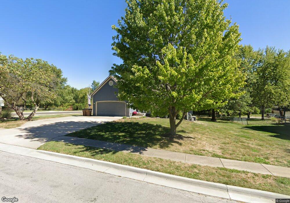
601 S Park Dr Raymore, MO 64083
Estimated Value: $289,642 - $321,000
3
Beds
4
Baths
1,214
Sq Ft
$249/Sq Ft
Est. Value
About This Home
This home is located at 601 S Park Dr, Raymore, MO 64083 and is currently estimated at $301,911, approximately $248 per square foot. 601 S Park Dr is a home located in Cass County with nearby schools including Stonegate Elementary School, Raymore-Peculiar South Middle School, and Raymore-Peculiar Senior High School.
Ownership History
Date
Name
Owned For
Owner Type
Purchase Details
Closed on
Dec 23, 2024
Sold by
Southard Ryan T and Courtney Lane
Bought by
Southard Ryan T and Moore Meghan Ma-Rie
Current Estimated Value
Purchase Details
Closed on
Feb 22, 2019
Sold by
Southard John and Southard Diane
Bought by
Southard Ryan and Southard Courtney
Home Financials for this Owner
Home Financials are based on the most recent Mortgage that was taken out on this home.
Original Mortgage
$156,000
Interest Rate
4.4%
Mortgage Type
New Conventional
Purchase Details
Closed on
Dec 11, 2017
Sold by
Gott Jennifer J and Gott Jason W
Bought by
Southard John and Southard Diane
Purchase Details
Closed on
Aug 29, 2006
Sold by
Welch Robert J and Welch Danielle D
Bought by
Gott Jason W and Gott Jennifer J
Home Financials for this Owner
Home Financials are based on the most recent Mortgage that was taken out on this home.
Original Mortgage
$167,000
Interest Rate
6.72%
Mortgage Type
New Conventional
Create a Home Valuation Report for This Property
The Home Valuation Report is an in-depth analysis detailing your home's value as well as a comparison with similar homes in the area
Home Values in the Area
Average Home Value in this Area
Purchase History
| Date | Buyer | Sale Price | Title Company |
|---|---|---|---|
| Southard Ryan T | -- | None Listed On Document | |
| Southard Ryan T | -- | None Listed On Document | |
| Southard Ryan | -- | Crescent Land Title | |
| Southard John | $133,381 | None Available | |
| Gott Jason W | -- | -- |
Source: Public Records
Mortgage History
| Date | Status | Borrower | Loan Amount |
|---|---|---|---|
| Previous Owner | Southard Ryan | $156,000 | |
| Previous Owner | Gott Jason W | $167,000 |
Source: Public Records
Tax History
| Year | Tax Paid | Tax Assessment Tax Assessment Total Assessment is a certain percentage of the fair market value that is determined by local assessors to be the total taxable value of land and additions on the property. | Land | Improvement |
|---|---|---|---|---|
| 2025 | $2,509 | $34,800 | $6,160 | $28,640 |
| 2024 | $2,509 | $30,830 | $5,600 | $25,230 |
| 2023 | $2,506 | $30,830 | $5,600 | $25,230 |
| 2022 | $2,313 | $28,270 | $5,600 | $22,670 |
| 2021 | $2,313 | $28,270 | $5,600 | $22,670 |
| 2020 | $2,282 | $27,390 | $5,600 | $21,790 |
| 2019 | $2,203 | $27,390 | $5,600 | $21,790 |
| 2018 | $2,034 | $24,430 | $4,820 | $19,610 |
| 2017 | $1,866 | $24,430 | $4,820 | $19,610 |
| 2016 | $1,866 | $23,260 | $4,820 | $18,440 |
| 2015 | $1,867 | $23,260 | $4,820 | $18,440 |
| 2014 | $1,868 | $23,260 | $4,820 | $18,440 |
| 2013 | -- | $23,260 | $4,820 | $18,440 |
Source: Public Records
Map
Nearby Homes
- 713 S Sunset Ln
- 506 S Adams St
- 512 S Washington St
- 901 W Lucy Webb Rd
- 605 S Franklin St
- 205 W Olive St
- 804 S Washington St
- 108 Rainbow Cir
- 503 S Harrison Ave
- 1108 Yokley Dr
- 405 S Monroe St
- 211 S Franklin St
- 205 N Pacific Ct
- 222 N Madison St
- 305 E Olive St
- 208 N Pacific Ct
- 809 Stratford Dr
- 1112 Carlisle Dr
- 1103 Carlisle Dr
- 204 N Pointe Ln
- 603 S Park Dr
- 605 S Park Dr
- 511 S Park Dr
- 600 Valley View
- 525 W Lucy Webb Rd
- 607 S Park Dr
- 605 W Lucy Webb Rd
- 600 Canter St
- 600 Valley View N A
- 602 Canter St
- 512 S Park Dr
- 604 Canter St
- 602 Valley View
- 609 S Park Dr
- 606 Canter St
- 510 S Park Dr
- 607 W Lucy Webb Rd
- 601 Valley View
- 608 Canter St
- 602 W Lucy Webb Rd
Your Personal Tour Guide
Ask me questions while you tour the home.