Estimated Value: $169,000 - $202,000
--
Bed
1
Bath
1,123
Sq Ft
$163/Sq Ft
Est. Value
About This Home
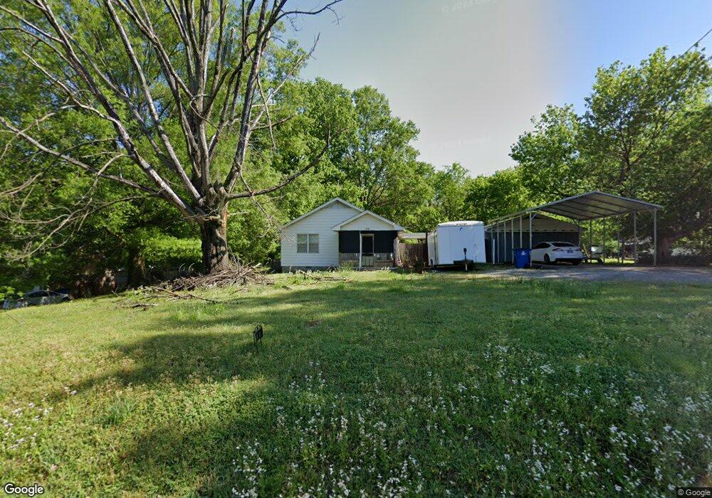
This home is located at 602 Kimbrough Ave, Atoka, TN 38004 and is currently estimated at $183,246, approximately $163 per square foot. 602 Kimbrough Ave is a home located in Tipton County with nearby schools including Atoka Elementary School, Munford Middle School, and Munford High School.
Ownership History
Date
Name
Owned For
Owner Type
Purchase Details
Closed on
Mar 16, 1998
Sold by
Neal Forbess
Bought by
Robert Johnson James
Current Estimated Value
Home Financials for this Owner
Home Financials are based on the most recent Mortgage that was taken out on this home.
Original Mortgage
$67,000
Outstanding Balance
$12,246
Interest Rate
7.01%
Estimated Equity
$171,000
Purchase Details
Closed on
Nov 11, 1996
Sold by
Neal Forbess
Bought by
Elkins And Lavelle Inc
Purchase Details
Closed on
Nov 24, 1972
Bought by
Forbess Neal and Forbess Erillas N
Create a Home Valuation Report for This Property
The Home Valuation Report is an in-depth analysis detailing your home's value as well as a comparison with similar homes in the area
Home Values in the Area
Average Home Value in this Area
Purchase History
| Date | Buyer | Sale Price | Title Company |
|---|---|---|---|
| Robert Johnson James | $67,000 | -- | |
| Elkins And Lavelle Inc | $8,000 | -- | |
| Elkins And Lavelle Inc | $8,000 | -- | |
| Forbess Neal | -- | -- |
Source: Public Records
Mortgage History
| Date | Status | Borrower | Loan Amount |
|---|---|---|---|
| Open | Forbess Neal | $67,000 |
Source: Public Records
Tax History Compared to Growth
Tax History
| Year | Tax Paid | Tax Assessment Tax Assessment Total Assessment is a certain percentage of the fair market value that is determined by local assessors to be the total taxable value of land and additions on the property. | Land | Improvement |
|---|---|---|---|---|
| 2024 | $532 | $23,575 | $7,525 | $16,050 |
| 2023 | $532 | $23,575 | $7,525 | $16,050 |
| 2022 | $512 | $16,675 | $5,525 | $11,150 |
| 2021 | $504 | $16,675 | $5,525 | $11,150 |
| 2020 | $503 | $16,675 | $5,525 | $11,150 |
| 2019 | $497 | $13,850 | $4,250 | $9,600 |
| 2018 | $497 | $13,850 | $4,250 | $9,600 |
| 2017 | $446 | $13,850 | $4,250 | $9,600 |
| 2016 | $446 | $13,850 | $4,250 | $9,600 |
| 2015 | $446 | $13,850 | $4,250 | $9,600 |
| 2014 | $412 | $13,851 | $0 | $0 |
Source: Public Records
Map
Nearby Homes
- 0 Atoka McLaughlin Dr
- 104 Lochmeade Dr
- 195 Munford Ave
- 319 Mclaughlin Dr
- 114 Walker Lake Rd
- 128 Loch Haven Cove S
- 160 S Gretna Green Dr
- 43 S Aberdeen Dr
- 249 Mignon Rd
- 0 Mclaughlin Dr
- 371 Beverly Dr
- 93 Sterling Farm Dr
- 35 Drysdale Cove
- 60 Drysdale Cove
- 29 Merino Dr
- 50 Drysdale Cove
- 236 Como Ln
- 170 Como Ln
- 78 Doe Trail
- 125 Columbia Way
- 580 Kimbrough Ave
- 624 Kimbrough Ave
- 566 Kimbrough Ave
- 619 Kimbrough Ave
- 55 Sullivan St
- 575 Kimbrough Ave
- 648 Kimbrough Ave
- 542 Kimbrough Ave
- 757 Kimbrough Ave
- 559 Kimbrough Ave
- 45 Sullivan St
- 39 Sullivan St
- 37 Sullivan St
- 523 Kimbrough Ave
- 165 Adkison Cir
- 81 Johnson St
- 495 Atoka Munford Ave
- 475 Atoka Munford Ave
- 125 Adkison Cir
- 65 Johnson St