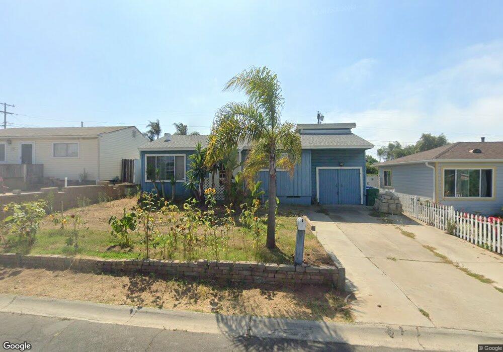
605 Capistrano Dr Oceanside, CA 92058
East Side Capistrano NeighborhoodEstimated Value: $681,000 - $760,000
3
Beds
1
Bath
1,150
Sq Ft
$630/Sq Ft
Est. Value
About This Home
This home is located at 605 Capistrano Dr, Oceanside, CA 92058 and is currently estimated at $724,744, approximately $630 per square foot. 605 Capistrano Dr is a home located in San Diego County with nearby schools including Oceanside High School and St. Mary Star Of The Sea Elementary School.
Ownership History
Date
Name
Owned For
Owner Type
Purchase Details
Closed on
Jan 8, 2003
Sold by
Gifford Randy L and Gifford Jennifer L
Bought by
Mcgrath Timothy
Current Estimated Value
Home Financials for this Owner
Home Financials are based on the most recent Mortgage that was taken out on this home.
Original Mortgage
$207,920
Interest Rate
6.62%
Purchase Details
Closed on
Jun 24, 1992
Purchase Details
Closed on
Apr 5, 1988
Create a Home Valuation Report for This Property
The Home Valuation Report is an in-depth analysis detailing your home's value as well as a comparison with similar homes in the area
Home Values in the Area
Average Home Value in this Area
Purchase History
| Date | Buyer | Sale Price | Title Company |
|---|---|---|---|
| Mcgrath Timothy | $260,000 | Chicago Title Co | |
| -- | $115,000 | -- | |
| -- | $96,000 | -- |
Source: Public Records
Mortgage History
| Date | Status | Borrower | Loan Amount |
|---|---|---|---|
| Previous Owner | Mcgrath Timothy | $207,920 | |
| Closed | Mcgrath Timothy | $51,980 |
Source: Public Records
Tax History
| Year | Tax Paid | Tax Assessment Tax Assessment Total Assessment is a certain percentage of the fair market value that is determined by local assessors to be the total taxable value of land and additions on the property. | Land | Improvement |
|---|---|---|---|---|
| 2025 | $4,099 | $376,404 | $275,173 | $101,231 |
| 2024 | $4,099 | $369,025 | $269,778 | $99,247 |
| 2023 | $3,971 | $361,790 | $264,489 | $97,301 |
| 2022 | $3,910 | $354,697 | $259,303 | $95,394 |
| 2021 | $3,924 | $347,743 | $254,219 | $93,524 |
| 2020 | $3,802 | $344,179 | $251,613 | $92,566 |
| 2019 | $3,691 | $337,431 | $246,680 | $90,751 |
| 2018 | $3,650 | $330,816 | $241,844 | $88,972 |
| 2017 | $3,582 | $324,330 | $237,102 | $87,228 |
| 2016 | $3,464 | $317,971 | $232,453 | $85,518 |
| 2015 | $3,274 | $305,000 | $222,000 | $83,000 |
| 2014 | $2,828 | $269,000 | $196,000 | $73,000 |
Source: Public Records
Map
Nearby Homes
- 845 Harbor Cliff Way Unit 305
- 1200 Harbor Dr N Unit 16B
- 0 Capistrano Dr
- 1019 Costa Pacifica Way Unit 1210
- 790 Harbor Cliff Way Unit 183
- 1021 Costa Pacifica Way Unit 2301
- 1021 Costa Pacifica Way Unit 2313
- 1021 Costa Pacifica Way Unit 2112
- 910 Windward Way
- 1202 N Pacific St Unit 209B
- 1202 N Pacific St Unit 205A
- 1202 N Pacific St Unit 106B
- 1202 N Pacific St Unit 204A
- 1202 N Pacific St Unit 402A
- 1202 N Pacific St Unit 101B
- 999 N Pacific St Unit D-011
- 999 N Pacific St Unit F101
- 999 N Pacific St Unit C201
- 999 N Pacific St Unit G321
- 999 N Pacific St Unit B209
- 607 Capistrano Dr
- 603 Capistrano Dr
- 608 Monterey Dr
- 609 Capistrano Dr
- 606 Monterey Dr
- 601 Capistrano Dr
- 610 Monterey Dr
- 604 Monterey Dr
- 612 Monterey Dr
- 604 Capistrano Dr
- 606 Capistrano Dr
- 611 Capistrano Dr
- 602 Capistrano Dr
- 602 Monterey Dr
- 608 Capistrano Dr
- 614 Monterey Dr
- 613 Capistrano Dr
- 610 Capistrano Dr
- 520 Capistrano Dr
- 521 Capistrano Dr
Your Personal Tour Guide
Ask me questions while you tour the home.