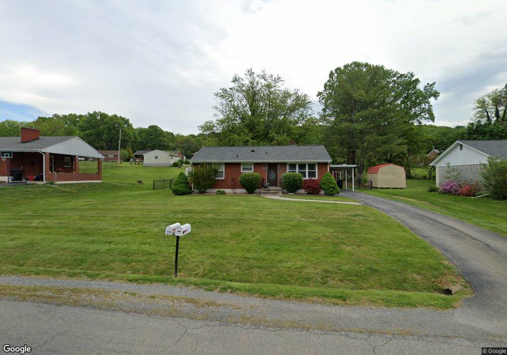
606 Devonshire Dr Vinton, VA 24179
Estimated Value: $215,339 - $246,000
3
Beds
1
Bath
1,000
Sq Ft
$231/Sq Ft
Est. Value
About This Home
This home is located at 606 Devonshire Dr, Vinton, VA 24179 and is currently estimated at $230,835, approximately $230 per square foot. 606 Devonshire Dr is a home located in Roanoke County with nearby schools including W.E. Cundiff Elementary School, William Byrd Middle School, and William Byrd High School.
Ownership History
Date
Name
Owned For
Owner Type
Purchase Details
Closed on
Oct 22, 2009
Sold by
Biggs Robert L and Biggs Sherry C
Bought by
Arthur Christina
Current Estimated Value
Home Financials for this Owner
Home Financials are based on the most recent Mortgage that was taken out on this home.
Original Mortgage
$134,640
Outstanding Balance
$87,828
Interest Rate
5.06%
Mortgage Type
FHA
Estimated Equity
$143,007
Purchase Details
Closed on
Apr 4, 2005
Sold by
Biggs Robert L and Biggs Sherry C
Bought by
Biggs Robert T and Biggs Sherry C
Home Financials for this Owner
Home Financials are based on the most recent Mortgage that was taken out on this home.
Original Mortgage
$100,000
Interest Rate
5.7%
Mortgage Type
New Conventional
Create a Home Valuation Report for This Property
The Home Valuation Report is an in-depth analysis detailing your home's value as well as a comparison with similar homes in the area
Purchase History
| Date | Buyer | Sale Price | Title Company |
|---|---|---|---|
| Arthur Christina | $129,950 | Acquisition Title & Settlem | |
| Biggs Robert T | -- | None Available |
Source: Public Records
Mortgage History
| Date | Status | Borrower | Loan Amount |
|---|---|---|---|
| Open | Arthur Christina | $134,640 | |
| Previous Owner | Biggs Robert T | $100,000 |
Source: Public Records
Tax History
| Year | Tax Paid | Tax Assessment Tax Assessment Total Assessment is a certain percentage of the fair market value that is determined by local assessors to be the total taxable value of land and additions on the property. | Land | Improvement |
|---|---|---|---|---|
| 2025 | $1,860 | $180,600 | $48,000 | $132,600 |
| 2024 | $1,767 | $169,900 | $46,000 | $123,900 |
| 2023 | $1,593 | $150,300 | $40,000 | $110,300 |
| 2022 | $1,473 | $135,100 | $38,000 | $97,100 |
| 2021 | $1,333 | $122,300 | $32,000 | $90,300 |
| 2020 | $1,322 | $121,300 | $32,000 | $89,300 |
| 2019 | $1,293 | $118,600 | $30,000 | $88,600 |
| 2018 | $1,263 | $116,800 | $30,000 | $86,800 |
| 2017 | $1,263 | $115,900 | $30,000 | $85,900 |
| 2016 | $1,264 | $116,000 | $30,000 | $86,000 |
| 2015 | $1,244 | $114,100 | $28,000 | $86,100 |
| 2014 | $1,245 | $114,200 | $28,000 | $86,200 |
Source: Public Records
Map
Nearby Homes
- 449 Cameron Dr
- 405 Dawnridge Dr
- 373 Langland Dr
- 2644 Lindenwood Dr
- 230 Dawnridge Dr
- 2971 Stonebridge Cir
- 2525 Fountain Ln
- 125 Bush Dr
- 427 Cambridge Court Rd
- 241 Lynn Haven Cir
- 2839 Matthew Dr
- 3015 Adam Dr
- 808 Mason Rd
- 1813 Cambridge Dr
- 1195 Fairmont Dr
- 7074 Blue Ridge Pkwy
- 7063 Blue Ridge Pkwy
- 0 Finney Dr
- 441 Aragona Dr
- 2124 Beavers Ln
- 602 Devonshire Dr
- 614 Devonshire Dr
- 510 Devonshire Dr
- 609 Briarwood Dr
- 601 Briarwood Dr
- 626 Devonshire Dr
- 605 Devonshire Dr
- 615 Briarwood Dr
- 613 Devonshire Dr
- 505 Briarwood Dr
- 489 Cameron Dr
- 511 Briarwood Dr
- 623 Briarwood Dr
- 503 Maplewood Dr
- 509 Maplewood Dr
- 628 Devonshire Dr
- 619 Devonshire Dr
- 478 Cameron Dr
- 475 Maplewood Dr
- 629 Briarwood Dr
Your Personal Tour Guide
Ask me questions while you tour the home.