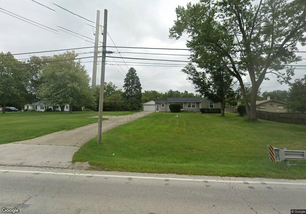
6070 Us Highway 34 Oswego, IL 60543
Northwest Oswego NeighborhoodEstimated Value: $273,688 - $348,000
2
Beds
1
Bath
1,004
Sq Ft
$299/Sq Ft
Est. Value
About This Home
This home is located at 6070 Us Highway 34, Oswego, IL 60543 and is currently estimated at $300,422, approximately $299 per square foot. 6070 Us Highway 34 is a home located in Kendall County with nearby schools including Hunt Club Elementary School, Traughber Junior High School, and Oswego High School.
Ownership History
Date
Name
Owned For
Owner Type
Purchase Details
Closed on
Jul 7, 2017
Sold by
Fujii Richard K and Fujii Toru
Bought by
Fujii Richard K and Fujii Janice
Current Estimated Value
Purchase Details
Closed on
Oct 22, 2003
Sold by
Fujii Kazuko
Bought by
Fujii Richard K and Fujii Toru
Purchase Details
Closed on
Sep 9, 1996
Sold by
Fujii Kazuko
Bought by
Kazuko Fujii Trust
Purchase Details
Closed on
Oct 1, 1995
Bought by
Fuji Kazuko
Create a Home Valuation Report for This Property
The Home Valuation Report is an in-depth analysis detailing your home's value as well as a comparison with similar homes in the area
Home Values in the Area
Average Home Value in this Area
Purchase History
| Date | Buyer | Sale Price | Title Company |
|---|---|---|---|
| Fujii Richard K | -- | None Available | |
| Fujii Richard K | -- | -- | |
| Kazuko Fujii Trust | -- | -- | |
| Fuji Kazuko | $108,000 | -- |
Source: Public Records
Mortgage History
| Date | Status | Borrower | Loan Amount |
|---|---|---|---|
| Closed | Fuji Kazuko | -- |
Source: Public Records
Tax History Compared to Growth
Tax History
| Year | Tax Paid | Tax Assessment Tax Assessment Total Assessment is a certain percentage of the fair market value that is determined by local assessors to be the total taxable value of land and additions on the property. | Land | Improvement |
|---|---|---|---|---|
| 2024 | $4,838 | $64,732 | $16,519 | $48,213 |
| 2023 | $4,404 | $57,796 | $14,749 | $43,047 |
| 2022 | $4,404 | $52,470 | $13,390 | $39,080 |
| 2021 | $4,343 | $50,085 | $13,390 | $36,695 |
| 2020 | $4,262 | $48,674 | $13,390 | $35,284 |
| 2019 | $4,192 | $47,256 | $13,000 | $34,256 |
| 2018 | $3,794 | $44,033 | $13,000 | $31,033 |
| 2017 | $3,447 | $41,734 | $13,000 | $28,734 |
| 2016 | $4,257 | $49,293 | $16,540 | $32,753 |
| 2015 | $3,994 | $44,560 | $15,006 | $29,554 |
| 2014 | -- | $43,423 | $15,006 | $28,417 |
| 2013 | -- | $43,423 | $15,006 | $28,417 |
Source: Public Records
Map
Nearby Homes
- 537 Arbor Ln
- 514 Bentson St
- 114 Riverview Ct
- 1 S Orchard Rd
- 411 Bayberry Dr
- 338 Millstream Ln Unit 1
- 125 Presidential Blvd Unit 3248
- 5161 US Highway 34
- 238 Willowwood Dr
- 0000 Riverwood Dr
- LOT 10 SW Station Dr
- 5055 U S 34
- 505 Parkland Ct
- 123 W Benton St
- 602 Clearwater Ct Unit 2
- 403 Lake Ct
- 608 Clearwater Ct
- 418-420 Monroe St
- 613 Murdock Place
- 388 Danforth Dr
- 6090 Us Highway 34 Unit B
- 6028 Us Highway 34
- 6012 Us Highway 34
- 6012 U S 34
- 6012 Us Highway 34
- 6120 Us Highway 34
- 3 Clark Ave
- 6115 Us Highway 34
- 40 W Pleasantview Dr
- 28 W Pleasantview Dr
- 6150 Us Highway 34
- 5790 Us-34
- 5790 Us Highway 34
- 6011 Us Highway 34
- 22 W Pleasantview Dr
- 6149 Us Highway 34
- 54 W Pleasantview Dr
- 15 Clark Ave
- 6168 Us Highway 34
- 5770 Us Highway 34