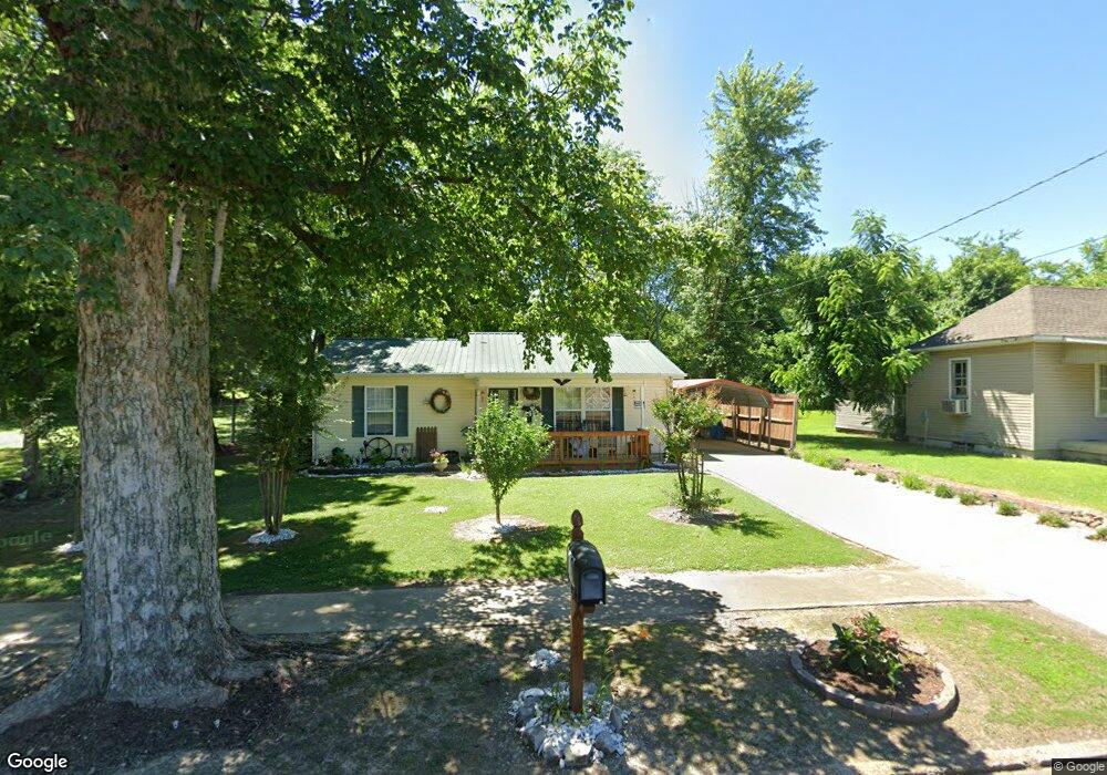
610 N Division St Union City, TN 38261
Estimated Value: $76,349 - $127,000
--
Bed
1
Bath
864
Sq Ft
$116/Sq Ft
Est. Value
About This Home
This home is located at 610 N Division St, Union City, TN 38261 and is currently estimated at $100,587, approximately $116 per square foot. 610 N Division St is a home located in Obion County with nearby schools including Union City Elementary School, Union City Middle School, and Union City High School.
Ownership History
Date
Name
Owned For
Owner Type
Purchase Details
Closed on
Oct 1, 2012
Sold by
Obion County Habitat For H
Bought by
Pickard Bridget
Current Estimated Value
Home Financials for this Owner
Home Financials are based on the most recent Mortgage that was taken out on this home.
Original Mortgage
$56,468
Outstanding Balance
$19,477
Interest Rate
3.58%
Mortgage Type
Cash
Estimated Equity
$81,110
Purchase Details
Closed on
Jan 24, 2011
Bought by
Obion County Habitat
Purchase Details
Closed on
May 16, 2005
Sold by
Obion County
Bought by
Sue Killion Mary
Purchase Details
Closed on
Feb 17, 2005
Bought by
Obion County Habitat For Humanity
Purchase Details
Closed on
Feb 12, 1991
Bought by
Scarborough Phillip N and Scarborough Doris M
Purchase Details
Closed on
Nov 28, 1990
Purchase Details
Closed on
Apr 16, 1980
Bought by
Scarborough Phillip N and Scarborough Marie
Purchase Details
Closed on
Jan 1, 1980
Create a Home Valuation Report for This Property
The Home Valuation Report is an in-depth analysis detailing your home's value as well as a comparison with similar homes in the area
Home Values in the Area
Average Home Value in this Area
Purchase History
| Date | Buyer | Sale Price | Title Company |
|---|---|---|---|
| Pickard Bridget | $56,300 | -- | |
| Obion County Habitat | $47,400 | -- | |
| Sue Killion Mary | $55,000 | -- | |
| Obion County Habitat For Humanity | $100 | -- | |
| Scarborough Phillip N | -- | -- | |
| -- | -- | -- | |
| Scarborough Phillip N | -- | -- | |
| -- | $5,900 | -- |
Source: Public Records
Mortgage History
| Date | Status | Borrower | Loan Amount |
|---|---|---|---|
| Open | Pickard Bridget | $56,468 |
Source: Public Records
Tax History Compared to Growth
Tax History
| Year | Tax Paid | Tax Assessment Tax Assessment Total Assessment is a certain percentage of the fair market value that is determined by local assessors to be the total taxable value of land and additions on the property. | Land | Improvement |
|---|---|---|---|---|
| 2025 | -- | $19,450 | $0 | $0 |
| 2024 | -- | $19,200 | $900 | $18,300 |
| 2023 | $538 | $19,200 | $900 | $18,300 |
| 2022 | $212 | $13,250 | $1,650 | $11,600 |
| 2021 | $208 | $13,250 | $1,650 | $11,600 |
| 2020 | $212 | $13,250 | $1,650 | $11,600 |
| 2019 | $489 | $13,250 | $1,650 | $11,600 |
| 2018 | $487 | $13,150 | $1,650 | $11,500 |
| 2017 | $518 | $13,600 | $1,500 | $12,100 |
| 2016 | $518 | $13,600 | $1,500 | $12,100 |
| 2015 | $516 | $13,600 | $1,500 | $12,100 |
| 2014 | $516 | $13,600 | $1,500 | $12,100 |
Source: Public Records
Map
Nearby Homes
- 501 N 1st St
- 922 N Division St
- 724 E Martin Luther King
- 803 E Main St
- 1009 E Cheatham St
- 817 Exchange St
- 610 Perkins St
- 616 S 3rd St
- 605 S 5th St
- 841 Mosswood Dr
- 0 Mosswood Dr Unit RRA45928
- 0 Mosswood Dr Unit 44704
- 1414 Forest Dr
- 901 S Home St
- 903 Sherwood Dr
- 633 E Jackson St
- 422-426 430 W Jackson St
- 1129 S 4th St
- 1449 Forest Dr
- 0 S Miles Ave Unit 41030
- 608 N Division St
- 620 N Division St
- 604 N Division St
- 624 N Division St Unit 229-231 E. Gibbs
- 520 N Bank St
- 611 N Division St Unit 613
- 605 N Division St
- 619 N Division St Unit 621
- 222 E Palmer St
- 227 E Gibbs St
- 231 E Gibbs St
- 601 N Division St
- 514 N Division St
- 231 E Palmer
- 221 E Gibbs St
- 409 E Gibbs St
- 218 E Palmer St
- 412 E Palmer St
- 221 E Palmer St
- 227 E Palmer St