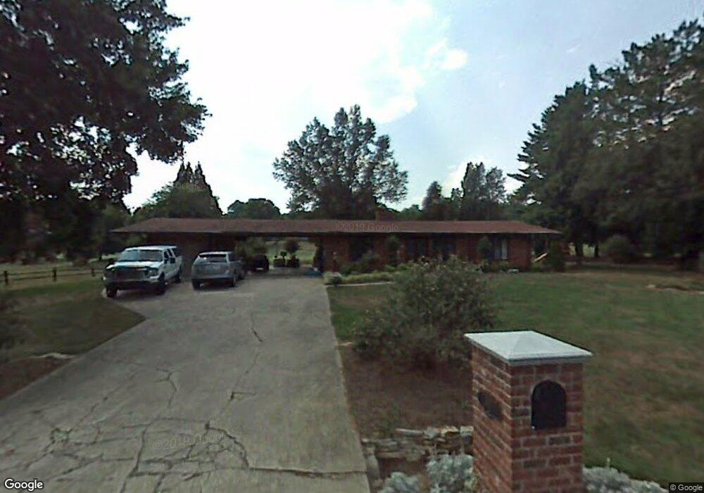
611 Burning Tree Cir High Point, NC 27265
Estimated Value: $466,000 - $587,000
3
Beds
2
Baths
2,347
Sq Ft
$224/Sq Ft
Est. Value
About This Home
This home is located at 611 Burning Tree Cir, High Point, NC 27265 and is currently estimated at $524,975, approximately $223 per square foot. 611 Burning Tree Cir is a home located in Davidson County with nearby schools including Friendship Elementary School, Ledford Middle School, and Ledford High School.
Ownership History
Date
Name
Owned For
Owner Type
Purchase Details
Closed on
Mar 28, 2023
Sold by
Secu*Re Inc
Bought by
Thompson Jo Schute
Current Estimated Value
Home Financials for this Owner
Home Financials are based on the most recent Mortgage that was taken out on this home.
Original Mortgage
$295,000
Outstanding Balance
$286,372
Interest Rate
6.32%
Mortgage Type
New Conventional
Estimated Equity
$238,603
Purchase Details
Closed on
May 17, 2012
Sold by
Brewer Cecil C and Brewer Avis H
Bought by
Thomas Chad Alan and Thomas Brooke Norfolk
Home Financials for this Owner
Home Financials are based on the most recent Mortgage that was taken out on this home.
Original Mortgage
$200,000
Interest Rate
4.01%
Mortgage Type
Seller Take Back
Purchase Details
Closed on
Sep 23, 2002
Bought by
Braetzkus Friederich Max
Purchase Details
Closed on
Sep 1, 1981
Purchase Details
Closed on
Feb 1, 1978
Purchase Details
Closed on
Apr 1, 1975
Create a Home Valuation Report for This Property
The Home Valuation Report is an in-depth analysis detailing your home's value as well as a comparison with similar homes in the area
Purchase History
| Date | Buyer | Sale Price | Title Company |
|---|---|---|---|
| Thompson Jo Schute | $420,000 | -- | |
| Thomas Chad Alan | $200,000 | None Available | |
| Brewer Cecil C | $211,500 | None Available | |
| Braetzkus Friederich Max | $190,000 | -- | |
| -- | $68,000 | -- | |
| -- | $80,000 | -- | |
| -- | $41,500 | -- |
Source: Public Records
Mortgage History
| Date | Status | Borrower | Loan Amount |
|---|---|---|---|
| Open | Thompson Jo Schute | $295,000 | |
| Previous Owner | Thomas Chad Alan | $200,000 |
Source: Public Records
Tax History
| Year | Tax Paid | Tax Assessment Tax Assessment Total Assessment is a certain percentage of the fair market value that is determined by local assessors to be the total taxable value of land and additions on the property. | Land | Improvement |
|---|---|---|---|---|
| 2025 | $3,086 | $454,010 | $0 | $0 |
| 2024 | $2,843 | $418,270 | $0 | $0 |
| 2023 | $2,555 | $375,950 | $0 | $0 |
| 2022 | $2,555 | $375,950 | $0 | $0 |
| 2021 | $2,555 | $375,950 | $0 | $0 |
| 2020 | $2,116 | $311,400 | $0 | $0 |
| 2019 | $2,149 | $311,400 | $0 | $0 |
| 2018 | $2,086 | $311,400 | $0 | $0 |
| 2017 | $2,086 | $311,400 | $0 | $0 |
| 2016 | $2,024 | $311,400 | $0 | $0 |
| 2015 | $2,024 | $311,400 | $0 | $0 |
| 2014 | $2,135 | $328,520 | $0 | $0 |
Source: Public Records
Map
Nearby Homes
- 219 Prestwick Dr
- 615 Burning Tree Cir
- 201 Cascade Dr
- 163 Emily Ct
- 2929 Fernley Ct
- 2925 Fernley Ct
- 2801 Swan Lake Dr
- 613 Dorado Cir
- 2731 Croquet Cir
- 2729 Croquet Cir
- 1513 Birkdale Ct
- 1366 Bayswater Dr
- 157 Calvin St
- 1329 Bayswater Dr
- 1706 Windsor Dr
- 246 Merry Hills Dr
- 872 Falls Grove Trail
- 397 Curry Rd
- 818 Falls Grove Trail
- 4095 Stallion St Unit Lot 19
- 607 Burning Tree Cir
- 620 Burning Tree Cir
- 0 Burning Tree Cir
- 603 Burning Tree Cir
- 416 Seminole Ln
- 412 Seminole Ln
- 604 Burning Tree Cir
- 262 Prestwick Dr
- 408 Seminole Ln
- 420 Seminole Ln
- 300 Prestwick Dr
- 302 Prestwick Dr
- 425 Seminole Ct
- 188 Seminole Ln
- 572 Burning Tree Cir
- 515 Burning Tree Cir
- Lot 99 Burning Tree Cir
- 95,96&99 Burning Tree Cir
- 95 Burning Tree Cir
- 404 Seminole Ln
Your Personal Tour Guide
Ask me questions while you tour the home.