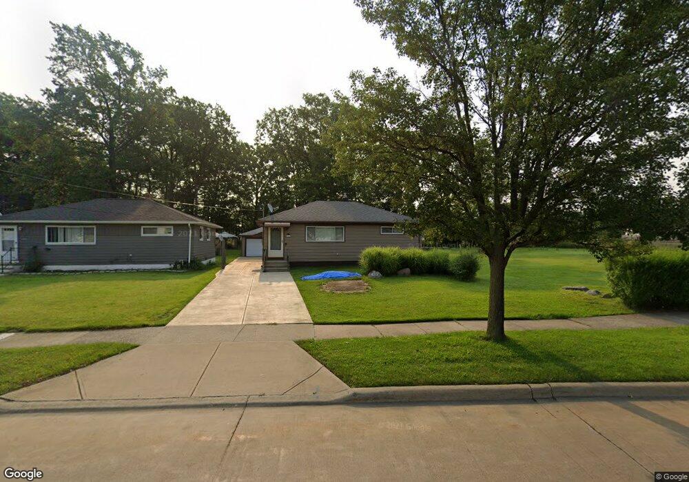
6119 Michael Dr Brookpark, OH 44142
Estimated Value: $199,394 - $229,000
3
Beds
1
Bath
936
Sq Ft
$227/Sq Ft
Est. Value
About This Home
This home is located at 6119 Michael Dr, Brookpark, OH 44142 and is currently estimated at $212,349, approximately $226 per square foot. 6119 Michael Dr is a home located in Cuyahoga County with nearby schools including Berea-Midpark Middle School, Berea-Midpark High School, and Huber Heights Preparatory Academy Parma Academy.
Ownership History
Date
Name
Owned For
Owner Type
Purchase Details
Closed on
May 27, 1994
Sold by
Medders Wayne K
Bought by
Broz Stanley B
Current Estimated Value
Purchase Details
Closed on
Jul 15, 1988
Sold by
Morris Robert A
Bought by
Medders Wayne K
Purchase Details
Closed on
Jul 24, 1984
Sold by
Ronald L Eckelmeyer
Bought by
Morris Robert A
Purchase Details
Closed on
Apr 14, 1983
Sold by
Eckelmeyer Lila R
Bought by
Ronald L Eckelmeyer
Purchase Details
Closed on
Jan 1, 1975
Bought by
Eckelmeyer Lila R
Create a Home Valuation Report for This Property
The Home Valuation Report is an in-depth analysis detailing your home's value as well as a comparison with similar homes in the area
Home Values in the Area
Average Home Value in this Area
Purchase History
| Date | Buyer | Sale Price | Title Company |
|---|---|---|---|
| Broz Stanley B | $90,000 | -- | |
| Medders Wayne K | $56,500 | -- | |
| Morris Robert A | $54,000 | -- | |
| Ronald L Eckelmeyer | -- | -- | |
| Eckelmeyer Lila R | -- | -- |
Source: Public Records
Tax History Compared to Growth
Tax History
| Year | Tax Paid | Tax Assessment Tax Assessment Total Assessment is a certain percentage of the fair market value that is determined by local assessors to be the total taxable value of land and additions on the property. | Land | Improvement |
|---|---|---|---|---|
| 2024 | $2,860 | $56,700 | $11,550 | $45,150 |
| 2023 | $2,874 | $47,180 | $9,870 | $37,310 |
| 2022 | $2,854 | $47,180 | $9,870 | $37,310 |
| 2021 | $2,837 | $47,180 | $9,870 | $37,310 |
| 2020 | $2,558 | $37,450 | $7,840 | $29,610 |
| 2019 | $2,482 | $107,000 | $22,400 | $84,600 |
| 2018 | $2,340 | $37,450 | $7,840 | $29,610 |
| 2017 | $2,392 | $33,470 | $7,390 | $26,080 |
| 2016 | $2,372 | $33,470 | $7,390 | $26,080 |
| 2015 | $2,226 | $33,470 | $7,390 | $26,080 |
| 2014 | $2,226 | $33,470 | $7,390 | $26,080 |
Source: Public Records
Map
Nearby Homes
- 14055 Donald Dr
- 14344 Fayette Blvd
- 14890 Holland Rd
- 6195 Hardin Dr
- 14417 Parkman Blvd
- 13971 Park Dr
- 5677 Gateway Ln Unit E504
- 13879 Zaremba Dr
- 6378 Edgehurst Dr
- 6363 Lockhaven Dr
- 15800 Holland Rd
- 16051 Holland Rd
- 13765 Newton Rd
- 14340 Kingman Dr
- 6470 Sandfield Dr
- 15446 Sheldon Rd
- 16310 Richard Dr
- 6274 Anita Dr
- 6406 Fernhurst Ave
- 13493 Pineview Ct
- 6113 Michael Dr
- 6107 Michael Dr
- 6101 Michael Dr
- 6123 Michael Dr
- 6112 Michael Dr
- 6114 Michael Dr
- 6095 Michael Dr
- 6106 Michael Dr
- 6116 Michael Dr
- 6125 Michael Dr
- 6100 Michael Dr
- 6087 Michael Dr
- 6118 Michael Dr
- 6094 Michael Dr
- 6127 Michael Dr
- 6103 Westbrook Dr
- 6088 Michael Dr
- 6113 Morrow Dr
- 6129 Michael Dr
- 6107 Morrow Dr