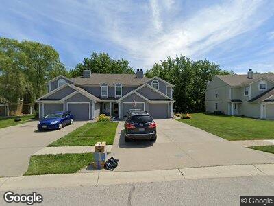
6133 NE Moonstone Ct Lees Summit, MO 64064
Chapel Ridge NeighborhoodEstimated Value: $200,591 - $205,000
2
Beds
2
Baths
1,244
Sq Ft
$163/Sq Ft
Est. Value
About This Home
This home is located at 6133 NE Moonstone Ct, Lees Summit, MO 64064 and is currently estimated at $202,898, approximately $163 per square foot. 6133 NE Moonstone Ct is a home located in Jackson County with nearby schools including Voy Spears Jr. Elementary School, Delta Woods Middle School, and Blue Springs South High School.
Ownership History
Date
Name
Owned For
Owner Type
Purchase Details
Closed on
Jan 21, 2000
Sold by
Brookwood Land Dev Corp
Bought by
Merriott Terry M
Current Estimated Value
Home Financials for this Owner
Home Financials are based on the most recent Mortgage that was taken out on this home.
Original Mortgage
$64,750
Outstanding Balance
$24,290
Interest Rate
7.95%
Mortgage Type
Purchase Money Mortgage
Create a Home Valuation Report for This Property
The Home Valuation Report is an in-depth analysis detailing your home's value as well as a comparison with similar homes in the area
Home Values in the Area
Average Home Value in this Area
Purchase History
| Date | Buyer | Sale Price | Title Company |
|---|---|---|---|
| Merriott Terry M | -- | Security Land Title Company |
Source: Public Records
Mortgage History
| Date | Status | Borrower | Loan Amount |
|---|---|---|---|
| Open | Merriott Terry M | $64,750 |
Source: Public Records
Tax History Compared to Growth
Tax History
| Year | Tax Paid | Tax Assessment Tax Assessment Total Assessment is a certain percentage of the fair market value that is determined by local assessors to be the total taxable value of land and additions on the property. | Land | Improvement |
|---|---|---|---|---|
| 2024 | $2,443 | $32,490 | $1,476 | $31,014 |
| 2023 | $2,443 | $32,490 | $4,309 | $28,181 |
| 2022 | $1,872 | $22,040 | $1,967 | $20,073 |
| 2021 | $1,870 | $22,040 | $1,967 | $20,073 |
| 2020 | $1,655 | $19,293 | $1,967 | $17,326 |
| 2019 | $1,604 | $19,293 | $1,967 | $17,326 |
| 2018 | $888,232 | $16,141 | $1,967 | $14,174 |
| 2017 | $1,384 | $16,141 | $1,967 | $14,174 |
| 2016 | $1,359 | $15,903 | $1,967 | $13,936 |
| 2014 | $1,367 | $15,903 | $1,967 | $13,936 |
Source: Public Records
Map
Nearby Homes
- 6145 NE Moonstone Ct
- 19250 E 50th Terrace S
- 6141 NE Kensington Dr
- 5912 NE Hidden Valley Dr
- 6201 NE Upper Wood Rd
- 18213 Cliff Dr
- 4908 S Cedar Crest Ave
- 5713 NE Sapphire Ct
- 5720 NE Quartz Dr
- 5004 S Tierney Dr
- 17201 E 32nd Unit 8 St
- 9531 & 9535 E 16th St S
- 21212 E 52nd St S
- 5468 NE Wedgewood Ln
- 5604 NE Scenic Dr
- 5484 NE Northgate Crossing
- 17207 E 52nd St S
- 5448 NE Northgate Cir
- 5103 S Shrank Ave
- 5112 S Shrank Ave
- 6133 NE Moonstone Ct
- 6131 NE Moonstone Ct
- 6135 NE Moonstone Ct
- 6127 NE Moonstone Ct Unit 20A
- 6141 NE Moonstone Ct
- 6125 NE Moonstone Ct
- 6125 NE Moonstone Ct Unit 20-B
- 6123 NE Moonstone Ct
- 6143 NE Moonstone Ct
- 6121 NE Moonstone Ct
- 6147 NE Moonstone Ct
- 6117 NE Moonstone Ct
- 6124 NE Moonstone Ct
- 6122 NE Moonstone Ct Unit 13B
- 6115 NE Moonstone Ct
- 6126 NE Moonstone Ct
- 6151 NE Moonstone Ct
- 6113 NE Moonstone Ct
- 6116 NE Moonstone Ct Unit 120
- 6116 NE Moonstone Ct