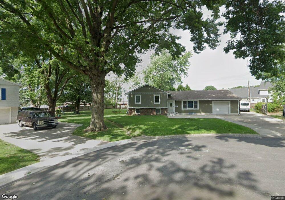
6136 Westgate St Shawnee, KS 66216
Estimated Value: $314,000 - $365,000
3
Beds
3
Baths
1,176
Sq Ft
$285/Sq Ft
Est. Value
About This Home
This home is located at 6136 Westgate St, Shawnee, KS 66216 and is currently estimated at $334,873, approximately $284 per square foot. 6136 Westgate St is a home located in Johnson County with nearby schools including Ray Marsh Elementary School, Trailridge Middle School, and Shawnee Mission Northwest High School.
Ownership History
Date
Name
Owned For
Owner Type
Purchase Details
Closed on
Oct 14, 2023
Sold by
Giesbrecht Walter and Giesbrecht Lea J
Bought by
Giesbrecht Walter and Giesbrecht Lea J
Current Estimated Value
Purchase Details
Closed on
Jun 20, 2002
Sold by
Wolfe Raleigh E and Wolfe Kristy J
Bought by
Olivarez Vincent R
Home Financials for this Owner
Home Financials are based on the most recent Mortgage that was taken out on this home.
Original Mortgage
$125,875
Interest Rate
5.12%
Create a Home Valuation Report for This Property
The Home Valuation Report is an in-depth analysis detailing your home's value as well as a comparison with similar homes in the area
Home Values in the Area
Average Home Value in this Area
Purchase History
| Date | Buyer | Sale Price | Title Company |
|---|---|---|---|
| Giesbrecht Walter | -- | None Listed On Document | |
| Olivarez Vincent R | -- | Security Land Title Company |
Source: Public Records
Mortgage History
| Date | Status | Borrower | Loan Amount |
|---|---|---|---|
| Previous Owner | Olivarez Vincent R | $125,875 |
Source: Public Records
Tax History Compared to Growth
Tax History
| Year | Tax Paid | Tax Assessment Tax Assessment Total Assessment is a certain percentage of the fair market value that is determined by local assessors to be the total taxable value of land and additions on the property. | Land | Improvement |
|---|---|---|---|---|
| 2024 | $3,860 | $36,558 | $5,492 | $31,066 |
| 2023 | $3,772 | $35,201 | $5,492 | $29,709 |
| 2022 | $3,320 | $30,878 | $5,013 | $25,865 |
| 2021 | $2,923 | $25,449 | $4,356 | $21,093 |
| 2020 | $2,671 | $22,931 | $3,961 | $18,970 |
| 2019 | $2,522 | $21,632 | $3,304 | $18,328 |
| 2018 | $2,268 | $19,355 | $2,987 | $16,368 |
| 2017 | $2,239 | $18,814 | $2,987 | $15,827 |
| 2016 | $2,003 | $16,595 | $2,987 | $13,608 |
| 2015 | $1,867 | $16,158 | $2,987 | $13,171 |
| 2013 | -- | $15,353 | $2,987 | $12,366 |
Source: Public Records
Map
Nearby Homes
- 4908 Noland Rd
- 12116 W 63rd Terrace
- 12225 W 64th Terrace
- 5845 Caenen St
- 5807 Noland Rd
- 12809 W 57th Terrace
- 5919 Pflumm Rd
- 6556 Charles St
- 6564 Charles St
- 12914 W 67th St
- 6610 Halsey St
- 6143 Park St
- 6145 Park St
- 5620 Monrovia St
- 13415 W 66th Terrace
- 12300 W 67th Terrace
- 12508 W 56th St
- 6640 Pflumm Rd
- 5504 Monrovia St
- 5703 Cottonwood St
- 6140 Westgate St
- 6129 Rosehill Rd
- 6130 Westgate St
- 6125 Rosehill Rd
- 12705 W 61st Terrace
- 6121 Rosehill Rd
- 6135 Westgate St
- 6122 Westgate St
- 6129 Westgate St
- 6117 Rosehill Rd
- 12711 W 61st Terrace
- 12522 W 62nd St
- 6121 Westgate St
- 6113 Rosehill Rd
- 6122 Rosehill Rd
- 12717 W 61st Terrace
- 6118 Rosehill Rd
- 6116 Westgate St
- 12518 W 62nd St
- 6109 Rosehill Rd