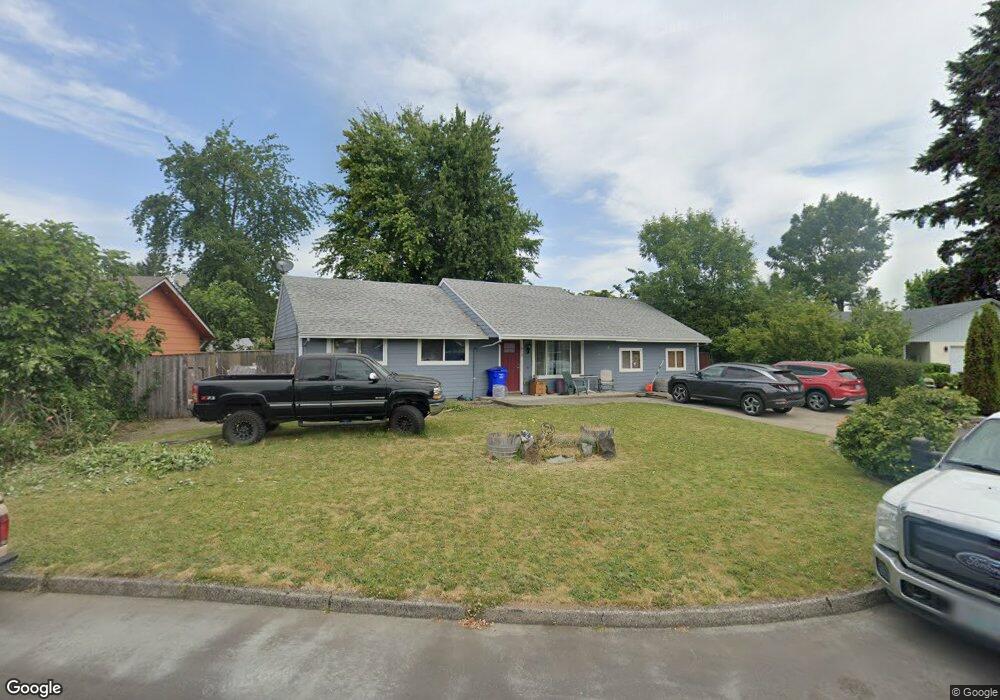
615 NE 20th Dr Gresham, OR 97030
North Central NeighborhoodEstimated Value: $410,820 - $462,000
3
Beds
1
Bath
1,560
Sq Ft
$281/Sq Ft
Est. Value
About This Home
This home is located at 615 NE 20th Dr, Gresham, OR 97030 and is currently estimated at $438,955, approximately $281 per square foot. 615 NE 20th Dr is a home located in Multnomah County with nearby schools including Highland Elementary School, Clear Creek Middle School, and Gresham High School.
Ownership History
Date
Name
Owned For
Owner Type
Purchase Details
Closed on
Mar 20, 1996
Sold by
Knakal Edward
Bought by
Mccrory Darryl J
Current Estimated Value
Home Financials for this Owner
Home Financials are based on the most recent Mortgage that was taken out on this home.
Original Mortgage
$78,400
Outstanding Balance
$2,576
Interest Rate
7.05%
Mortgage Type
Purchase Money Mortgage
Estimated Equity
$436,379
Create a Home Valuation Report for This Property
The Home Valuation Report is an in-depth analysis detailing your home's value as well as a comparison with similar homes in the area
Home Values in the Area
Average Home Value in this Area
Purchase History
| Date | Buyer | Sale Price | Title Company |
|---|---|---|---|
| Mccrory Darryl J | $98,000 | Transnation Title Insurance |
Source: Public Records
Mortgage History
| Date | Status | Borrower | Loan Amount |
|---|---|---|---|
| Open | Mccrory Darryl J | $78,400 |
Source: Public Records
Tax History
| Year | Tax Paid | Tax Assessment Tax Assessment Total Assessment is a certain percentage of the fair market value that is determined by local assessors to be the total taxable value of land and additions on the property. | Land | Improvement |
|---|---|---|---|---|
| 2025 | $4,148 | $203,840 | -- | -- |
| 2024 | $3,971 | $197,910 | -- | -- |
| 2023 | $3,618 | $192,150 | $0 | $0 |
| 2022 | $3,517 | $186,560 | $0 | $0 |
| 2021 | $3,428 | $181,130 | $0 | $0 |
| 2020 | $3,226 | $175,860 | $0 | $0 |
| 2019 | $3,141 | $170,740 | $0 | $0 |
| 2018 | $2,995 | $165,770 | $0 | $0 |
| 2017 | $2,874 | $160,950 | $0 | $0 |
| 2016 | $2,534 | $156,270 | $0 | $0 |
Source: Public Records
Map
Nearby Homes
- 450 NE 22nd St
- 2105 NE Cleveland Ave
- 349 NE 18th St
- 1783 1791 NE Beech Place
- 85 NE 23rd St
- 2200 NE Liberty Ave
- 2578 NE Morlan Ave
- 2775 NE Linden Ave
- 2730 NE Roberts Ave
- 1035 SE 225th Ave
- 1830 NE Hogan Dr Unit 83
- 54 NW 13th St
- 1556 NE 27th Terrace
- 1802 NE Hogan Dr Unit 97
- 1795 NE 19th St
- 1722 NE Hogan Dr Unit 103
- 660 NE 9th St
- 1812 NE 19th St Unit 27
- 1508 NE Hogan Dr Unit 134
- 1418 NE Hogan Dr
- 605 NE 20th Dr
- 655 NE 20th Dr
- 700 NE 22nd St
- 720 NE 22nd St
- 585 NE 20th Dr
- 670 NE 22nd St
- 610 NE 20th Dr
- 740 NE 22nd St
- 600 NE 20th Dr Unit 1
- 600 NE 20th Dr
- 705 NE 20th Dr
- 715 NE 20th Dr
- 580 NE 20th Dr
- 525 NE 20th Dr
- 780 NE 22nd St
- 630 NE 20th Dr
- 725 NE 20th Dr
- 605 NE 19th St
- 695 NE 22nd St
- 2055 NE Juniper Ct
Your Personal Tour Guide
Ask me questions while you tour the home.