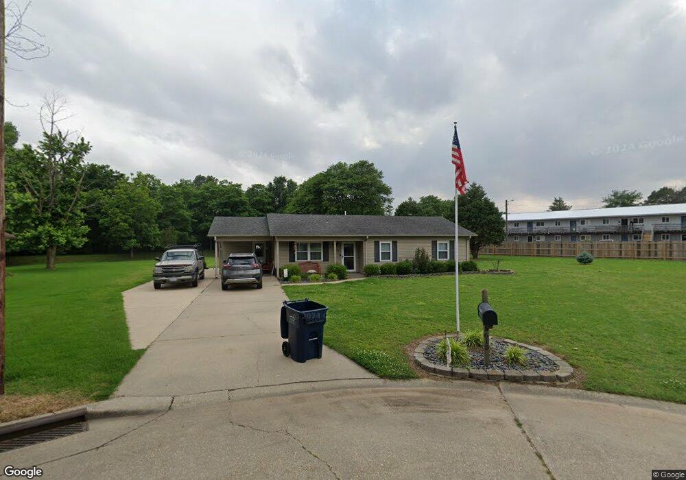
615 Tonya Ave Kennett, MO 63857
Estimated Value: $85,039 - $142,000
--
Bed
--
Bath
1,281
Sq Ft
$91/Sq Ft
Est. Value
About This Home
This home is located at 615 Tonya Ave, Kennett, MO 63857 and is currently estimated at $116,760, approximately $91 per square foot. 615 Tonya Ave is a home with nearby schools including Early Childhood Center, H. Byron Masterson Elementary School, and South Elementary School.
Ownership History
Date
Name
Owned For
Owner Type
Purchase Details
Closed on
Apr 8, 2009
Sold by
Oberman Ruan C
Bought by
Crafton Betty Jean
Current Estimated Value
Home Financials for this Owner
Home Financials are based on the most recent Mortgage that was taken out on this home.
Original Mortgage
$62,000
Outstanding Balance
$39,444
Interest Rate
5.14%
Mortgage Type
Unknown
Estimated Equity
$77,316
Purchase Details
Closed on
Jun 6, 2005
Sold by
Deutsche Bank National Trust Co
Bought by
Oberman Raun C
Home Financials for this Owner
Home Financials are based on the most recent Mortgage that was taken out on this home.
Original Mortgage
$55,400
Interest Rate
5.87%
Mortgage Type
USDA
Purchase Details
Closed on
Jan 12, 2005
Sold by
Campbell Rhonda
Bought by
Deutsche Bank National Trust Co
Create a Home Valuation Report for This Property
The Home Valuation Report is an in-depth analysis detailing your home's value as well as a comparison with similar homes in the area
Home Values in the Area
Average Home Value in this Area
Purchase History
| Date | Buyer | Sale Price | Title Company |
|---|---|---|---|
| Crafton Betty Jean | -- | None Available | |
| Oberman Raun C | -- | None Available | |
| Deutsche Bank National Trust Co | $60,915 | None Available |
Source: Public Records
Mortgage History
| Date | Status | Borrower | Loan Amount |
|---|---|---|---|
| Open | Crafton Betty Jean | $62,000 | |
| Previous Owner | Oberman Raun C | $55,400 |
Source: Public Records
Tax History Compared to Growth
Tax History
| Year | Tax Paid | Tax Assessment Tax Assessment Total Assessment is a certain percentage of the fair market value that is determined by local assessors to be the total taxable value of land and additions on the property. | Land | Improvement |
|---|---|---|---|---|
| 2025 | $685 | $11,880 | $0 | $0 |
| 2024 | $685 | $11,770 | $0 | $0 |
| 2023 | $678 | $11,740 | $0 | $0 |
| 2022 | $675 | $11,740 | $0 | $0 |
| 2021 | $672 | $11,740 | $0 | $0 |
| 2020 | $672 | $0 | $0 | $0 |
| 2019 | $671 | $0 | $0 | $0 |
| 2018 | $658 | $0 | $0 | $0 |
| 2017 | $609 | $0 | $0 | $0 |
| 2016 | -- | $830 | $0 | $0 |
| 2015 | -- | $0 | $0 | $0 |
| 2014 | -- | $0 | $0 | $0 |
| 2013 | -- | $0 | $0 | $0 |
Source: Public Records
Map
Nearby Homes
- 2012 Bradley St
- 2118 Eastwood Ave
- 2004 Russell St
- 2201 Chris Ave
- 920 Starnes St
- 2016 Harris St
- 0000 1st St
- 123 1st St
- First Street 1st St
- 1600 Jennifer Ln
- 1707 Ely St
- 1513 Malady Ln
- 0 County 442 Rd Unit MAR25014333
- 1412 Eleanor St
- 1506 George St
- 1801 Preston St
- 1801 W Mallori Cir
- 1022 E 4th St
- 1918 Lynndale St
- 709 E Washington St
- 619 Tonya Ave
- 616 Tonya Ave
- 620 Tonya Ave
- 701 Tonya Ave
- 700 Tonya Ave
- 621 Angie Ln
- 2101 Eastwood Ave
- 600 Angie Ln
- 701 Angie Ln
- 2109 Eastwood Ave
- 2010 Bradley St
- 2113 Eastwood Ave
- 2006 Bradley St
- 616 Angie Ln
- 713 Starnes St
- 700 Angie Ln
- 2121 Eastwood Ave
- 2000 Bradley St
- 2112 Eastwood Ave
- 717 Starnes St