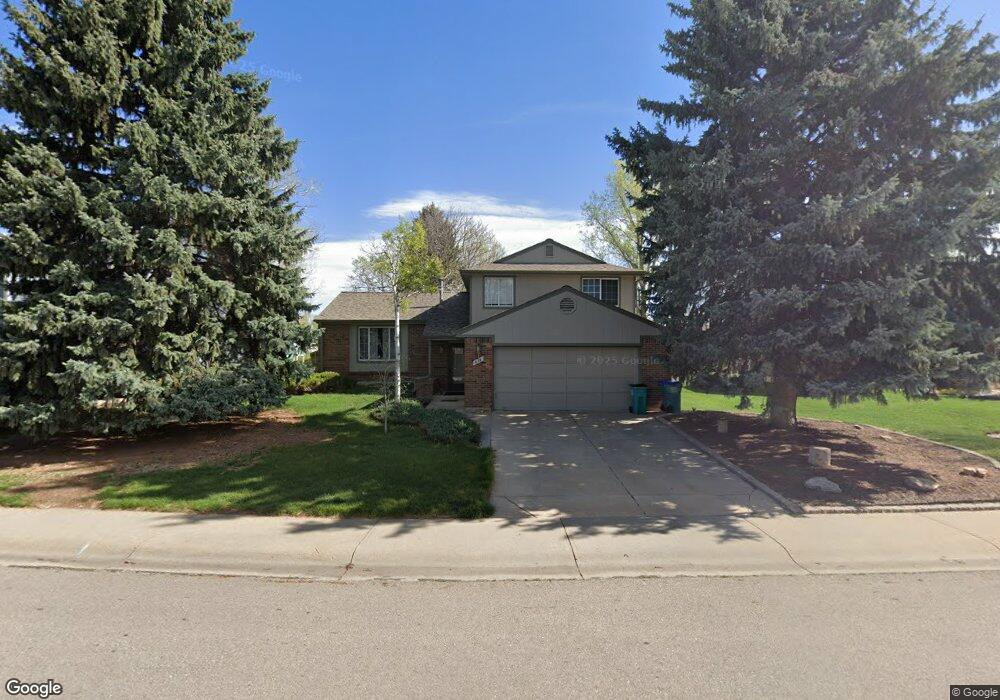
618 Blue Mesa Ave Fort Collins, CO 80526
Woodwest NeighborhoodEstimated Value: $505,187 - $573,000
3
Beds
2
Baths
1,672
Sq Ft
$322/Sq Ft
Est. Value
About This Home
This home is located at 618 Blue Mesa Ave, Fort Collins, CO 80526 and is currently estimated at $538,047, approximately $321 per square foot. 618 Blue Mesa Ave is a home located in Larimer County with nearby schools including Beattie Elementary School, Blevins Middle School, and Rocky Mountain High School.
Ownership History
Date
Name
Owned For
Owner Type
Purchase Details
Closed on
Oct 17, 1997
Sold by
Szlendak John J
Bought by
Szlendak John J
Current Estimated Value
Home Financials for this Owner
Home Financials are based on the most recent Mortgage that was taken out on this home.
Original Mortgage
$116,250
Outstanding Balance
$18,480
Interest Rate
7.33%
Estimated Equity
$519,567
Purchase Details
Closed on
Jun 1, 1992
Sold by
Szlendak John Joseph
Bought by
Szlendak Donna B
Create a Home Valuation Report for This Property
The Home Valuation Report is an in-depth analysis detailing your home's value as well as a comparison with similar homes in the area
Home Values in the Area
Average Home Value in this Area
Purchase History
| Date | Buyer | Sale Price | Title Company |
|---|---|---|---|
| Szlendak John J | -- | Land Title | |
| Szlendak Donna B | -- | -- |
Source: Public Records
Mortgage History
| Date | Status | Borrower | Loan Amount |
|---|---|---|---|
| Open | Szlendak John J | $116,250 |
Source: Public Records
Tax History Compared to Growth
Tax History
| Year | Tax Paid | Tax Assessment Tax Assessment Total Assessment is a certain percentage of the fair market value that is determined by local assessors to be the total taxable value of land and additions on the property. | Land | Improvement |
|---|---|---|---|---|
| 2025 | $2,295 | $34,304 | $3,015 | $31,289 |
| 2024 | $2,184 | $34,304 | $3,015 | $31,289 |
| 2022 | $1,769 | $25,681 | $3,128 | $22,553 |
| 2021 | $1,787 | $26,420 | $3,218 | $23,202 |
| 2020 | $1,680 | $25,104 | $3,218 | $21,886 |
| 2019 | $1,687 | $25,104 | $3,218 | $21,886 |
| 2018 | $1,449 | $23,105 | $3,240 | $19,865 |
| 2017 | $2,099 | $23,105 | $3,240 | $19,865 |
| 2016 | $1,671 | $18,308 | $3,582 | $14,726 |
| 2015 | $1,659 | $19,340 | $3,580 | $15,760 |
| 2014 | $1,591 | $17,440 | $3,580 | $13,860 |
Source: Public Records
Map
Nearby Homes
- 630 Homestead Ct
- 3113 Colony Dr
- 600 Republic Dr
- 3225 Eagle Dr
- 431 W Swallow Rd
- 3440 Windmill Dr Unit 5-2
- 3440 Windmill Dr Unit 3-4
- 3001 Worthington Ave
- 3378 Gunnison Dr
- 3024 Placer Ct
- 3031 Placer Ct
- 3036 Rustic Ct
- 720 Arbor Ave Unit 6
- 3565 Windmill Dr Unit 1
- 3565 Windmill Dr Unit N3
- 814 Arbor Ave Unit C
- 3106 Lymen St
- 1115 W Swallow Rd Unit 20
- 2716 Ringneck Dr
- 812 Coronado Ave
- 612 Blue Mesa Ave
- 630 Blue Mesa Ave
- 3212 Colony Dr
- 625 Homestead Ct
- 3300 Colony Dr
- 619 Blue Mesa Ave
- 619 Homestead Ct
- 625 Blue Mesa Ave
- 3219 Colony Dr
- 700 Blue Mesa Ave
- 613 Blue Mesa Ave
- 3213 Colony Dr
- 3306 Colony Dr
- 3207 Colony Dr
- 3301 Colony Dr
- 3212 Gunnison Dr
- 706 Blue Mesa Ave
- 618 Homestead Ct
- 3206 Gunnison Dr
- 3324 Colony Dr