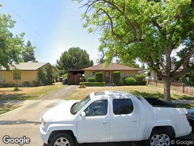
619 W Simpson Ave Fresno, CA 93705
Roeding Park NeighborhoodEstimated Value: $237,000 - $284,000
2
Beds
1
Bath
825
Sq Ft
$315/Sq Ft
Est. Value
About This Home
This home is located at 619 W Simpson Ave, Fresno, CA 93705 and is currently estimated at $259,795, approximately $314 per square foot. 619 W Simpson Ave is a home located in Fresno County with nearby schools including Homan Elementary School, Fort Miller Middle School, and Fresno High School.
Ownership History
Date
Name
Owned For
Owner Type
Purchase Details
Closed on
Jul 13, 2011
Sold by
Stephen R Graves Profit Sharing 401K Pla and Graves Stephen R
Bought by
Warkentin Dennis L and Warkentin Elizabeth J
Current Estimated Value
Purchase Details
Closed on
Mar 23, 2011
Sold by
California Housing Finance Agency
Bought by
Stephen R Graves Profit Sharing 401K Pla and Graves Stephen R
Purchase Details
Closed on
Jul 28, 2010
Sold by
Rutherford Janie I
Bought by
California Housing Finance Agency
Purchase Details
Closed on
May 1, 2007
Sold by
Ray Lanay P
Bought by
Rutherford Janie I
Home Financials for this Owner
Home Financials are based on the most recent Mortgage that was taken out on this home.
Original Mortgage
$65,000
Interest Rate
6.21%
Mortgage Type
Stand Alone Second
Create a Home Valuation Report for This Property
The Home Valuation Report is an in-depth analysis detailing your home's value as well as a comparison with similar homes in the area
Home Values in the Area
Average Home Value in this Area
Purchase History
| Date | Buyer | Sale Price | Title Company |
|---|---|---|---|
| Warkentin Dennis L | $70,000 | Fidelity National Title Co | |
| Stephen R Graves Profit Sharing 401K Pla | $54,000 | Lawyers Title | |
| California Housing Finance Agency | $94,281 | None Available | |
| Rutherford Janie I | $170,000 | Fidelity National Title Co |
Source: Public Records
Mortgage History
| Date | Status | Borrower | Loan Amount |
|---|---|---|---|
| Previous Owner | Rutherford Janie I | $65,000 | |
| Previous Owner | Rutherford Janie I | $89,900 | |
| Previous Owner | Ray Lanay | $3,032 |
Source: Public Records
Tax History Compared to Growth
Tax History
| Year | Tax Paid | Tax Assessment Tax Assessment Total Assessment is a certain percentage of the fair market value that is determined by local assessors to be the total taxable value of land and additions on the property. | Land | Improvement |
|---|---|---|---|---|
| 2023 | $1,097 | $84,500 | $30,176 | $54,324 |
| 2022 | $1,082 | $82,844 | $29,585 | $53,259 |
| 2021 | $1,053 | $81,220 | $29,005 | $52,215 |
| 2020 | $1,048 | $80,388 | $28,708 | $51,680 |
| 2019 | $1,009 | $78,813 | $28,146 | $50,667 |
| 2018 | $987 | $77,269 | $27,595 | $49,674 |
| 2017 | $970 | $75,754 | $27,054 | $48,700 |
| 2016 | $939 | $74,270 | $26,524 | $47,746 |
| 2015 | $925 | $73,155 | $26,126 | $47,029 |
| 2014 | $905 | $71,723 | $25,615 | $46,108 |
Source: Public Records
Map
Nearby Homes
- 618 W Simpson Ave
- 3012 N Fruit Ave
- 2835 N Fruit Ave
- 213 W Fountain Way
- 230 W Fountain Way
- 506 W Terrace Ave
- 345 W Dayton Ave
- 1028 W Cortland Ave
- 3681 N Fruit Ave Unit A
- 1206 W Harvard Ave
- 728 W Vassar Ave
- 115 W Fedora Ave
- 2423 N Thorne Ave
- 3725 N Fruit Ave Unit B
- 505 W Vassar Ave
- 3749 N Fruit Ave Unit A
- 528 W Yale Ave
- 32 E Fedora Ave
- A N Fruit Ave
- 107 W Garland Ave
- 619 W Simpson Ave
- 629 W Simpson Ave
- 609 W Simpson Ave
- 639 W Simpson Ave
- 549 W Simpson Ave
- 614 W Cornell Ave
- 624 W Cornell Ave
- 3040 N Delno Ave
- 539 W Simpson Ave
- 544 W Cornell Ave
- 634 W Cornell Ave
- 628 W Simpson Ave
- 608 W Simpson Ave
- 534 W Cornell Ave
- 548 W Simpson Ave
- 529 W Simpson Ave
- 644 W Cornell Ave
- 538 W Simpson Ave
- 648 W Simpson Ave