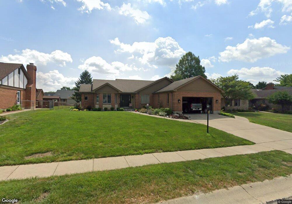
62 Argile Ct Franklin, OH 45005
Estimated Value: $317,000 - $429,000
3
Beds
3
Baths
2,014
Sq Ft
$188/Sq Ft
Est. Value
About This Home
This home is located at 62 Argile Ct, Franklin, OH 45005 and is currently estimated at $379,238, approximately $188 per square foot. 62 Argile Ct is a home located in Warren County with nearby schools including Franklin High School.
Ownership History
Date
Name
Owned For
Owner Type
Purchase Details
Closed on
Apr 19, 2018
Sold by
Kennard Oscar D
Bought by
Kennard Trust
Current Estimated Value
Purchase Details
Closed on
Jul 11, 1991
Sold by
Henderson Turf Farm & Inc
Bought by
Kennard Kennard and Kennard Oscar Douglas
Purchase Details
Closed on
Jun 27, 1988
Sold by
Henderson Turf Farm & Inc
Bought by
Henderson Turf Farm & Inc.
Create a Home Valuation Report for This Property
The Home Valuation Report is an in-depth analysis detailing your home's value as well as a comparison with similar homes in the area
Home Values in the Area
Average Home Value in this Area
Purchase History
| Date | Buyer | Sale Price | Title Company |
|---|---|---|---|
| Kennard Trust | $667 | None Available | |
| Kennard Kennard | $20,000 | -- | |
| Henderson Turf Farm & Inc. | -- | -- |
Source: Public Records
Tax History
| Year | Tax Paid | Tax Assessment Tax Assessment Total Assessment is a certain percentage of the fair market value that is determined by local assessors to be the total taxable value of land and additions on the property. | Land | Improvement |
|---|---|---|---|---|
| 2024 | $5,886 | $122,370 | $26,250 | $96,120 |
| 2023 | $4,731 | $88,231 | $11,623 | $76,608 |
| 2022 | $4,640 | $88,232 | $11,624 | $76,608 |
| 2021 | $4,397 | $88,232 | $11,624 | $76,608 |
| 2020 | $4,052 | $71,733 | $9,450 | $62,283 |
| 2019 | $3,693 | $71,733 | $9,450 | $62,283 |
| 2018 | $3,644 | $71,733 | $9,450 | $62,283 |
| 2017 | $3,295 | $58,468 | $8,778 | $49,690 |
| 2016 | $3,360 | $58,468 | $8,778 | $49,690 |
| 2015 | $3,360 | $58,468 | $8,778 | $49,690 |
| 2014 | $3,446 | $58,470 | $8,780 | $49,690 |
| 2013 | $2,854 | $69,940 | $10,500 | $59,440 |
Source: Public Records
Map
Nearby Homes
- 520 Arlington Ave
- 821 Arlington Ave
- 657 E 2nd St
- 33 Stadia Dr
- 651 E 2nd St
- 212 Rossman Ct
- 551 E 2nd St
- 0 Victoria Dr Unit 942075
- 0 Victoria Dr Unit 1852824
- 747 David Blvd
- 760 David Blvd
- 210 N Riley Blvd
- 202 E 2nd St
- 16 S Main St
- 228 Bridge St
- 779 Martha Dr
- 388 Thomas Dr
- 995 E 4th St
- 16 Harding Ct
- 205 Oxford Rd