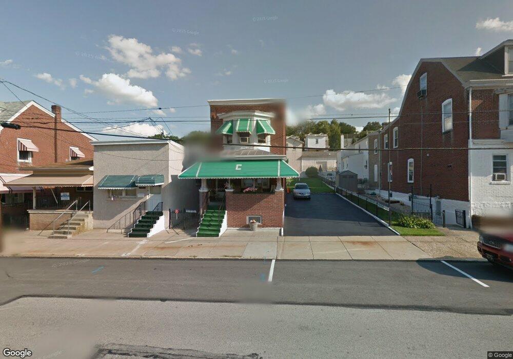
622 Ford St Bridgeport, PA 19405
Estimated Value: $253,000 - $340,000
2
Beds
1
Bath
1,205
Sq Ft
$256/Sq Ft
Est. Value
About This Home
This home is located at 622 Ford St, Bridgeport, PA 19405 and is currently estimated at $309,045, approximately $256 per square foot. 622 Ford St is a home located in Montgomery County with nearby schools including Bridgeport Elementary School, Upper Merion Middle School, and Upper Merion High School.
Ownership History
Date
Name
Owned For
Owner Type
Purchase Details
Closed on
Jul 23, 2025
Sold by
Cilio Kevin
Bought by
Dippolito Anthony
Current Estimated Value
Home Financials for this Owner
Home Financials are based on the most recent Mortgage that was taken out on this home.
Original Mortgage
$50,000
Outstanding Balance
$49,654
Interest Rate
5.97%
Mortgage Type
New Conventional
Estimated Equity
$259,391
Purchase Details
Closed on
Mar 1, 2019
Sold by
Angela Cilio Estatte
Bought by
Cilio Kevin M and Cilio Melissa M
Purchase Details
Closed on
Jan 1, 1960
Bought by
Cilio Henry and Cilio Angelina
Create a Home Valuation Report for This Property
The Home Valuation Report is an in-depth analysis detailing your home's value as well as a comparison with similar homes in the area
Home Values in the Area
Average Home Value in this Area
Purchase History
| Date | Buyer | Sale Price | Title Company |
|---|---|---|---|
| Dippolito Anthony | $250,000 | First American Title | |
| Dippolito Anthony | $250,000 | First American Title | |
| Cilio Kevin M | -- | None Available | |
| Cilio Henry | -- | -- |
Source: Public Records
Mortgage History
| Date | Status | Borrower | Loan Amount |
|---|---|---|---|
| Open | Dippolito Anthony | $50,000 | |
| Closed | Dippolito Anthony | $50,000 |
Source: Public Records
Tax History Compared to Growth
Tax History
| Year | Tax Paid | Tax Assessment Tax Assessment Total Assessment is a certain percentage of the fair market value that is determined by local assessors to be the total taxable value of land and additions on the property. | Land | Improvement |
|---|---|---|---|---|
| 2025 | $3,342 | $84,810 | $40,380 | $44,430 |
| 2024 | $3,342 | $84,810 | $40,380 | $44,430 |
| 2023 | $3,249 | $84,810 | $40,380 | $44,430 |
| 2022 | $3,164 | $84,810 | $40,380 | $44,430 |
| 2021 | $3,139 | $84,810 | $40,380 | $44,430 |
| 2020 | $3,089 | $84,810 | $40,380 | $44,430 |
| 2019 | $3,051 | $84,810 | $40,380 | $44,430 |
| 2018 | $3,050 | $84,810 | $40,380 | $44,430 |
| 2017 | $2,972 | $84,810 | $40,380 | $44,430 |
| 2016 | $2,938 | $84,810 | $40,380 | $44,430 |
| 2015 | $2,861 | $84,810 | $40,380 | $44,430 |
| 2014 | $2,861 | $84,810 | $40,380 | $44,430 |
Source: Public Records
Map
Nearby Homes